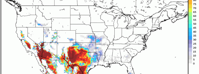
Potent, Dangerous Heatwave Coming This Week For The Southwest
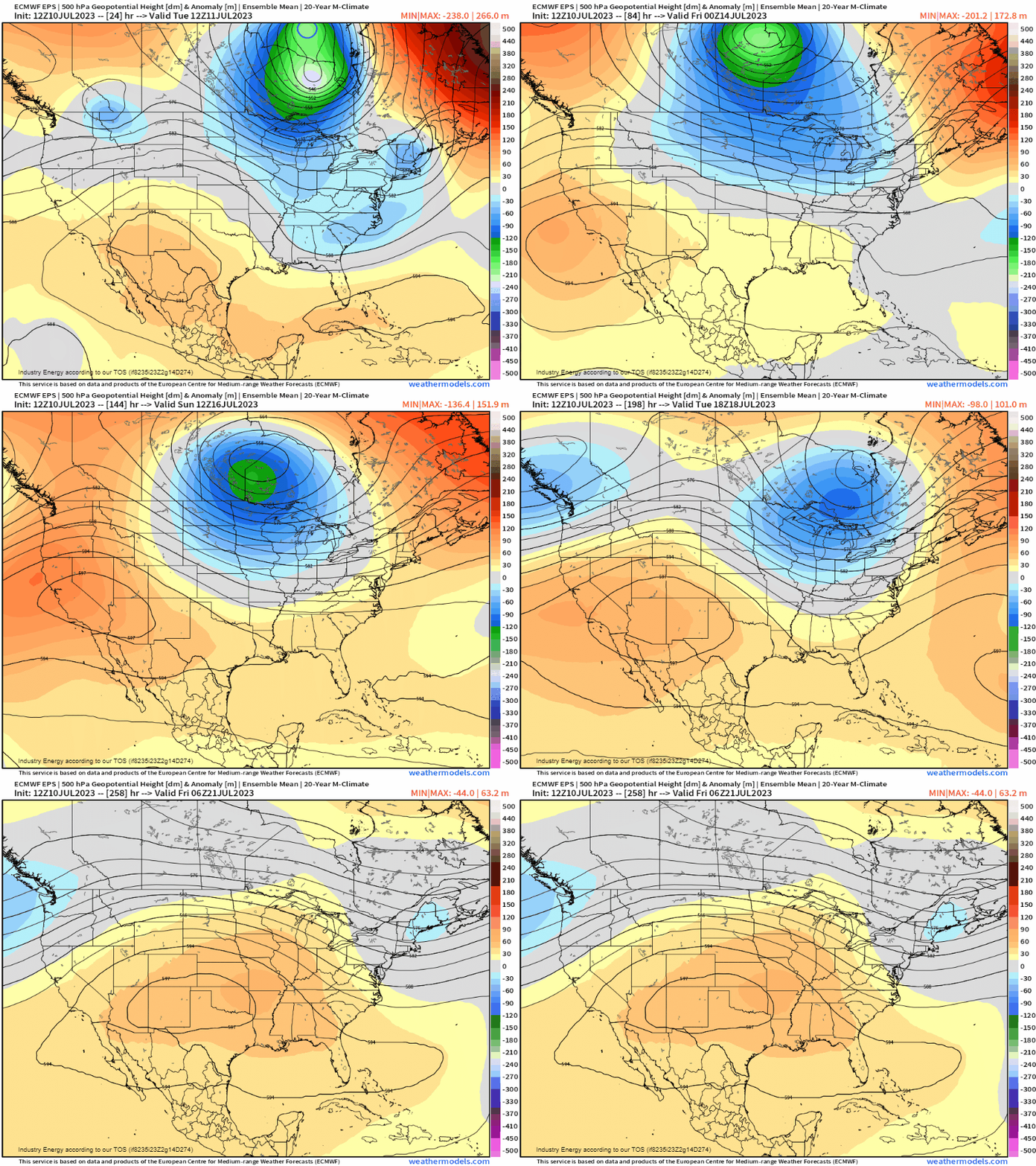
Currently, we have a strong sub-tropical heat ridge across the southern tier of the U.S. delivering heat advisories across the majority of Texas and into New Mexico. However, notice in the animation below of the EPS how the ridge shifts west, becomes nearly stationary across the desert southwest by “cutting off” from the mean flow, and sits at several deviations above normal relative to the height climatology across the region as we head deeper into this week.
A potent, strong sub-tropical ridge in this region will further exacerbate the present drought conditions that currently are taking place across southern California, southern Nevada, western Arizona, and into Utah.
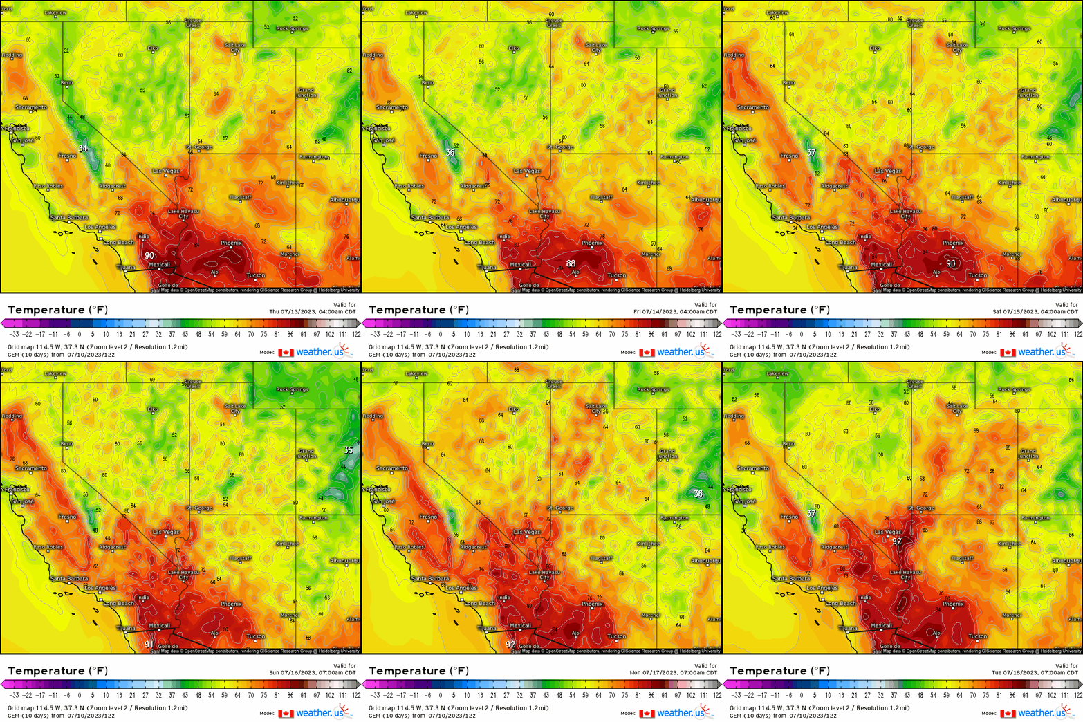
To exemplify and portray such magnitude, I’ve chosen to show the probability of temperatures exceeding 100*F. Astonishingly, you’ll note that there is a strong percentage (>90%) of temperatures exceeding this threshold. What makes this extreme and dangerous, is the duration and intensity of these temperatures where the daily high’s fail to fall below 90*F and the nighttime lows don’t even fall below 70-80*F! That is what makes this so dangerous, and quite extreme as we head into this weekend where the heat intensifies for the southwest.
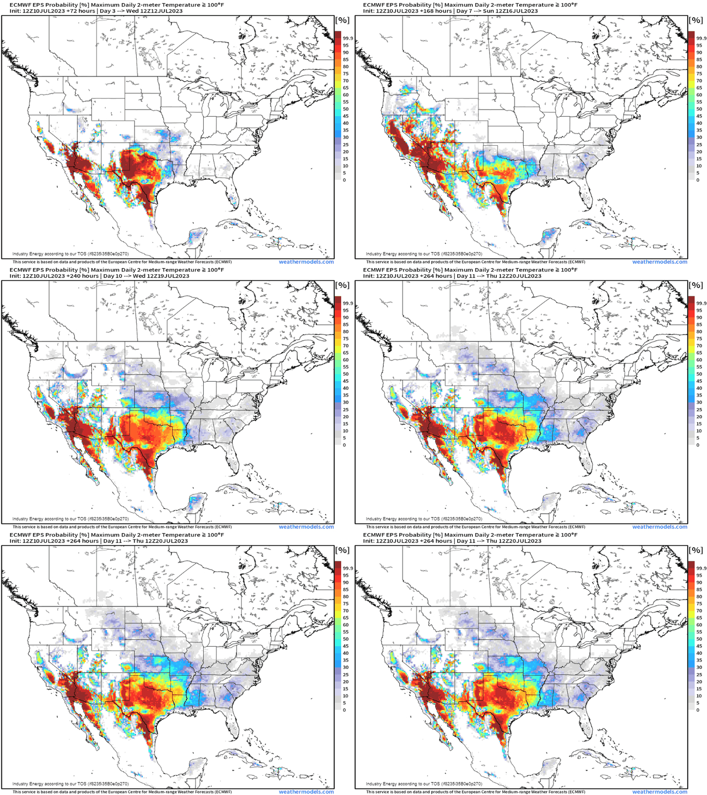
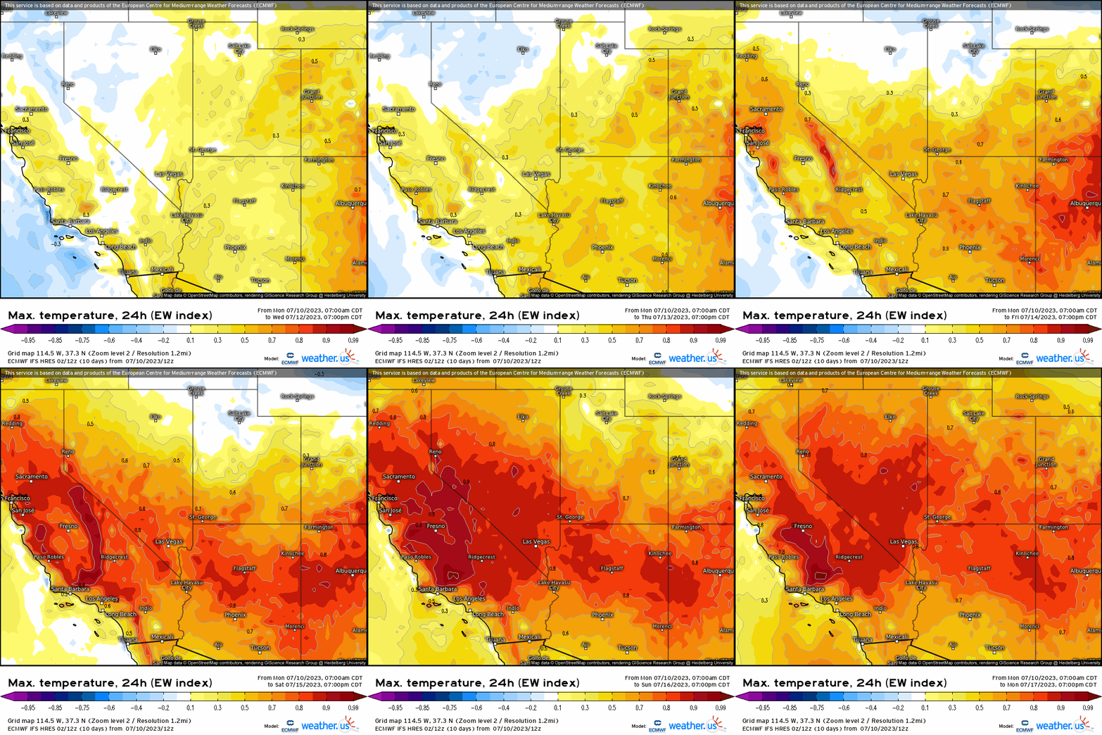
Here we see a long animation that extends into next week for most of this area, which then expands into California and parts of the Great Basin. Daily max temperatures persistently reach into the triple digits, and this includes major metro areas such as Las Vegas, Phoenix, and into Tucson. Furthermore, daily record highs will be challenged later this week, and especially all weekend and into early next week for these aforementioned areas. This also goes for surrounding locations unequivocally.
Just to show how extreme this heatwave will be, look at the “Extreme Weather Index” (EWI) via ECMWF (found here). Indices on a widespread scale here approach the absolute max percentile, or value of 1 where this indicates the utmost unusuality of this event from a climatological standpoint. This expands across California, Nevada, and across most of the four-cornered states.
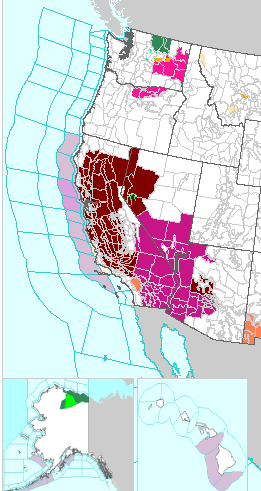
As of now, the National Weather Service has issued already a copious amount of excessive heat watches and warnings from California to southern Arizona, and surrounding areas.
The main takeaway from this upcoming event:
A long-duration heatwave will settle in from basically now through this weekend, and into next week. Heat levels will reach “extreme” levels, as temperatures soar into the triple digits by the end of this week and into the weekend where no relief will occur even at night.
Please treat this very carefully, especially if you’re heat-sensitive and make preparations to be proactive for when it becomes too oppressive. Stay indoors, try to remain cool for as long as possible, wear protective gear, stay hydrated(!), seek out cooling centers or know where there will be, and please check in on the elderly!


