Plains States Severe Set-up
Apologies to my readers for the lack of blogs last week. A nasty little virus made its way through my family and took us all out of commission. But, I’m back and writing this week and we’ve got what could be a fairly potent round of severe weather ahead of us.
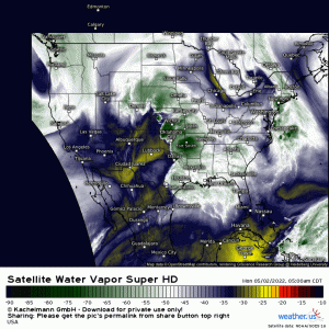
Water Vapor imagery is one of my very favorite tools, mainly because we can glean quite a bit of information about the current state of the atmosphere from one short loop. So what does this loop tell us?
- A weak surface low is located in the vicinity of the Texas panhandle. Note the counter-clockwise rotation.
- A shortwave trough is digging in behind the surface low.
- A somewhat messy dryline sits near the Texas/New Mexico border. This will sharpen and move eastward as the day wears on.
- A warm front is very slowly lifting over Oklahoma and Kansas. Non-severe showers and thunderstorms are currently ongoing but are expected to move northeast along with the warm front throughout the day.
That’s our set up for today.
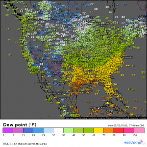
The moisture to fuel the expected severe weather is ready and waiting. Dewpoints in the 60s and 70s lurk below the boundary of the warm front and will filter north as it lifts.
By this afternoon/early evening as moisture streams northward, the surface low wanders eastward near the KS/OK border, and the dryline jogs eastward as well, a few powerful storms are possible.
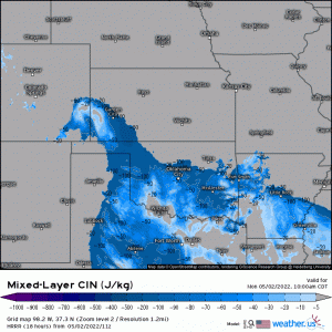
That is, if they can get past the cap.
The capping inversion is expected to be fairly strong today. Therefore, the best chance of storms erupting will be closer to the low itself, along the KS/OK border. There is a chance storms could struggle past the cap and strengthen further south along the dryline, but forcing is weaker there and convective initiation isn’t a guarantee.
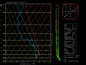
What hazards do we expect? Let’s look at a sounding.
This is an observed sounding valid at 12z (8 am ET) for Dodge City, KS. Though it is for the current time and won’t tell us much about the atmosphere at the expected time of the storms, it’s still useful.
- A stout cap is in place. It’s not unable to be overcome, but we’ll need more instability added to the atmosphere along with a lifting mechanism to break through it. Instability will build under this cap all day until the surface low approaches and lifts that instability beyond the cap. Powerful storms are possible.
- Good shear is already in place. We have surface winds backing from the ESE. These should switch to SSE as the warm front lifts. We also have decent speed shear, especially in the lower levels. Low level shear is especially important in tornadogenesis.
- Lapse rates are already fairly decent at ~7 degrees C/km and should become steeper as the cold air aloft moves further east.
- There is really no CAPE to speak of yet, but that will come as the warm front lifts and heat/moisture is moved north.
- A layer of dry air exists in the mid-levels along with decent wind speeds. As this dry air entrains into the storms, damaging wind gusts can be brought to the surface.
So, it appears we have, or will have, the ingredients necessary for all hazards (hail, damaging winds, tornadoes) to be possible.
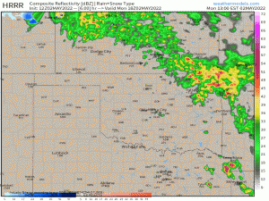
Today’s event bears the possibility of very strong tornadoes and large hail, mainly in the beginning while cells are still discrete. It will then transition to a wind-driven threat as convection grows upscale into a more linear mode.
This is the HRRR’s version of how this event will unfold and, given the analysis we just did, it may be fairly accurate.
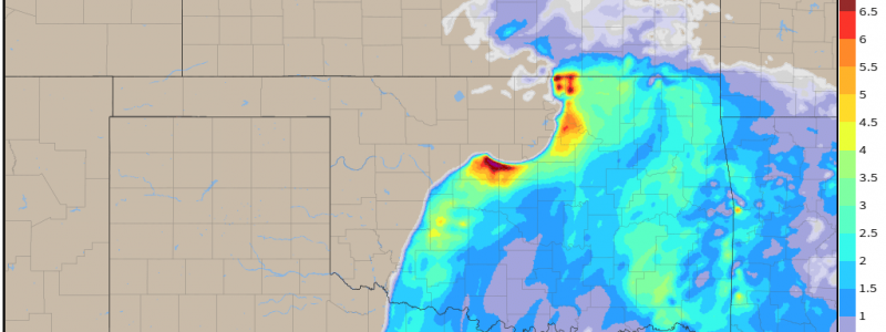
The biggest threat, as mentioned before, is along the OK/KS border near the triple point. Moisture is expected to be good here and lift will be maximized via proximity to both the cold front and the warm front.
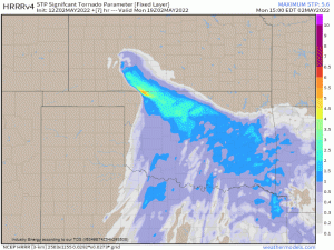
Parameters such as the Significant Tornado Parameter (STP) take into account a number of ingredients that, when combined, are thought to have a higher chance of producing significant tornadoes. It’s not a guarantee, but it shows you where, according to model output run through the formula, the atmosphere is most likely to produce. The STP for the HRRR indicates the highest probability along the KS/OK border, as I’ve been discussing.
Now, don’t just focus on the tornado potential for today. Yes, there is a risk of strong, long tracked tornadoes. However, the window for these will be fairly brief as the cold front catches the convection and initially discrete cells transition into a bowing line. At this point, damaging winds – which can often effect a larger area than a tornado and pack a hefty punch themselves – become the main threat.
My point: shelter for a wind-driven severe thunderstorm warning as you would for a tornado warning today. Have your safe place ready to go and be ready to act if need be. Make sure you’re receiving warnings this afternoon and evening.
Stay safe!
