Pesky Upper Level Low To Impact The Southeast By This Weekend
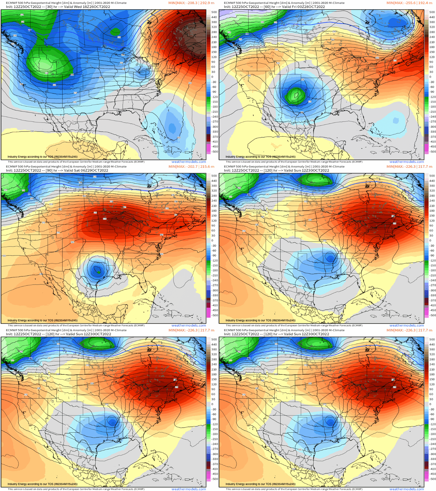
As an active pattern remains with troughs digging into the West through this week and into next week, this keeps downstream regions active, as well with shortwaves riding west to east within the mean flow! We also begin to see wavelengths of troughs and ridges lengthen as seasons change, resulting in anomalous patterns. Going forward, we’re going to see one of these mid-level troughs that’ll be robust in nature, propagate into the Deep South and swing into the Southeast by this weekend as it slides underneath a relatively anomalous ridge to the northeast. Below shows z500mb height anomalies, which portrays nicely the evolution of this pattern showing both the deviation from climatology (“anomaly”), regarding the cut-off mid-level low and ridge.
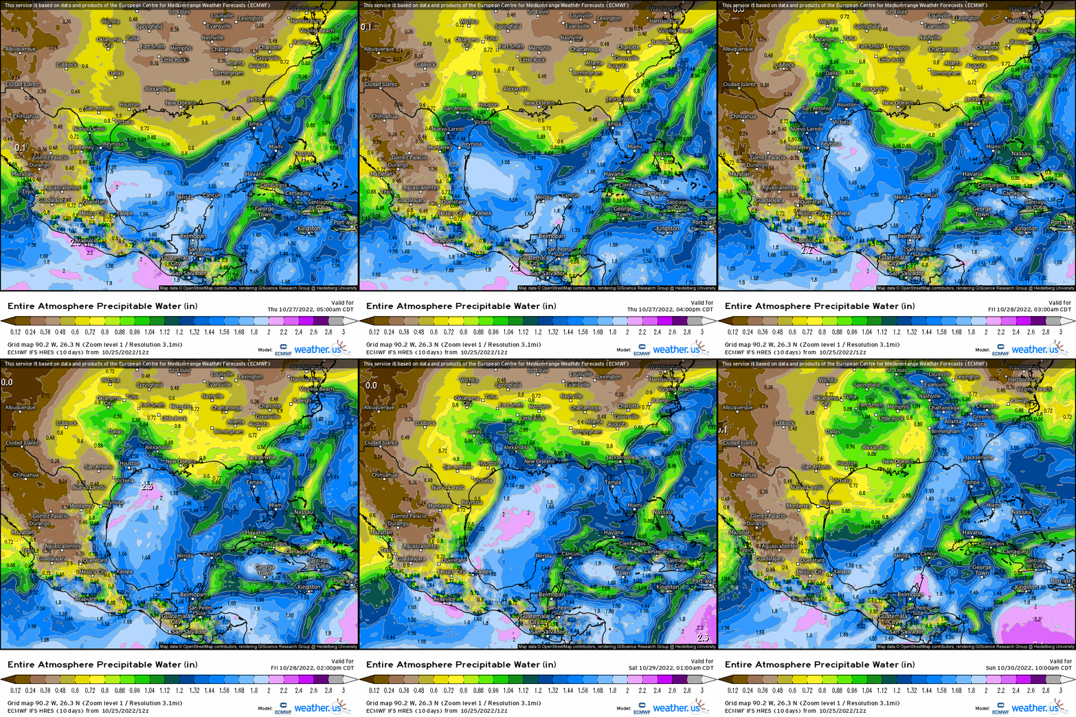
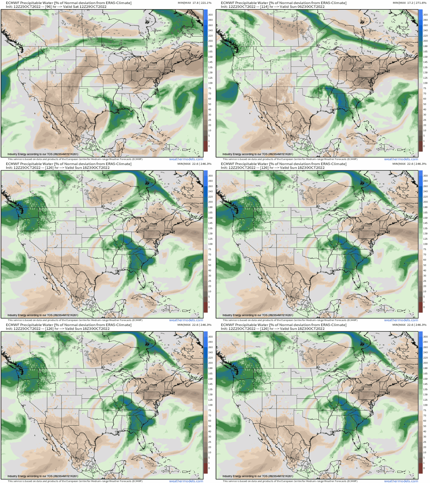
At the surface, this mid-level low spawns a surface low pressure across the Panhandle of TX through today and into tomorrow before gradually digging further toward the Gulf states. However, as the mid-level occludes, we see a few relatively weak areas of low pressure develop along frontal boundaries, creating a wider area of rain impacts. This broad area of lower pressure induced southerly flow and robust moisture advection from the Gulf. This is reflected in the very high PWAT’s as shown verbatim via ECMWF hi-res beginning late Friday into Saturday.
Further, to show how anomalous the PWATs are for this time of year, the ECMWF shows in excess of 180% above normal surging into states like AR, MS, AL, TN and neighboring Southeastern states.
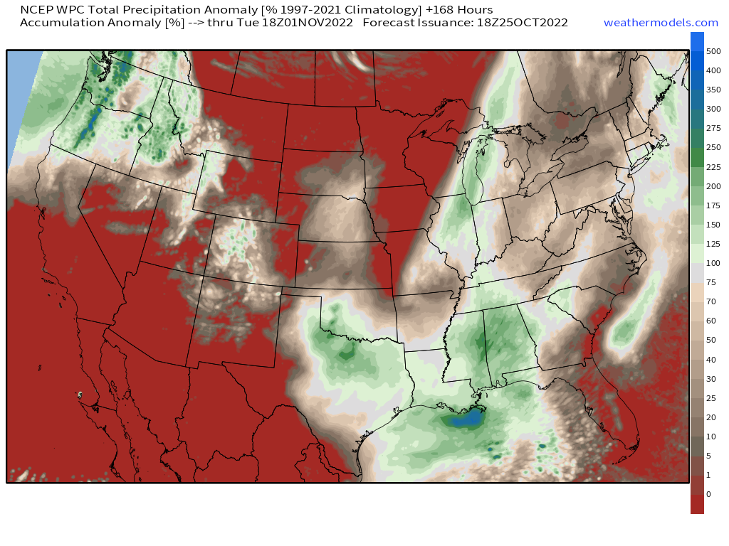
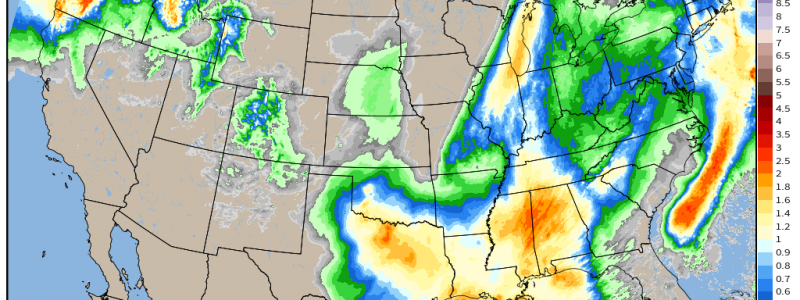
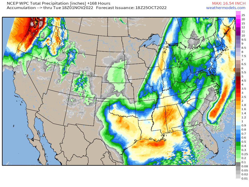
The combination of a favorable synoptic pattern along with robust moisture surge from the Gulf, will culminate in total rainfall of over 2’’, especially across MS and AL. This is what is expected via the WPC through Sunday showing that relatively large swath, with a widespread area of at least an inch as shown.
However, there’s some good news to this situation. In the last 60 days across these aforementioned places, many are actually below normal (20-60% of average or so) in terms of rainfall! So while localized flash flooding is certainly a legitimate possibility, widespread flooding won’t necessarily be realized and this event will be welcomed in fact for much needed rainfall!
