Persistent Heavy Rain Could Bring Flooding Threat to Southern Mississippi Valley
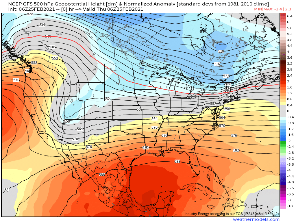
This morning sees ridging building into the southern and eastern US, forcing a progressive longwave to take on a very positive, SW->NE tilt. This will, to a large degree, continue for the next week, with the trough axis shifting somewhat S->N but remaining largely constant in orientation and placement. The pattern is mellow for many, with limited amplification and generally pleasant temperatures across much of the CONUS, but is conducive for two different types of impactful sensible weather.
Meghan talked about the first way this positive longwave can create noticeable impacts in her blog yesterday. As semi-closed off lows at the base of the longwave slide south into the Great Basin, they incentivize back-end pressure rises that press up against the Sierra Nevadas and other west coast topography. This process can allow dramatic offshore flow to develop, which is responsible for locally damaging wind today in SoCal, and will be once again around Saturday night when the pattern repeats itself.
But this blog is about a different threat produced by the positively tilted troughs, of the type of persistent heavy rain that can create flooding, focused over the southern Mississippi valley.
A heavy rain/flooding threat is a function of a few variables, in both the short and long term. In the short term, saturation is most efficient when rain falls heavily and efficiently, which can happen when the typical factors that allow rain to fall in general (synoptic-scale lift, moisture, and low-level convergence) occur alongside a parameter space that can enhance the rain, typically including some degree of convective instability, high-end moisture transport (a function of both high-end moisture and brisk low level flow) and full-column saturation below 500mb. At short time scales, setups that allow for training, in which the orientation of low-level convergence runs parallel to storm motion, is also important. At longer scales, any broad pattern that allows for the aforementioned parameters to be brought together over and over again can significantly increase medium-range flooding threat by steadily saturating grounds.
That’s a lot of stuff, and some patterns are much better at bringing it all together than others. This type of set-up, with a positively oriented longwave persistently stretched east across a long fetch of near-Gulf land, is one of the best.
The trouble starts as synoptic scale encouragement for ascent overspreads the southeast as the base of the trough axis shifts east, spreading the height fields well downstream.
First of all, that’s one check mark for rain in general.
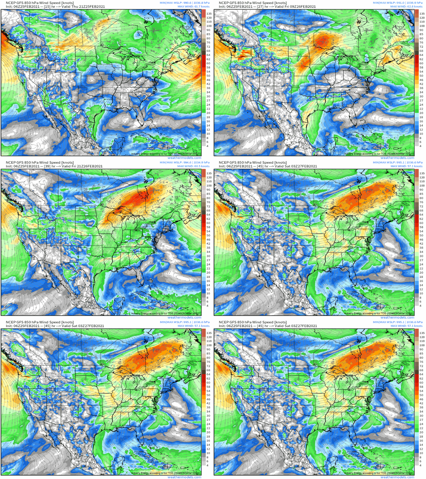
This will also allow two things to happen with importance for heavy rain: the removal of mass that will encourage a southerly low level jet; and enough divergence aloft for a zone of low surface pressure to develop. The former will begin transporting Gulf moisture inland.
Meanwhile, surface pressure falls will promote a zone of the type of low-level convergence that can lift parcels to saturation. These should all overlap in a zone stretched generally from Texas to Tennessee.
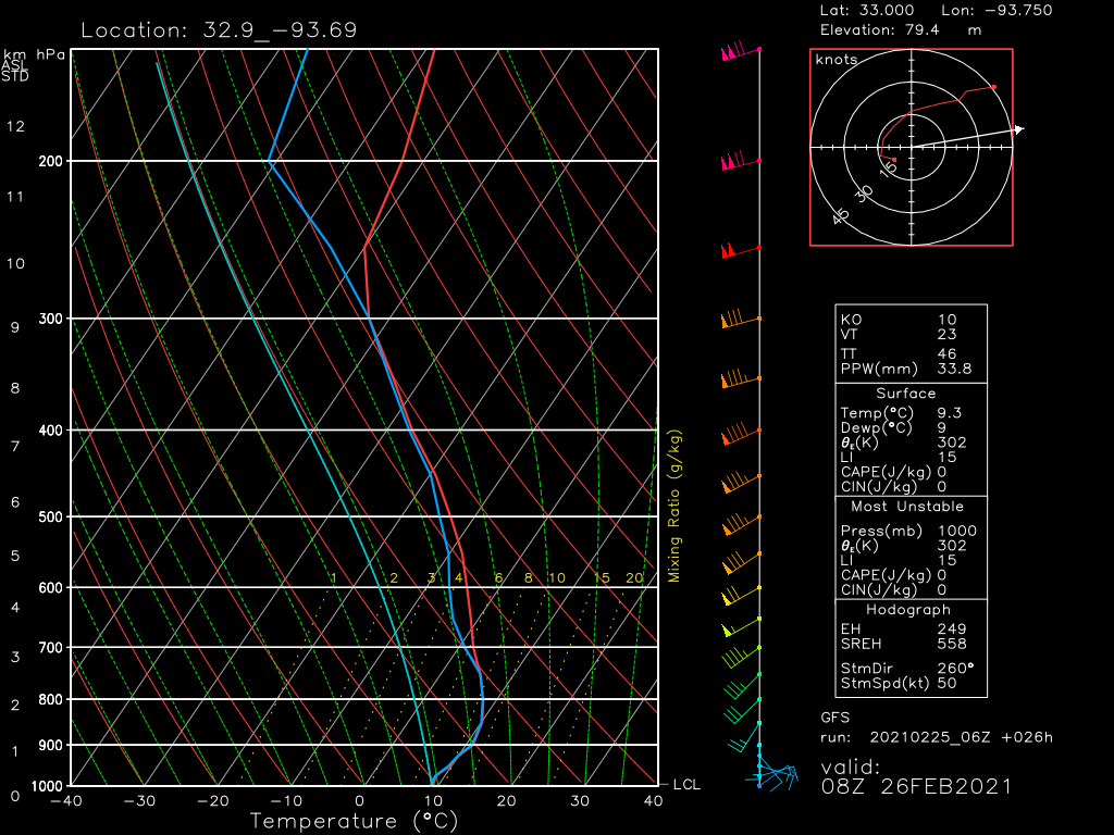
How about the rest of the parameters I mentioned, which can help rain fall as efficiently and heavily as possible? It’s a mixed bag, as a vertical slice of the atmosphere shows.
Immediately, an impressive degree of saturation jumps out, with a completely saturated parcel to around 700mb drying slightly through 500mb. This, in conjunction with 30-50 knot low level flow transporting precipitable water values of 1.4in implies an atmosphere loaded for efficient rainfall. As far as heavy rain goes, convective potential energy is limited to some meh elevated destabilization in the mid-levels, which should limit the downpour-ness of rain.
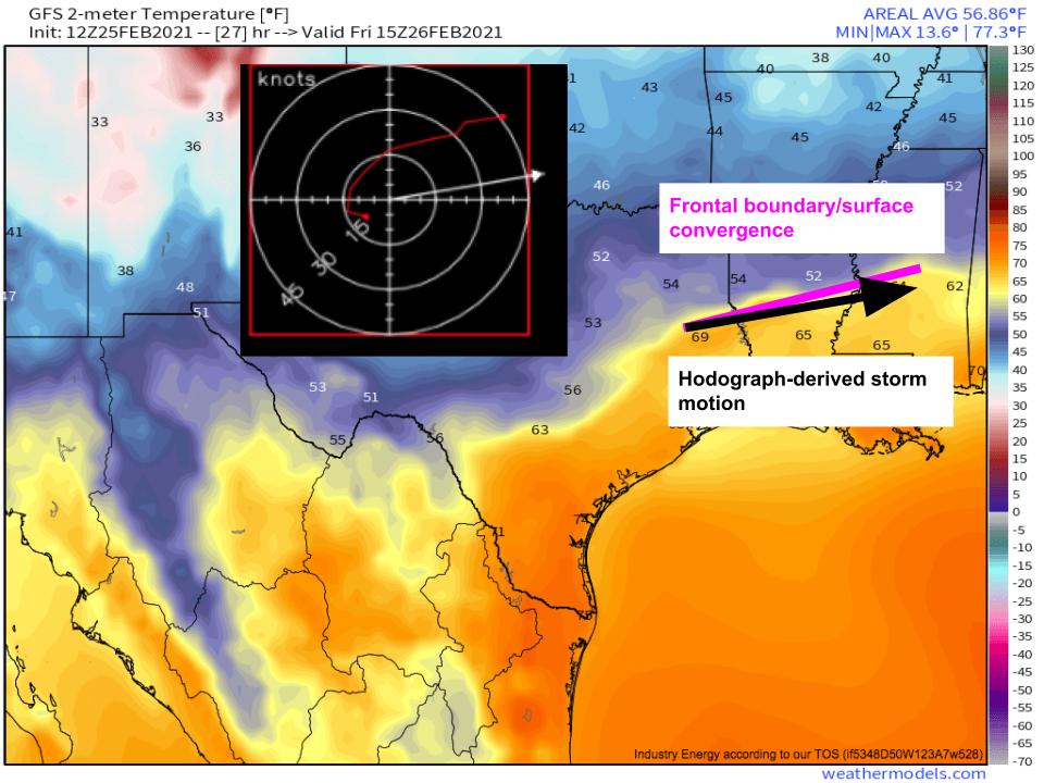
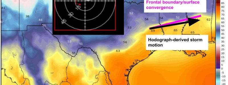
Like with so many other weather events, persistence is king. In heavy rain events, this persistence is most commonly achieved by storm motion that parallels the orientation of forcing, which allows total rainfall values to end up quite high. Pasting the hodograph-derived storm motion over the orientation of the surface boundary region confirms that this is something to watch out for.
Storm motion that almost directly parallels a frontal boundary means training, in which storms move over the same area over and over, is quite possible. This will allow for enhanced short-term persistence of heavy rain.
In the medium term, the training of broader setups works similarly to the training of storms. If the motion of a trough at large is parallel to the region of divergence to its east, height falls and associated parameter space overlaps will persistently occur over the same areas. This is a confusing concept, but means that long-fetch divergence oriented almost due west to east, such as ahead of this week’s very positively amplified longwave series, can promote the same kind of weather for a long time.
To see this happen, watch the belt of strongest midlevel flow stay almost still from Louisiana towards Kentucky with the weekend/early week system. 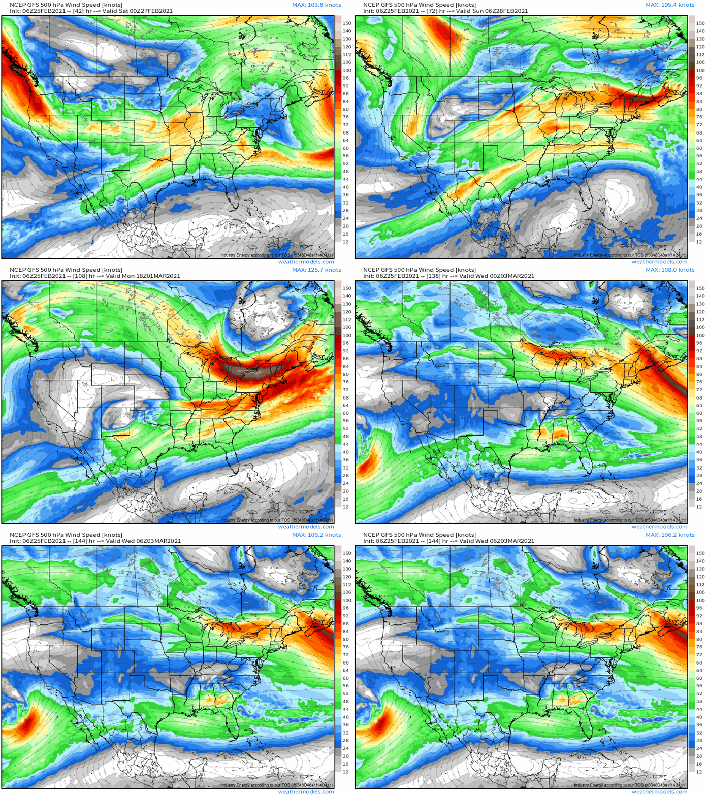
If this weather is heavy rain, the threat of which is amplified significantly by longevity, then flooding becomes increasingly likely in the medium range.
