Pending Nor’easter and It’s Threats: Part One
Good morning!
We have a lot to talk about this morning so we’re going to go ahead and dive in.
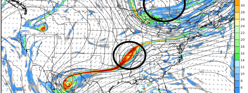
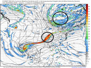
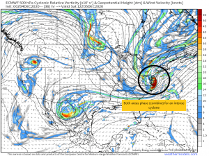
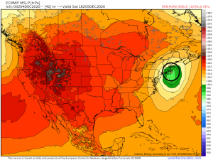
We are watching an area of low pressure over the mid-south. Though it is rather elongated at the moment, it is expected to perpetuate eastward throughout the day and eventually combine with an area of energy currently over Canada.
As both areas combine, the system is expected to undergo rapid cyclogenesis (bombogenesis) meaning that it will intensify at a rate equal to or greater than a pressure drop of 24 mb in 24 hours.
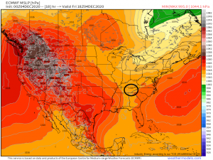
If you’ll look at the images above, you’ll see from 18Z Friday to 18Z Saturday, the system is expected to fall ~27 mb in 24 hours which exceeds the requirements for bombogenesis.
But what does that really mean? Well, a rapidly deepening system such as this brings with it a few hazards, and they aren’t just confined to the geographic location of the center of low pressure.
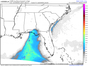
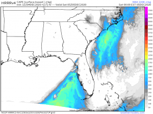
First: We will see a severe threat as a result of warm air advection and high shear due to the strengthening system. This will come in the form of a marginal threat along both the Florida panhandle and the North Carolina/South Carolina coast. The Florida threat will materialize this morning/afternoon as the the system starts to deepen while the Carolina threat will come later tonight as the system moves toward the east coast.
As with the last few severe threats in the east, this will be a high shear/low CAPE event. The shear required for severe weather will be adequate due to the strengthening system, however, the CAPE (energy to fuel the storms) will be somewhat lacking due the generally stable atmosphere preceding the system’s arrival. Both the Florida panhandle and the Carolina coasts are relatively cool right now with abundant cloud cover which inhibits day time heating. Lack of day time heating means little instability gets added to the atmosphere, except what is advected in from the southerly flow.
A small amount of CAPE will be advected into the panhandle this morning, but nothing crazy. Possibly enough for a few severe storms with damaging winds and hail, perhaps a tornado or two, although confidence isn’t high. Any severe activity will be confined expressly to the coastal areas as the inland areas are in a stable environment.
For the Carolinas…
Minimal CAPE will be present along the coast overnight with an area of higher CAPE directly offshore. It is possible that we will see supercell formation in this area and that they could be blown into the coast via the southerly flow as severe storms. Waterspout formation is certainly a possibility and if it transfers to shore, a few tornado warnings are not out of the question. Suffice it to say, if you live in this immediate area, don’t let your guard down tonight. We have seen a few relatively destructive spin-up tornadoes form in low CAPE environments recently. Have a way to receive warnings and please act on them if they are issued. As I’m writing this, the SPC has upgraded the risk level to the “Slight” category along the immediate coast in the Carolinas, further reinforcing the possibility of all I’ve mentioned above. Please take it seriously even though confidence isn’t terribly high and it’s not an “outbreak” situation.
I’d also like to mention the possibility of severe weather along the western Florida peninsula overnight. As a convective line swings through, it seems there will be enough energy for a severe storm or two to form. Risks here are likely limited to damaging winds, given that CAPE is on the lower end. Still something to be aware of.
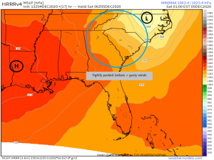
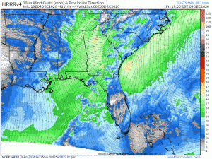
Moving on, threat number two is going to come in the form of gusty winds over the southeast.
As rapid cyclogenesis occurs, the Southeast will be squeezed between an area of high pressure to the west and the developing low pressure to the east. This results in a tightly packed pressure gradient which generates gusty winds.
Winds will increase through the overnight hours. It’s not much of a stretch to expect gusts approaching 70 mph over the exposed ridges and peaks of the southern Appalachians. Scattered power outages are possibility.
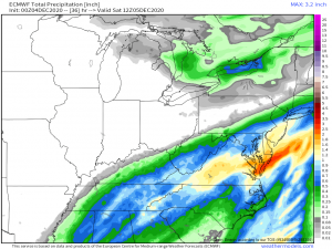
Locally heavy rainfall upwards of an inch in places, especially over higher terrain where orographic lifting will come into play, is a likelihood as well through Saturday morning in the southeast.
Flash flooding could be on the table for flood-prone areas. Parts of the mid-Atlantic, specifically the Delmarva area, are under a flash flood watch. It will just depend where the heavier bands set up. As this storm will be deepening and moving off quickly, lingering precipitation won’t be a problem.
Alright, that was a lot to digest so, now that I’ve covered the immediate threats, I’ll pause here. Look for part 2 of this blog covering the second half of this storm and it’s threats in the Northeast later today!


Great write up! Thanks