Pattern Change to Bring Major Snow Downstream of Great Lakes
Midlevel cold air intrusions have been few and far between so far this winter. You don’t need a meteorologist to tell you that: across almost the entire northern half of the US, the first half of the season has been extremely warm, at least compared to climatology. One victim of the unusual warmth thus far has been the lake effect snow season.
Lake effect snow is one of the topographical machines I love writing about so much. The lakes provide a constant moisture source, and a combination of land’s lower specific heat and higher frictional coefficient compared to water provide incentive for relatively warm, moisture-laden lake parcels to cool and converge as they move ashore, forcing condensation. Where complex terrain lies immediately downwind of a lake, such as in the Tug Hill Plateau of northwest New York, orographic lift can force additional convergence and increase the intensity of lift. This all means that, with relatively limited atmospheric input- cold enough air aloft to allow moderate instability over the warm lakes; synoptic-scale lift; cold enough air over land to allow precipitation to fall as snow; and, above all, flow that parallels the major axis of the lake- precipitation can occur. The fact that topography provides both moisture and lift means lake effect snow can be incredible persistent, dumping feet in relatively narrow swaths downwind.
Ok, fair enough. But compared to the other topographical machines, it seems lake effect snow requires a lot of atmospheric input!
This is true, and it’s why a few parts of the country are exceptionally prone to big storms, and also why this season has been largely a dud so far.
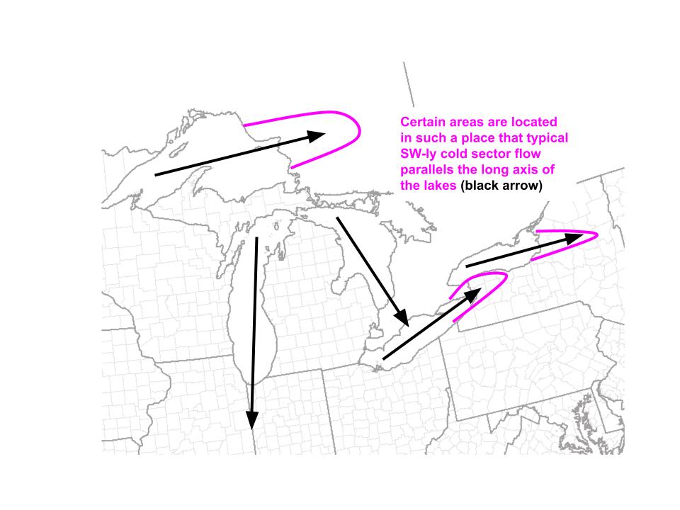
The first few aspects- cold air aloft, synoptic scale lift, and cold air, are pretty easy to find beneath a midlevel trough axis, typically in the cold sector of a surface cyclone. The fact that these parameters must overlap with flow that parallels the major axis of a lake upwind for lake effect snow, and the fact that cyclone cold sectors typically foster westerly, often southwesterly, cold flow, means a few bullseyes for lake effect snow appear seasonally.
 As for why lake effect snow hasn’t really been happening this year in the pink bullseyes I’ve outlined: there haven’t been almost any deep midlevel polar intrusions! A major pattern shift looks to change that, starting this week.
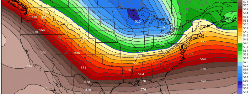
The first chunk of polar air aloft will slide into the country behind the midwest snow storm Meghan wrote about in her blog yesterday. It’ll be associated with frigid conditions in much of the north-central US, and will also bring cold air aloft, midlevel divergence, significant cooling of land, and southwesterly flow to the eastern Great Lakes. Ding ding ding!
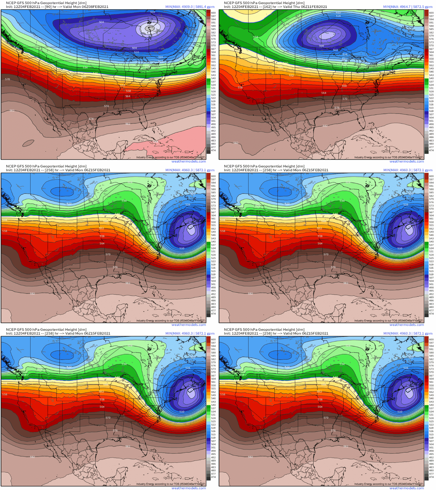
Notice the persistent shortwaves rotating around the impressive 504dm midlevel low over SE Canada. As these progress through the Great Lakes, they will promote increased ascent, a re-orientation of any deviant westerly flow, and pockets of cooler air aloft/increased convective instability. The result? A golden opportunity from Friday through Monday for persistent lake effect snow downstream of Erie and Ontario.
I would not be surprised if snow is measured in feet by the beginning of the work week, especially on the Tug Hill and perhaps just south of Buffalo, locations seemingly favored by the largely unwavering WSW flow.
That won’t be it, either. The lake is still largely open water due to a warm early season, and so an unusual February blitz of lake effect snow is seeming increasingly likely following this weekend’s storm.
The unusually persistent south Canada low, combined with near record low ice extent, could promote a series of lake effect storms downwind of the eastern lakes at levels near historic for February.


