Omega Block Ridge Shifts East
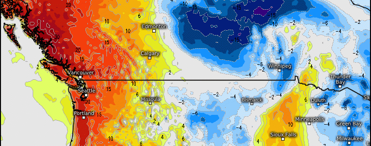
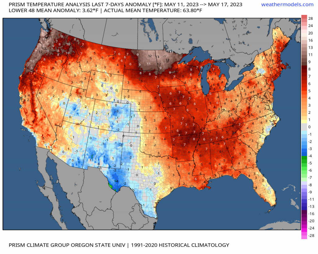
Since the first week of May, we’ve seen an omega blocking ridge establish across the Pacific NW, British Columbia territories. This has rendered both well above average temperatures and new records were exceeded for places such as Seattle and Portland where consecutive 90’s were observed this past week. Further, we’ve seen poor air quality with wildfires across Canadian provinces that causes smoke to become trapped within the dome of high pressure. This has been carried into the Pacific NW and northern Plains states where air quality alerts are still in effect.
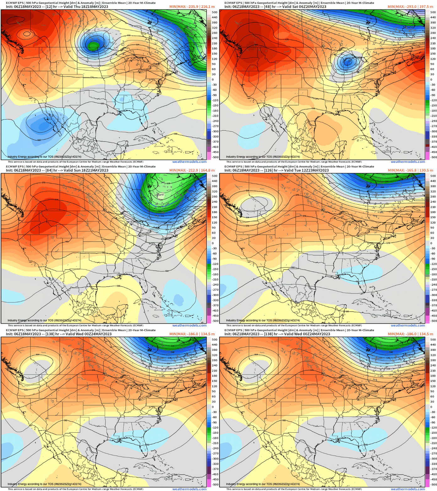
Using water vapor imagery, we can see the general anticyclonic (or clockwise) flow across Western Canada that outlines our omega ridge. We’ll now see this ridge break down to an extent, and shift eastward bringing the risk for yet more mild temperatures and near-record values to the Intermountain West and northern Plains.


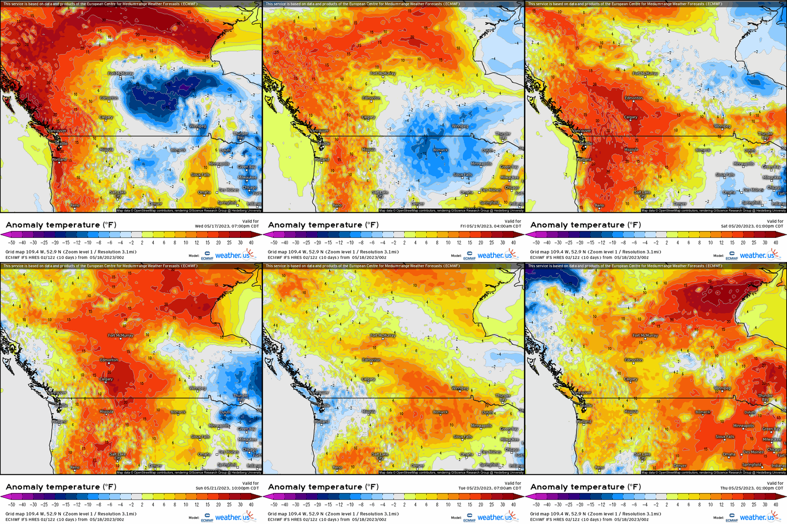
Over the next few days, we’ll see the core of the ridge shift eastward toward Saskatchewan and Manitoba. This will shift the above average temperatures eastward into the northern Plains into next week, as relief in the form of a trough shifts into the southern British Columbia and Washington bringing in the form of precipitation and below average temperatures. Anywhere from 5 to 20 degrees above normal will be expected as high pressure shifts east.


As we see, widespread 80’s and near 90 will shift from Washington to Montana, Dakotas, and into Minnesota through next week before the ridge breaks down, and we shift into a more zonal-esque type pattern leading into Memorial Day Weekend where large-scale ridging begins to envelope a majority of the CONUS and broad above average temperatures look to occur.


