Occluding Low Brings Flash Flood Threats to Mid-Atlantic
Flash flooding is often a story told in parallels. Tonight, as an impressive Great Lakes cyclone occludes, such parallels will bring a deluge to the interior mid-Atlantic.
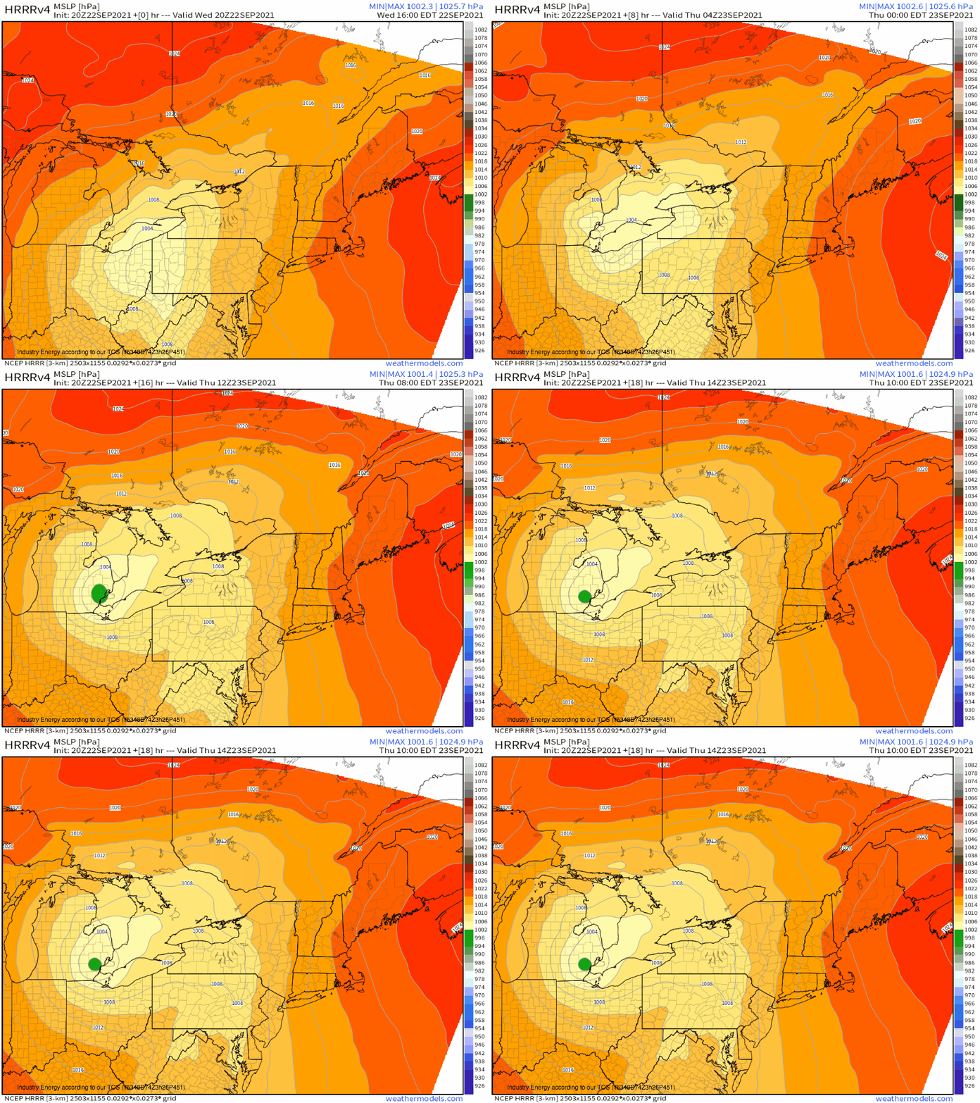
A deep, well-organized trough tilting through the Ohio Valley today is encouraging quick intensification and occlusion of a surface low near Lake Erie. A fairly textbook cyclone maturity process will see the surface low ‘stack’ beneath the strengthening midlevel trough, leading to several hours of midlevel forcing that will run largely parallel to the surface cold front.
As can be seen in this surface pressure loop, the cold front at ground level- indicated by a N->S oriented trough over and south of PA- effectively stops moving for several hours tonight.
This will give an area approximately delineated by the Northern Appalachians persistent forcing for ascent, a crucial ingredient in the recipe of overwhelming local capacity to safely shuttle away precipitation. But will the region have sufficient moisture to cash the check of flash flooding?
Or, to rephrase the question, do you all remember Hurricane Nicholas?
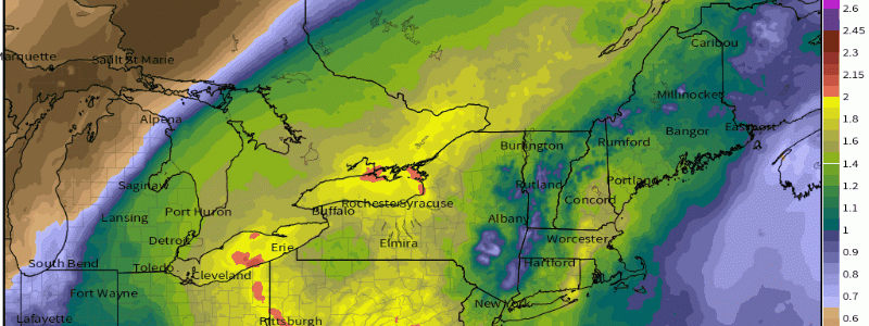
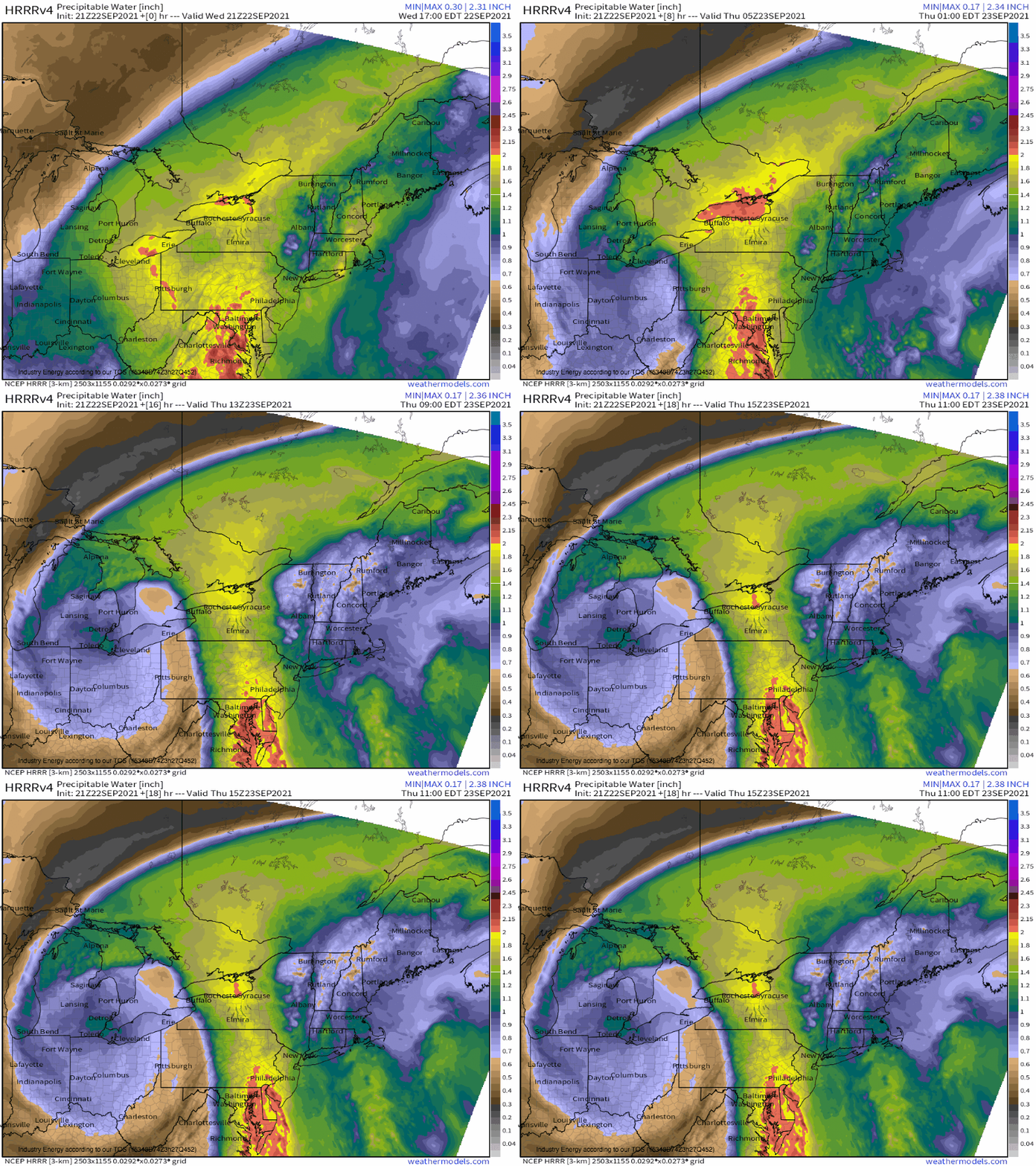
An open circulation stretched south of the main low is something of a ‘peaked in high school’ version of what was once the Houston-threatening tropical system. While it has almost nothing else reminiscent of its time in the limelight, it does retain some degree of tropical moisture- PWATs near the center of what was once the storm still exceed 2.0″.
Another interesting aspect of the synoptic setup currently overlapping the Northeast is the impressive low level jet siphoned north by substantial diffluence aloft. It’ll do what LLJs do best: move an airmass. The result? Impressive poleward moisture flux, smack into the stalled Pennsylvania front.
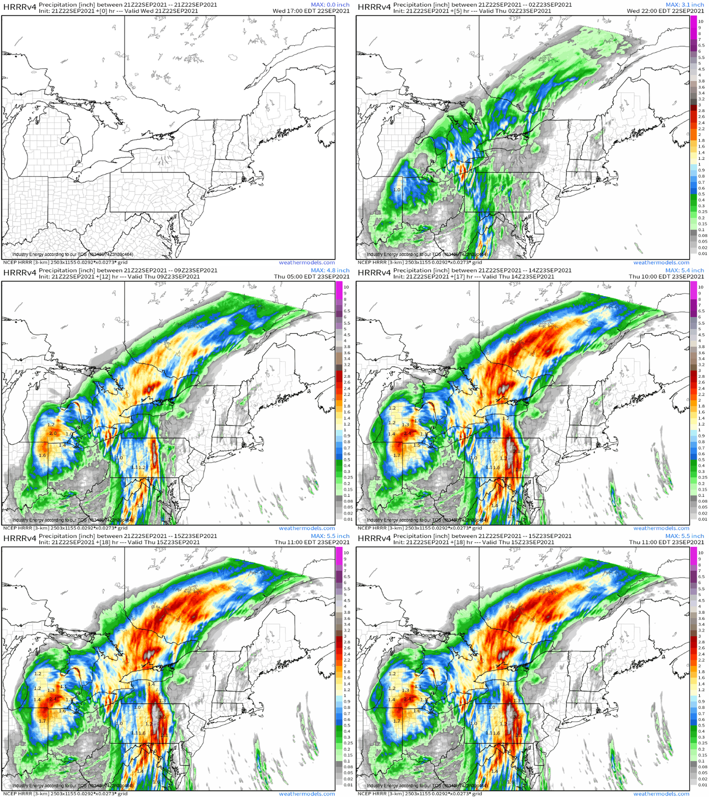
As this moisture is lifted over and over again over a few counties, particularly where the topography of central PA can assist, flash flooding seems probable as rainfall exceeds 5″ for some.


