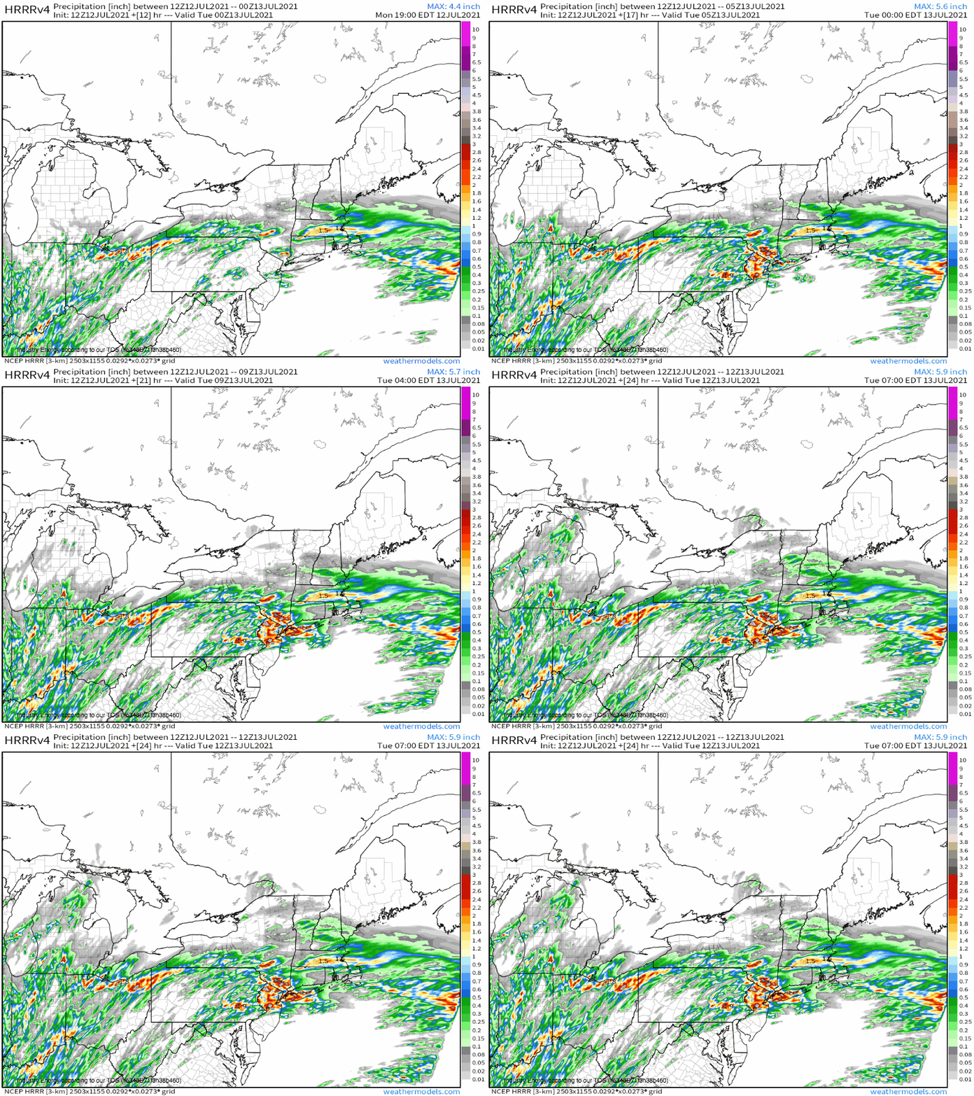
NYC Braces For Another Day of Flash Flooding
The feedback loops of the atmosphere can seem cruel, favoring areas recently struck by natural disaster for further destruction. One example we’ve been writing about often is how extreme heat propagates itself to a degree by drying soil moisture, which in turn makes it easier to heat. Such feedback loops are like if lightning were actually more likely to strike the same place twice, and can lead to increased human and economic toll as regions are battered over and over by the same hazards.
Flash flooding is another example. One of the most important indicators of flooding potential is the saturation of soils, which is brought around by flooding. One bout of exceptionally heavy rain in an active pattern can thus propagate forward a cycle of flooding, which is exactly what looks to occur today in the NYC metro.
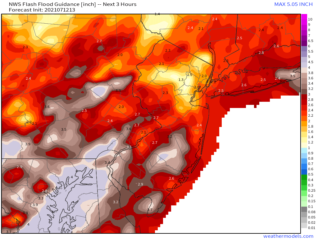
You probably remember last week’s unusually severe flash flooding in New York City and surrounding counties, as a hefty predecessor rain event (PRE) ahead of Elsa poured moisture, instability, and front-parallel lift into the metro. Thunderstorms trained for hours, flooding parts of the subway system alongside several streets. In doing so, they not only reminded New Yorkers of their fragile relationship with nature; they also prepped the environment for further flooding by saturating soils and overwhelming storm drain systems. This can be seen in unusually small FFG values, which show how much rain must fall in a certain amount of time for flash flooding to commence.
That brings us to today, when an atmospheric setup once again favorable for slow-moving, very heavy rain could trigger the self-propagating system that is flash flooding.
It’s sometimes possible to glance at a large-scale weather map and see warning signs. Meteorologists, often drama averse, call it a “synoptically evident” setup, and such an atmosphere seems in place for one half of the NYC flooding equation today.
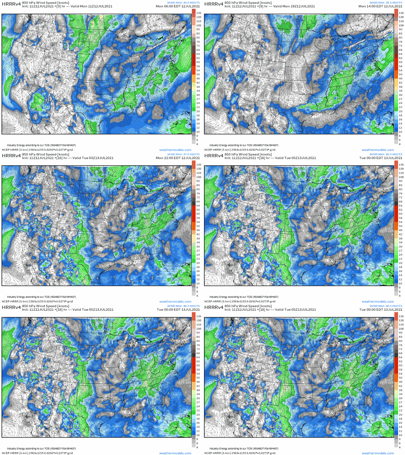
A wide, summer-type Bermuda ridge is currently in cahoots with a hefty, seasonably unusual midlevel trough over the central US to steer dual airmasses towards the northeast amidst rapid low-level flow. The first, from the vicinity of the Bahamas, is meeting the second, from the western Gulf, over the northern mid-Atlantic today.
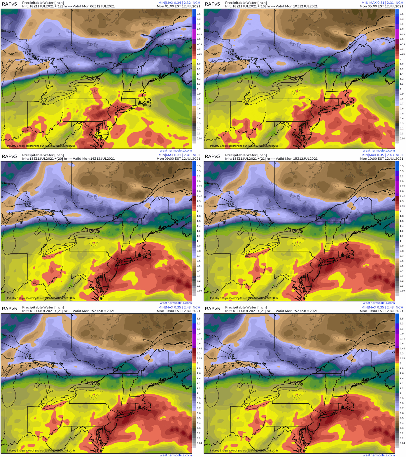
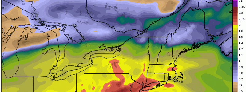
Both the Bahamas and the Gulf are characterized by large levels of atmospheric moisture, of course. Advection from these areas, then, results in an environment over NYC is characterized by truly excessive water vapor content. Such atmospheric liquid can be comprehended using a parameter known as precipitable water (PWAT), which sums total moisture through a vertical slice of the atmosphere.
Values of PWAT are expected to be through the roof today over the NYC metro, around 2.3″! This value, should it verify, would far exceed today’s daily record, which is around 2.05″.
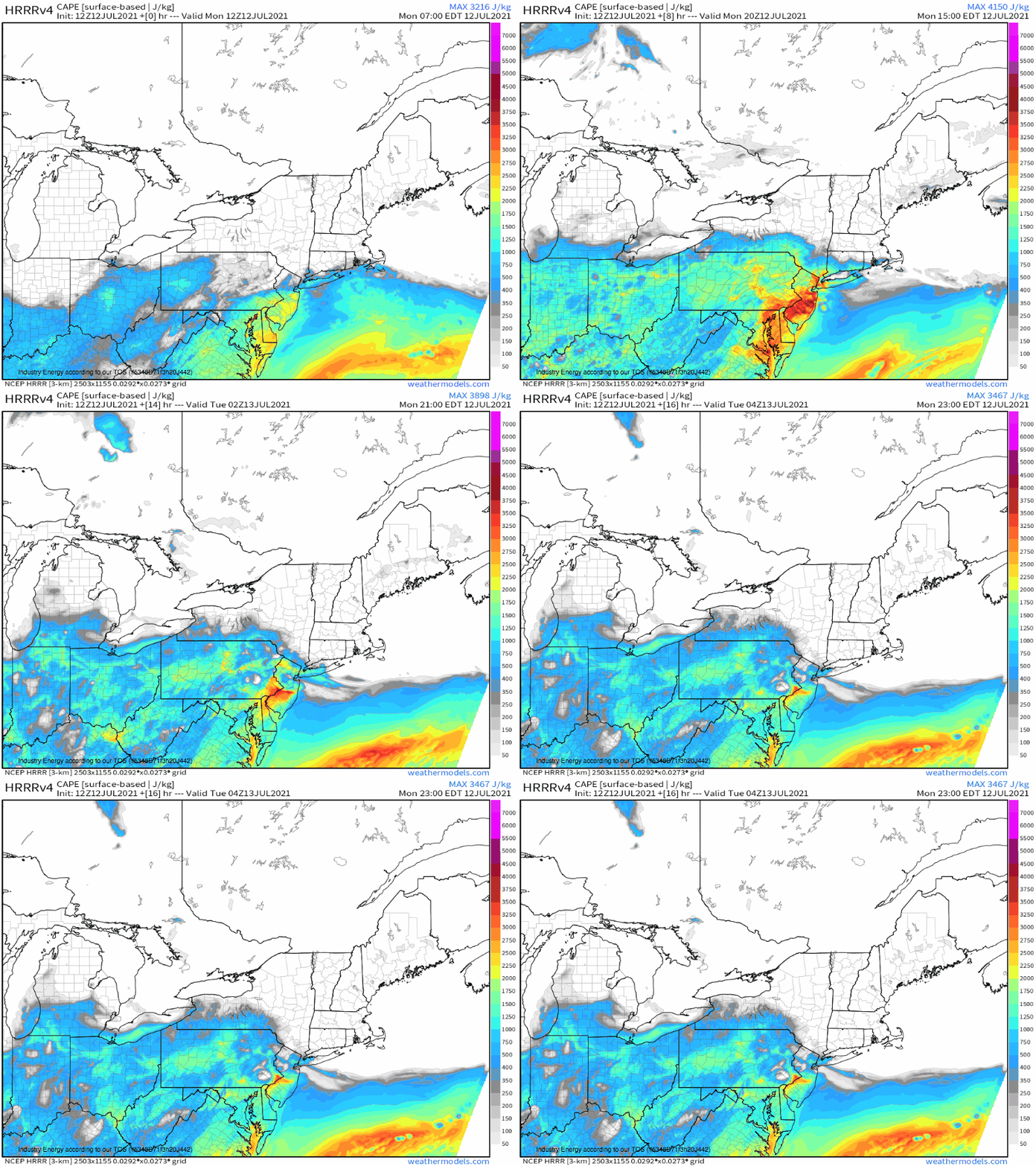
The moist atmosphere, heated by the July sun, will also encourage convective instability (CAPE) exceeding 3000 j/kg south of a warm front draped near the aforementioned CONUS trough’s attendant surface low. These levels of potential energy will allow vigorous updrafts to develop near sources of lift, which can work with the very high PWATs to promote efficient, profuse rain that can lead to flash flooding.
Weak midlevel flow will keep storms moving very slowly and likely front-parallel, which will likely keep excessive downpours over the same places for hours.
Remember the FFG values posted above? They showed us that it would only take ~2″ of rain in a three hour period for flash flooding over NYC. Given the atmospheric parameters in place, this could easily be achieved given updraft initiation. But that brings another question: what mechanism could lift storms over the NYC metro? Answer: the aforementioned warm front!
There is such thing as a synoptically evident warm front for NYC metro flash flooding- it even happened last week. It sees a warm front attempt to lift through southern New England fairly far away from its parent low, before cold air damming inspires a Cape Cod meso-low to develop. The result is a boundary pulled weakly north by the distant primary low, and weakly south by the closer but weaker Cape Cod depression. It’s hard to get a front that moves more slowly than that, and when flow aloft keeps storms moving along the boundary, major flooding can occur. Aside from last Thursday, such a pattern allowed training storms to drop 6-9″ of rain across my part of CT in 2018 in a few hours.
Anyway, such a synoptically evident frontal setup is actually unlikely today. Modeled MSLP fields show no real mesolow development, which casts doubt on the ability of the boundary to truly stall. 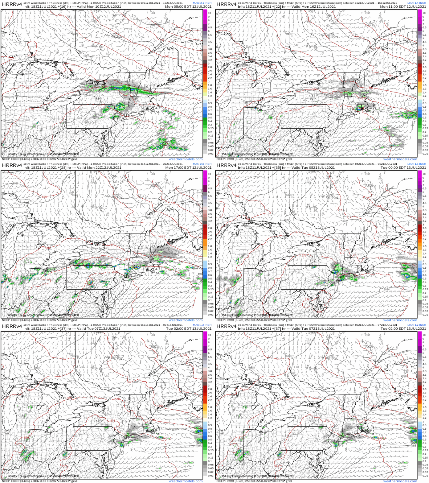
This takes away a bit of confidence in today truly being a perfect storm for NYC flooding. But with shear vectors largely under 10 knots, FFG so dang low, and an environment with so much moisture, it won’t necessarily take the usual slow front/parallel flow magic to get flash flooding in the NYC metro. All it will take is the warm front’s presence for a couple hours, which should happen late this evening into tonight.
Residents of NYC should remember not to walk or drive into flood waters, as they can easily be deeper than anticipated and sweep people and cars away. Additionally, floods can hide other hazards, like downed electric lines, and can be ridden with sewage in a city. Stay safe out there, folks!
