Not So Fast Spring … Winter’s Continuation(?)
Here we in March, and unsurprisingly it’s coming in like a lion! Why? Well, if you read my blog regarding the long-range outlook from nearly two weeks ago (here ), I described a situation we’d be heading given the major disruption with the stratospheric polar vortex and the tropical forcing (MJO).
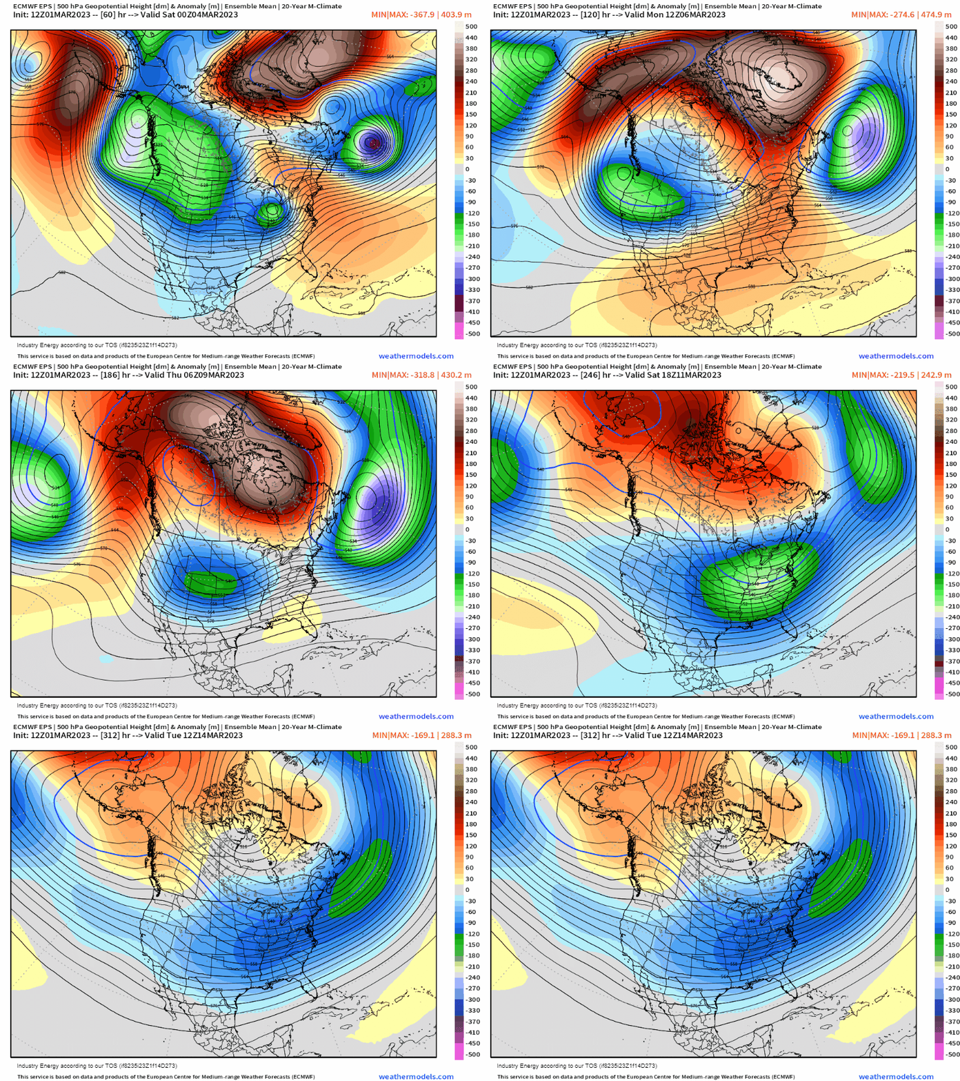
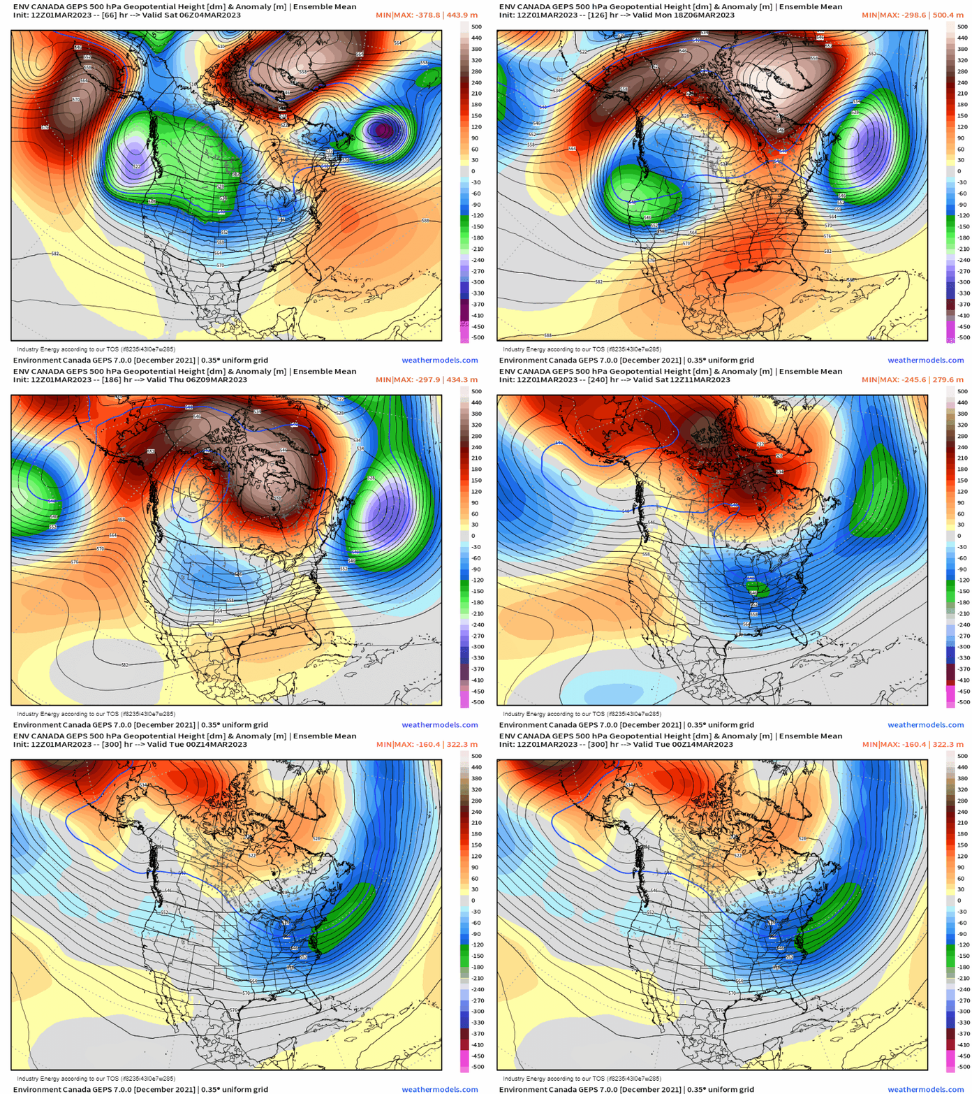
Lets dive into what we’re going to see manifest this weekend and into next week. What we see from the European and Canadian ensembles is a classic evolution with fantastic agreement – our once Scandinavian ridge, now retrogrades fully into Greenland and we see a “peak” in high-latitude blocking across Greenland (nearly 3 standard deviations below average). We not only see this evolution, but notice on the Pacific side. A large anticyclonic wave break manifests, and a blossoming Alaskan ridge pushes poleward into the Arctic circle, and “join” over North America. The result is a suppressed polar jet, and watch how the trough fully shifts eastward and the widespread below average heights cascade into the CONUS. This is a classic response to high-latitude blocking developing “over-the-top”.
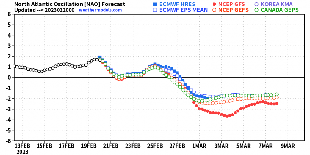
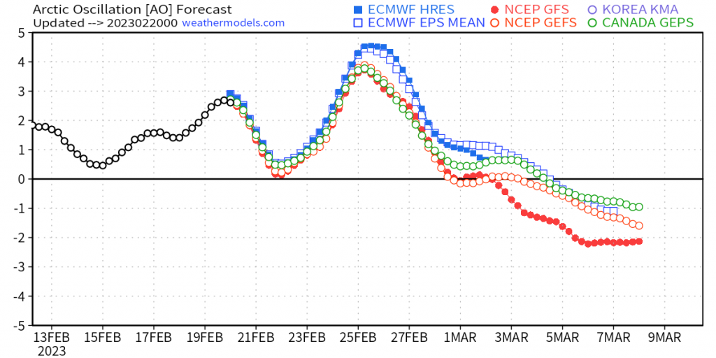
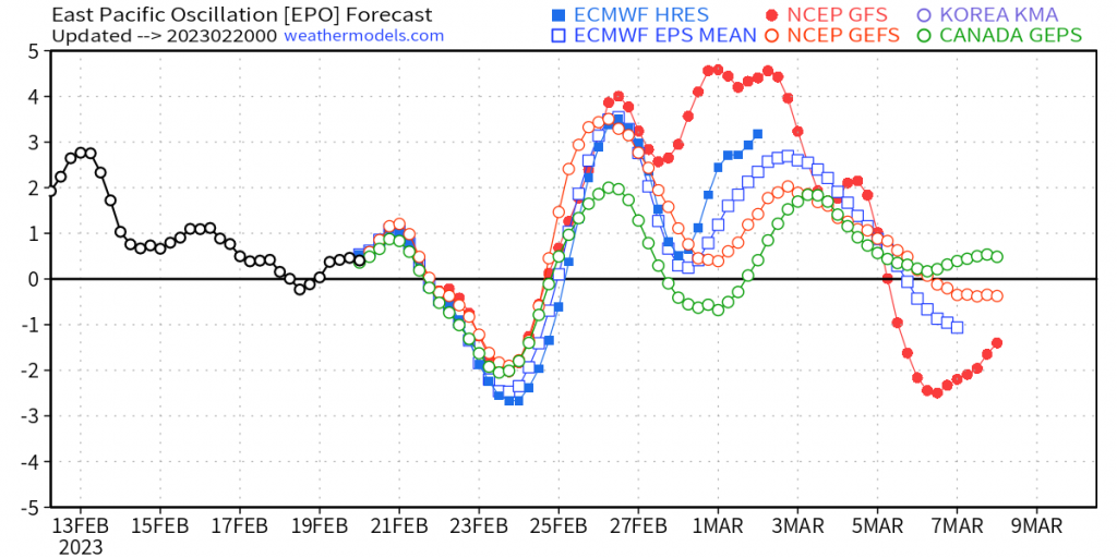
Lets see how this looks on teleconnection indices. No surprise, we see how the ridging blossoming across Greenland tanks the NAO index. What we also get is a tanking AO because of the cross-polar blocking that manifests, further sending the arctic air from the North Pole down into the mid-latitudes. Then we see the response in the EPO as it drops due to the aforementioned billowing ridge in the northern Pacific.
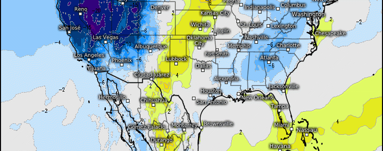
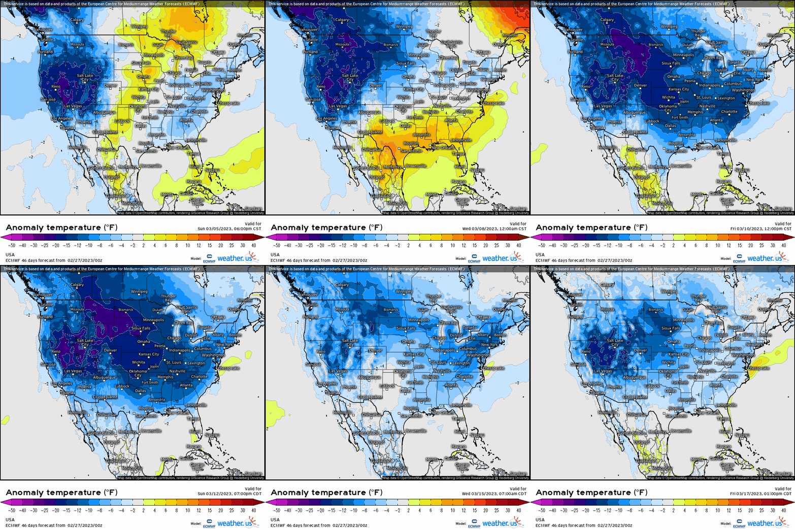
We add that all together, and we see a pattern as such below: below average temperatures inititate unsurprisingly out West, but then quickly without hesitation, bleeds eastward before flooding the majority of the CONUS.
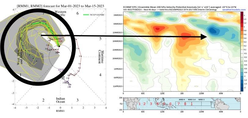
Now, remember I discussed regarding the MJO in my long-range blog? Well, it turns out we’re going to finally get one coherent robust MJO wave that will rounds the “cold phases” that correlates well with below average temperatures across U.S. On the left is what is known as a Real-Time Multivariate index (RMM) that is used to track convection across the tropics (used to monitor and forecast the MJO), and on the right is the famous hovmoller. It aligns rather nicely with the anomalous divergent wave crossing east of 120*W.
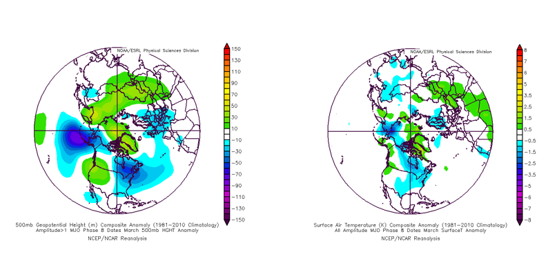
Digging into this further to help support the above, we can show correlations with where the MJO situates itself along the Equator from a superb website that has MJO phases 1-8 (accessed here). So no surprise, phase 8 and phase 1 look uncannily similar to the z500mb evolution on the ensembles above with the 500mb composites on the left, and the surface temperature on the right.

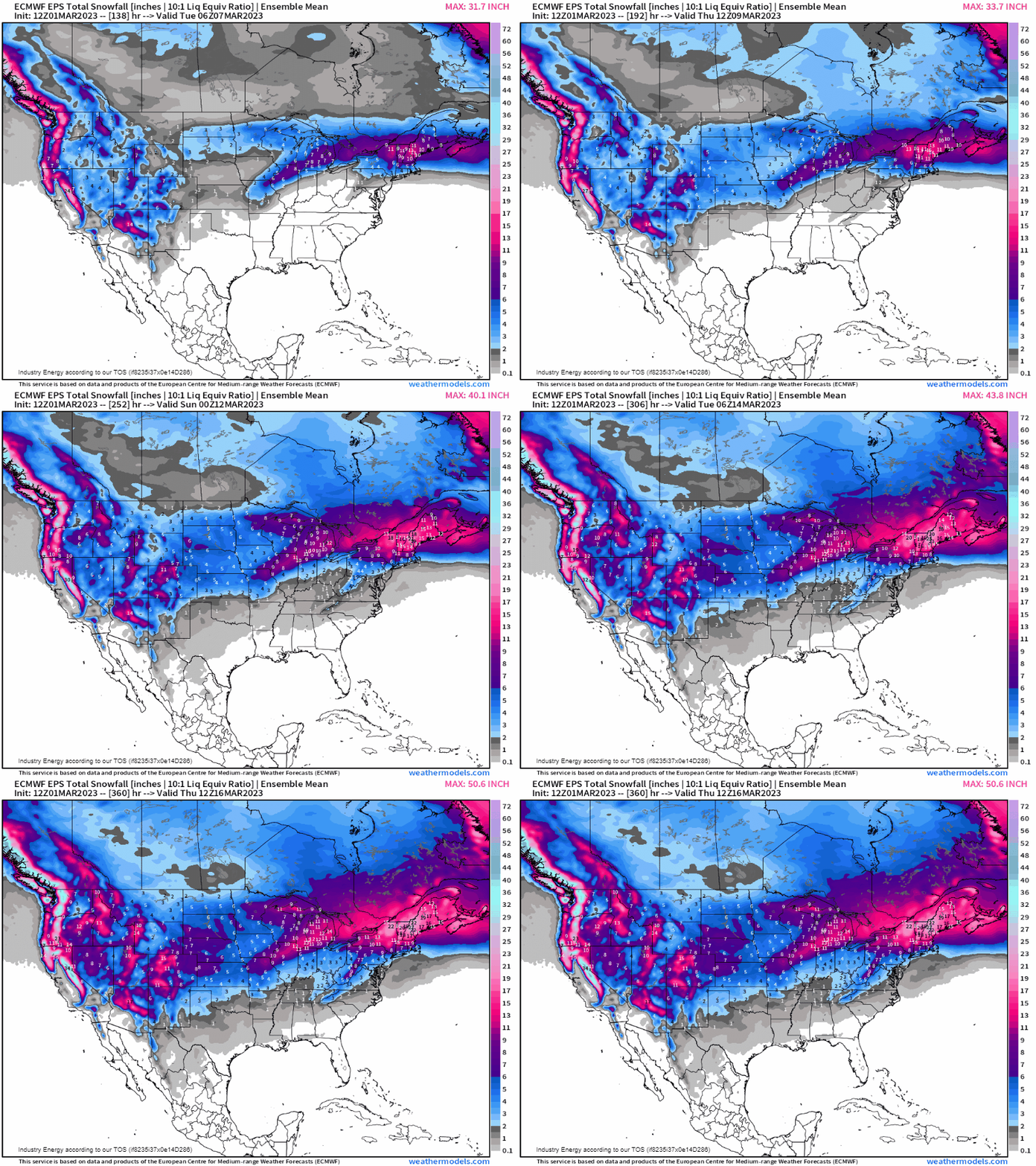
Of course with all of this as we have the most important “ingredient” begs the question – what about snow? When the polar jet is suppressed southward, you’re bound to run into a whole lot more wintry weather setups and we can at least garner a sense of what the pattern could produce by running the EPS to mid-month regarding total accumulated snowfall. So by no means is winter over, and despite running well above average with many places seeing a top 5-10 meteorological winter (Dec 1st – Mar 1st), the Spring-esque weather will certainly be delayed.
