Northwest Flow Brings Southern Snow
Even though cold air has graced the South a few times this winter, southern accumulating snowfall has been rather difficult to find.

While we’ve had plenty of moisture, it never seems to line up just right with the cold air. This is true even for the Southern Appalachians: a location which should have normally seen a few decent snowfalls already this season due to their naturally colder environment. Yet, when we look at the season total snowfall, there’s not much to be found. This is true even on the highest peaks – Clingman’s Dome, Mount LeConte, and Grandfather Mountain. A paltry 4 inches (at best) has fallen on these peaks so far.
That’s about to change, however, as we’re primed for the first decent northwest flow event of the season.

A deep trough will pass through the region Thursday/Friday. As it departs, colder air will filter in behind it.
As those who reside in the warmer valleys know, the cold-air-chasing-moisture scenario rarely works in our favor in terms of accumulating snowfall. However, the naturally colder elevations combined with a little help from favorably-oriented winds and orographic lift can do wonders for elevation snowfall.
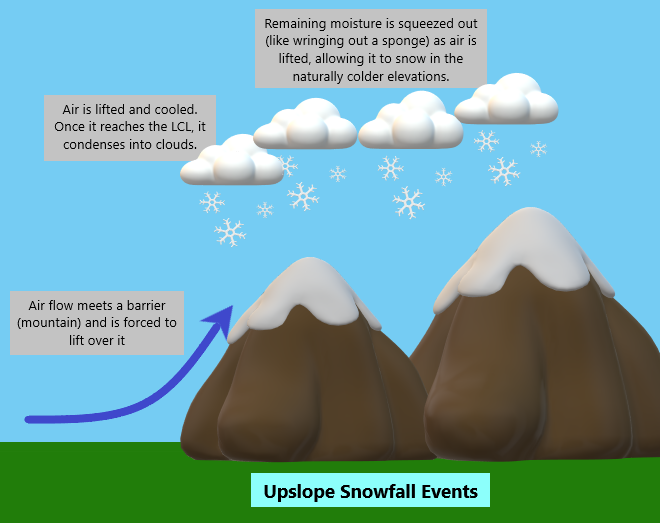
Here’s a little homemade explainer graphic for those who need help visualizing the process.

Upslope Snowfall:
- Air with small amounts of moisture meets a barrier (a mountain, in this case). It cannot go around the barrier, so it is forced to lift over it.
- As the air is lifted, it cools. Eventually it reaches the Lifting Condensation Level (LCL). This is the point where the air becomes saturated and clouds are able to form.
- The now-saturated air continues to lift over the mountains. This process acts like squeezing a sponge and wrings out any remaining moisture.
- As long as the naturally-colder elevations are at or below freezing, this moisture falls as snow.
This process works best when the air is flowing perpendicular to the mountain range. For the southwest-to-northeast-oriented Appalachians, we need winds from the northwest if we want a shot at a decent snowfall.

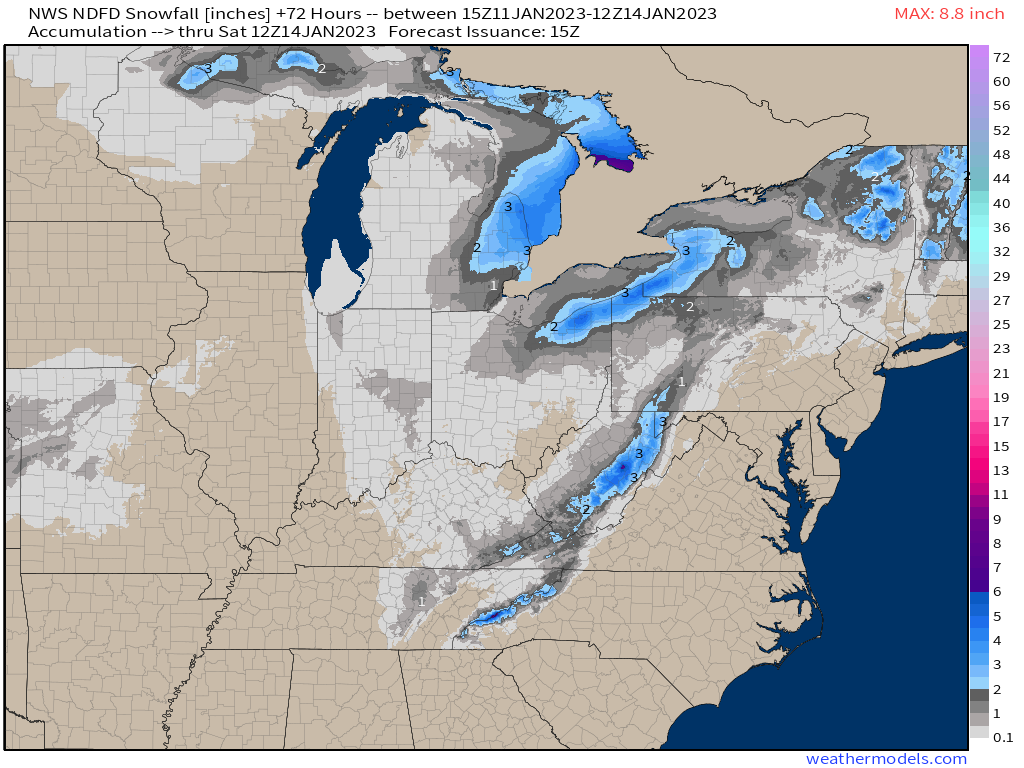
Modeling suggests that this flow will materialize late on Thursday and continue through Saturday morning before becoming unfavorable. Additionally, the colder air will begin to filter in late Thursday night as well.
So, as long as even just a little bit of moisture is available during that time, snow is likely to keep falling in the mountains over this 36 hour window.
Due to a little more NNW than perfectly NW orientation of the flow, it’s likely that the slightly skewed Great Smoky Mountains and Blue Ridge Mountains will benefit more from this event than, say, the Alleghenys of West Virginia.

Due to marginal temps (no sudden influx of truly cold air) and quick departure of any meaningful moisture, valleys will struggle with any accumulation and likely only receive occasional, non-accumulating snow showers. It might be pretty to watch for a bit, but is more than likely to amount to nothing outside of the higher elevations.
The Smokies and Blue Ridge will be where its at this weekend. If you’re a fan of snow-covered mountain scenery, that’s where you’ll want to be. Though roadways through the mountains will likely be closed, there are many scenic spots from which to view the higher peaks.
Personally, I’m looking forward to it as I have yet this season to capture a snow-covered Mt. LeConte.


