Northern Plains Could See Substantial Heatwave
If 2020 was the year of hurricanes and wildfires, 2021 will likely go down as the year of extreme temperatures. A catastrophic mid-February polar intrusion crippled the Texas power grid and caused more damage than any other winter storm, all time record heat in the Southwest broiled Las Vegas and set global temperature records in Death Valley, and a generational anomaly smashed temperature records across the Pacific Northwest to unimaginably dramatic degrees.
That’s three temperature events that rivaled even the most infamous extremes of the past century in terms of scope, longevity, and return interval this year. In this blog, I’ll discuss whether signals for very anomalous heat in the Northern Plains this week could join these ranks.
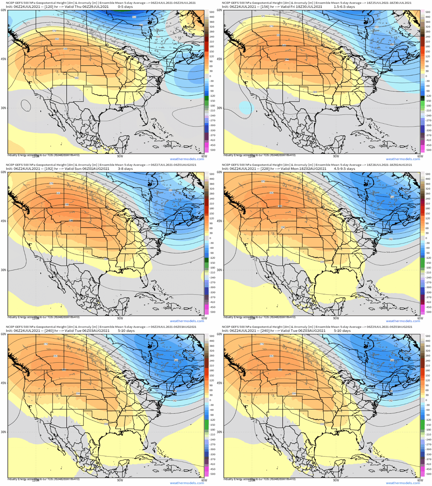
A combination of downstream blocking over the North Atlantic and seasonally impressive upstream troughing will push heights over the US into a bipolar, winter-esque pattern to start the work week, with anomalous troughing east and powerful, extreme ridging west.
As this ridging strengthens and pushes north, it’ll enforce general subsidence and clear skies, and will remain largely immobile for some time. Under this midlevel regime, hefty July solar heating will work with soils rendered unusually dry by moderate drought and downsloping from the Rockies to the west. The former will increase the amount of energy portioned to heat, while the latter will allow sinking air to warm dramatically adiabatically. Combined with the warming influences of anthropogenic climate change, which creates a backdrop upon which more impressive relative temperature records can occur, it seems likely that an unusually intense heat wave will occur.
The question now becomes to what extent will temperatures exceed normal across the Northern Plains and interior Northwest.
Extreme temperatures can be hard to predict more than a couple days out, especially when they threaten the edges of regional climate envelopes. One way to get something of a grasp on how widespread, intense, and predictable a heatwave will be is to look at averages of many models over many hours. For there to be meaningful signals on such smoothed output, the three aforementioned conditions must be met to a degree, and there’s a good chance local conditions could well exceed the mean data.
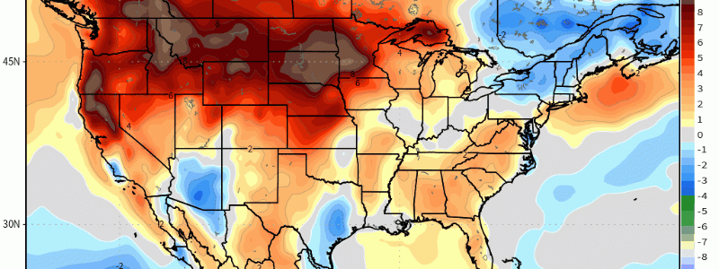
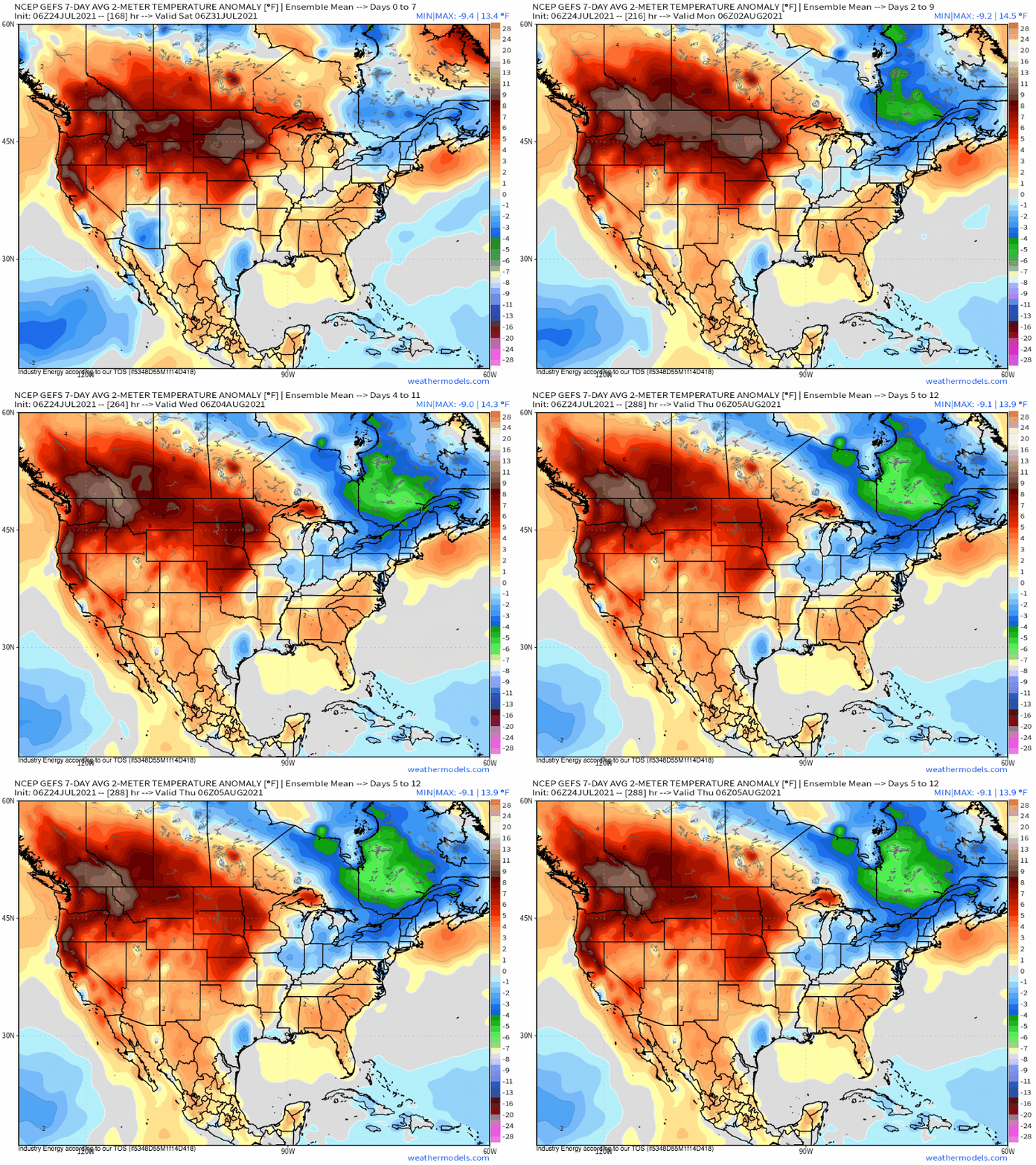
With this in mind, we can look at output like the GFS Ensemble system (GEFS)’s seven day mean temperature product for the area in question.
From the Pacific coast to the northern Midwest, the 8ºF-15ºF contour reveals the output we were looking for: a substantial anomaly appearing on averaged model output itself averaged over a seven day period. While these anomalies themselves seem insignificant, they include significant smoothing on account of temporal and spatial uncertainty and therefore likely indicate actual, shorter-duration temperature extremes that could well exceed such values.
It’s still a little early to say with confidence where the highest temperatures will set up, and just how bad it’ll get. But a record-challenging heat wave, potentially quite intense, will impact parts of the north-central CONUS over the next week. Residents should start to prepare now.


