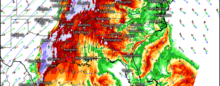
No Rest For The Weary
I hate to be the bearer of bad news, but we have another (potentially significant) severe weather day in the forecast for Tuesday.
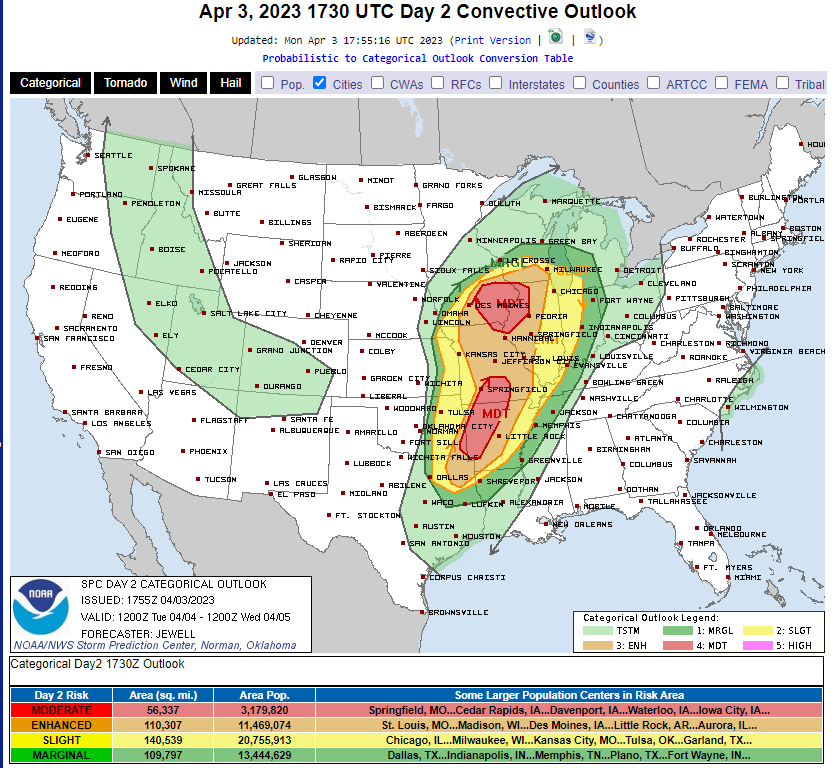
No, this isn’t last Friday’s outlook. A similar set up targets the same general area that just experienced devastating severe weather not 4 days ago. Like Friday, we have two different “maximums” where forecasters are most certain severe weather will occur.
Let’s take a look at the set up first.
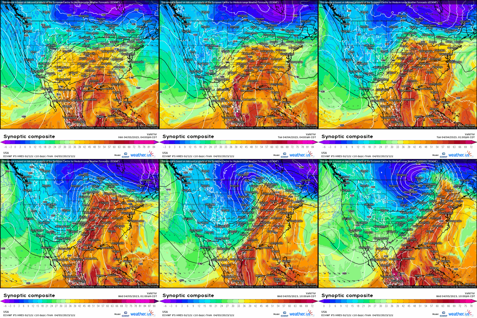
A large, deep trough is now over land and will make its way eastward over the next few days. Inside that trough, a shortwave can be seen developing, rounding the base of the aforementioned trough, and ejecting northeastward. This is the match.
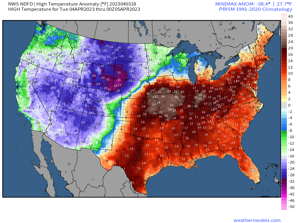
Ahead of the trough, increasing southerly flow along the edge of a large ridge of high pressure will allow for temperatures much above average over the area in question – and really, nearly the entire Eastern US. This is our tinder.
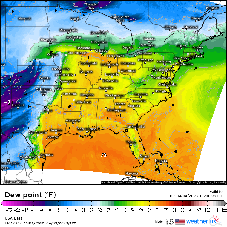
So by late afternoon, we have a large warm sector with dew points in the 60s. Moisture will pool along the warm front in Iowa and Illinois and dew points may make a run at 70 degrees. Further south and closer to the Gulf, dew points near the dry line draped over the Plains states will also be approaching 70 degrees.
This event seems to be a bit of a two-parter. The northern portion of the risk maximum may see severe weather blossom as early as the afternoon hours as the warm front lifts north. The southern portion will remain capped during the day and therefore be most at risk during the evening and overnight hours as the cold front finally arrives.
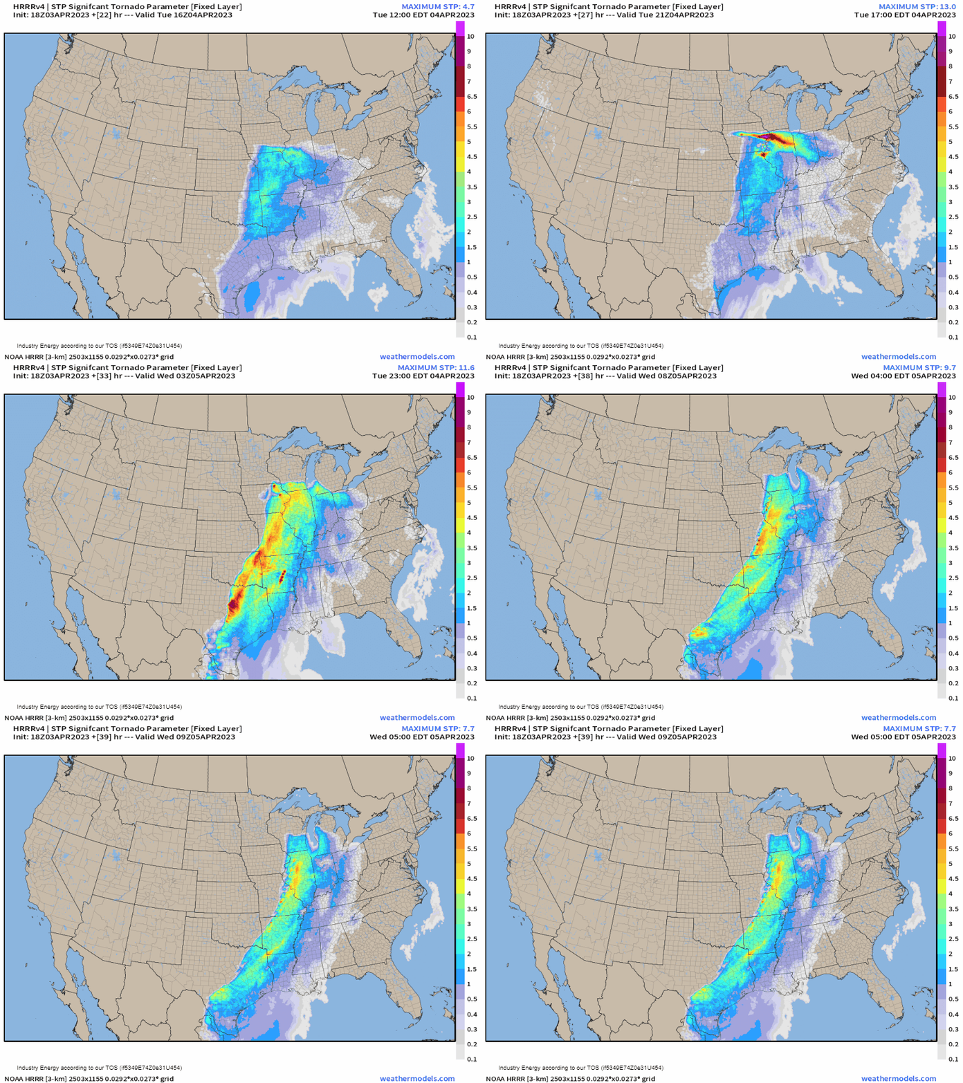
Using the Significant Tornado Parameter map, the two distinct waves are clear. First, we see the afternoon/evening round further north as the warm front lifts across the region. Then, after dark, we see the southern threat materialize in force.
As you may have guessed from the above map, tornadoes are anticipated tomorrow. Some of these may be strong and long tracked. Unfortunately, if any tornadoes occur in the southern defined region, they will occur in the dark and while some are sleeping, making them even more dangerous.
Damaging winds and large hail are also possibilities tomorrow.
I normally don’t stress the tornado threat over more widespread hazards like damaging winds, but I really want to stress tomorrow’s:
We are coming off back to back deadly severe weather outbreaks. This event is targeting the same areas that are still reeling from the latest round. Additionally, strong, long-tracked nocturnal tornadoes are a good possibility. It is incredibly important to prepare ahead of time.
- Have multiple ways to receive warnings, including one that will wake you if necessary. Your primary warning source should be a NOAA weather radio (which can be found on Amazon or at places like Walmart, Target, or sometimes even your local grocery store).
- Outdoor warning sirens are NOT reliable. They are not meant to be heard indoors and sometimes may not even sound.
- Prepare your safe space ahead of time. This should be an interior room on the lowest level of your house. Stock it with helmets and hard sole shoes. Put a battery-powered radio in there as well so you can keep receiving information if the power goes out.
- Know your plan to shelter and make sure your family is aware of it as well.
- Know what county you reside in, how to find it on a map, and the surrounding counties. Remember, warnings are issued by counties. Knowing the counties near you can give you a heads up on whether or not you need to be thinking about getting to safety.
- Mobile/manufactured homes are NOT a safe place to ride out a tornado. If you reside in one, you need to make plans to shelter elsewhere. Do not wait until a warning is issued to leave for a shelter. If a watch is issued, that is the time to start enacting your plan. The Red Cross keeps an updated map of open shelters which you can access here.
- Stay weather aware and up-to-date with the forecast throughout the day. Check your local NWS website or tune in to your local broadcast meteorologists on the news for specifics regarding your area and extended coverage.
- Warn your friends, warn your family. If you know someone in the risk areas, WARN THEM. Increase awareness so no one can say they were caught off guard. Stress the seriousness of the situation and the need to prepare.
Check back here in the morning for an updated look at what we’re expecting in terms of severe weather from Armando.


