Nicholas Brings Substantial Flood Threat to Gulf Coast
A significant round of freshwater flooding will be likely over the coming days as Nicholas, a poorly organized tropical storm, interacts with a stalled front just inland of the Gulf.
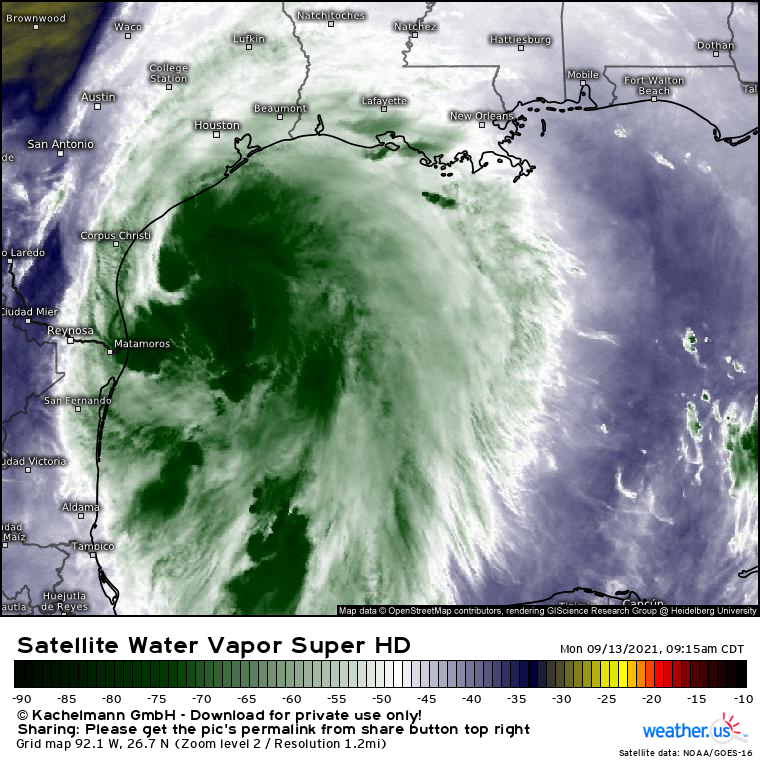
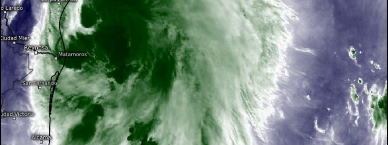
Satellite imagery shows a tropical storm that, well, looks like a tropical storm. It’s currently centered east of Corpus Christi, and will crawl north towards the central Texas coast over the next 12 hours before a landfall somewhere south of Houston. Winds and surge will likely cause scattered issues near the coast around the time of landfall , but this will not be a wind storm or a surge storm.
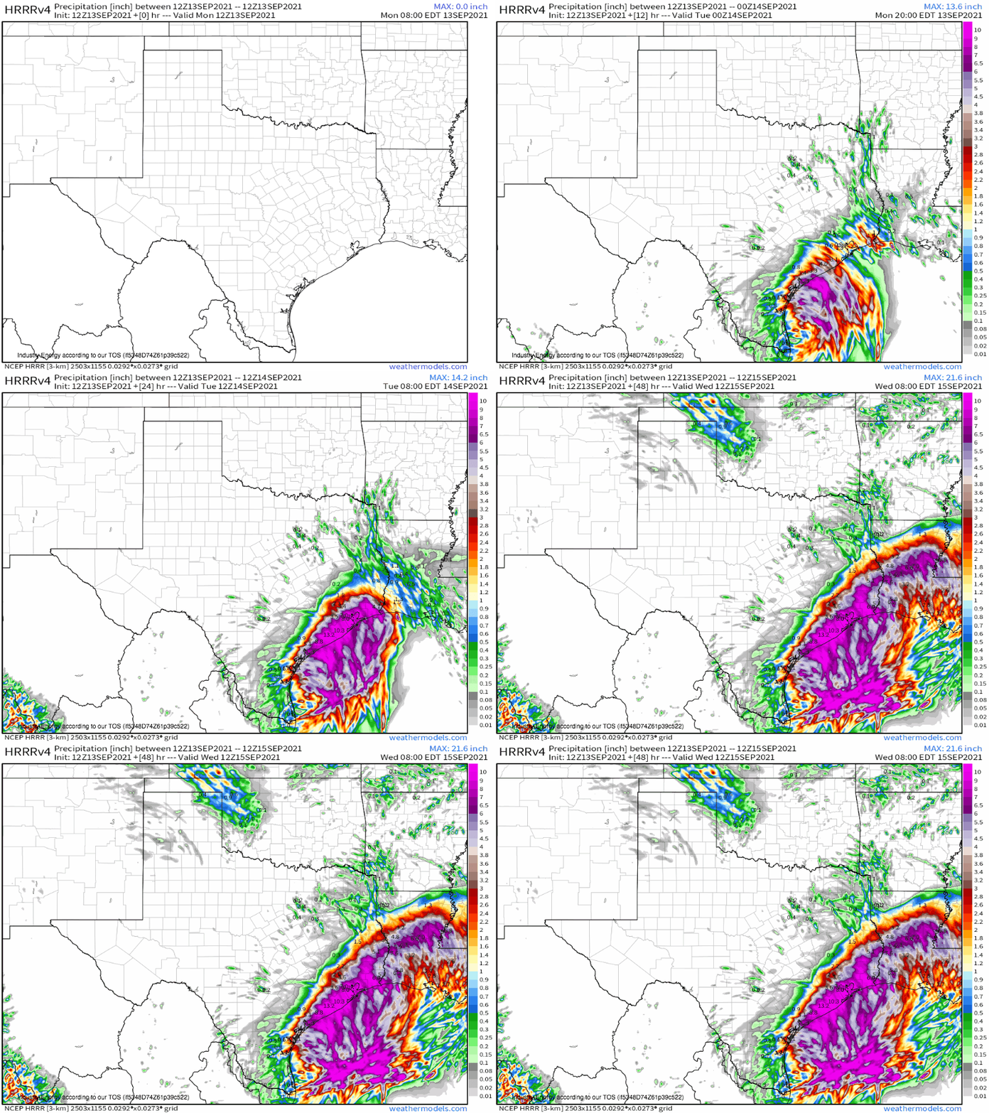
Rather, it will be a rain storm. Nicholas is a dense mass of deep tropical moisture, and as it interacts with convergence from a stationary surface front near the Gulf coast, prolific and slow-to-progress convection will result in a widespread 6-20″ of rain over the next week from SE Texas to Louisiana.
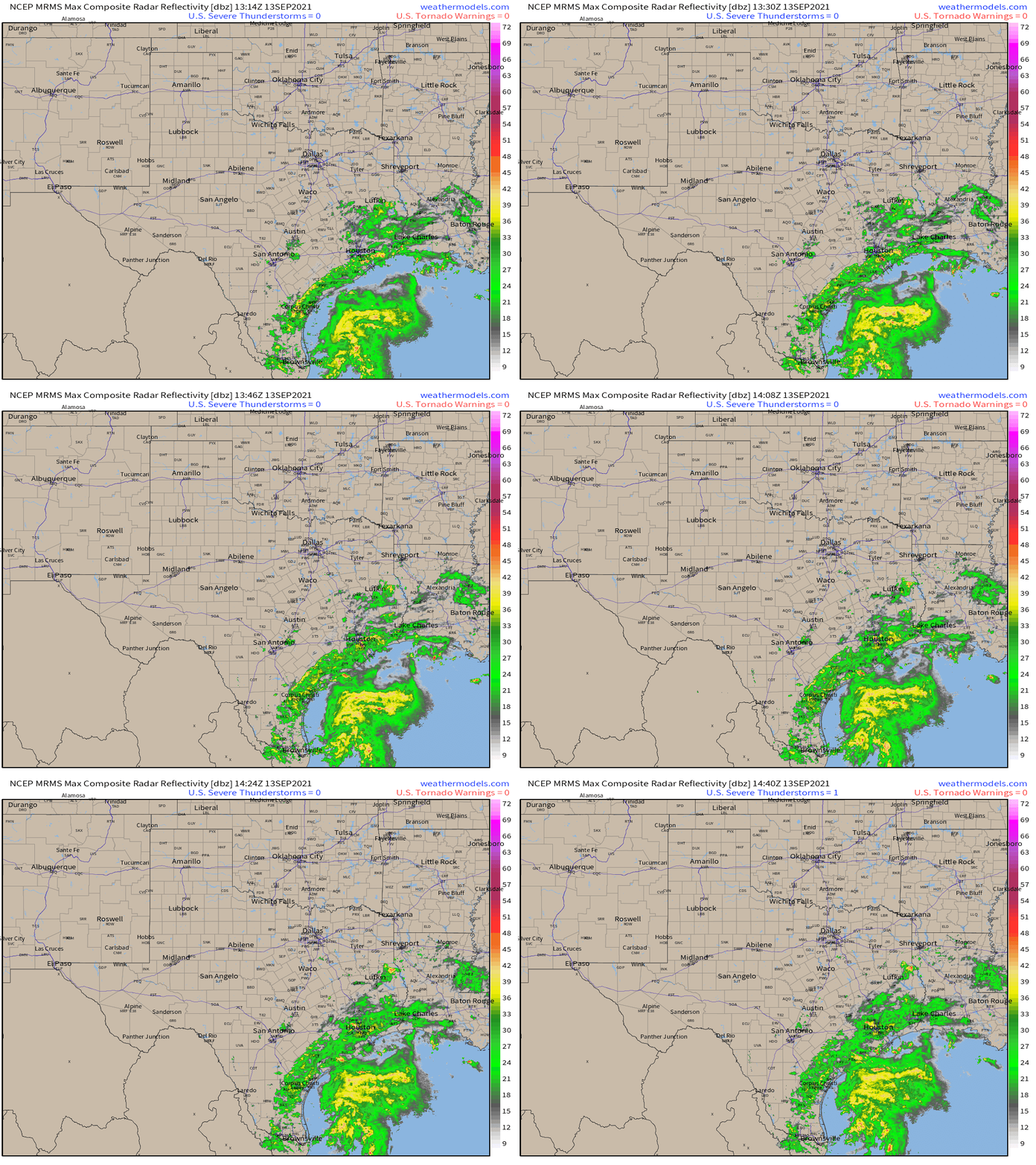
Rain has already begun in earnest for many, associated with lifting of tropical moisture along the frictional flow convergence inherent to a coastline.
Rainfall rates generally under 1″/hr mean this rain is not yet heavy enough to cause flash flooding, but tropical stratiform is a patient beast. The steady, soaking rain will steadily wear down the ability of environmental drainage to whisk away runoff by saturating soils and filling storm drains, with scattered imbedded convection (like the heavy rainstorm currently over Houston) promoting further degradation of environmental flood protection.
The degradation of runoff capacity won’t directly lead to dangerous flash flooding, but it will set the table sufficiently such that any high-rate rainfall this evening into tonight will be capable of leading to considerable, or even catastrophic, flash flooding.
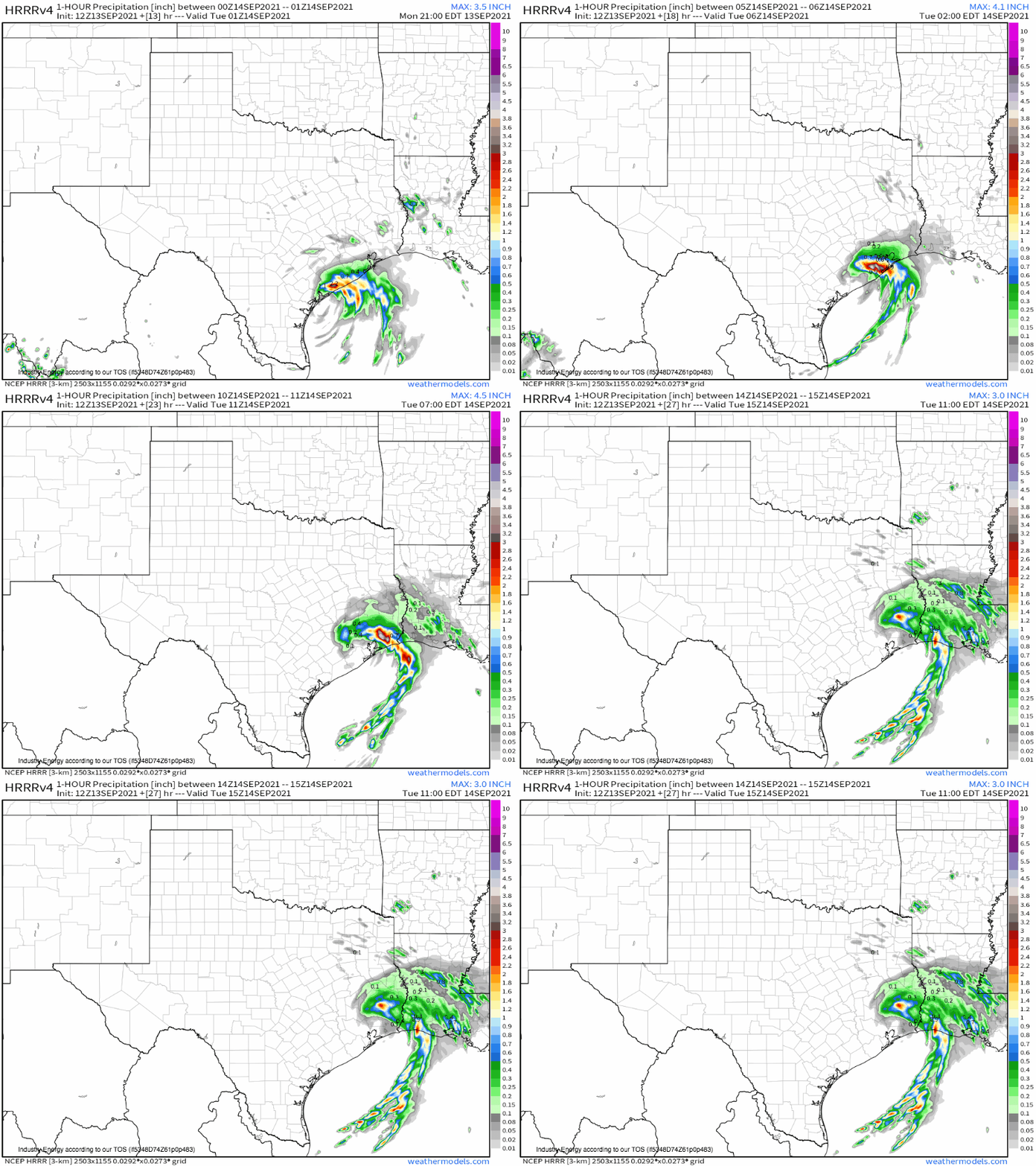
Such high-rate rainfall will start isolated, with localized instances of imbedded convection in broader moist convergence promoting a flash flood capable of stranding cars and inundating basements through the afternoon. But around sunset, as the actual core of Nick approaches the coast, a much more dire chapter in the tropical storm’s hydrological life will begin.
Intense convergence and very deep moisture near the storm’s core will promote a band of intense convection capable of rainfall rates from 2-5″/hour. As it slowly moves northeast through parts of the Texas and Louisiana coast, including some of the Houston metro, it will dump prolific rainfall atop ground saturated by this morning’s stratiform rain.
This is when I fear catastrophic flash flooding could occur for some, as massive amounts of runoff are produced with no environmental capacity to shuttle it. Where several hours of this rain falls, flooding could prove severely life-threatening. If you live in this part of the country, and plan to travel tonight, please reconsider. Sleep with a WEA-equipped device on a higher floor of your house. And of course, remember: turn around, don’t drown.
