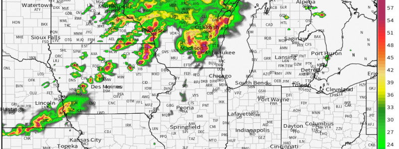
Multi-Hazard Severe Threat Targets the Corn Belt Today
Yesterday, Jacob wrote on a possible severe threat for the midwest for today. We’re going to revisit that topic today as severe weather is still expected, some of which may prove rather intense.
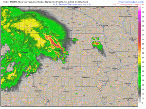
Current radar shows a system of storms with a strengthening line out front. Notice, at the end of that loop, severe warnings begin to appear. This line is expected to expand and intensify as it moves northeast through Iowa into Wisconsin throughout the day.
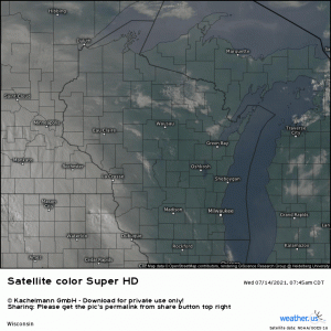
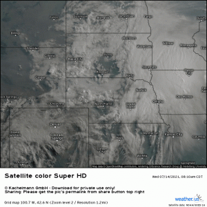
A quick look at the visible satellite…
…Reveals clear skies ahead of the complex. With the sun out in full force and temperatures/dew points climbing into the 70s already, this intensifying line will be moving into an area with more unstable air ready to fuel it. CAMs have remained insistent on a bowing line forming this afternoon as the complex crosses into Wisconsin.
Large, bowing lines usually call to mind that dreaded D word: Derecho. Whether or not this ends up evolving and being classified as such is really not important right now. It’s simply a name. What we need to focus on is that, with a strong LLJ feeding this system, severe, damaging winds are likely once the bowing line is organized. I highly suggest treating any severe thunderstorm warnings issued for this line, should it indeed form, as you would a tornado warning and take shelter. We’ve seen the fury of straight-line winds before; they can be just as damaging as a weaker tornado.
The threat this potential line brings isn’t the only concern today.
Behind this system, skies are clearing. With heating and further destabilization, redevelopment is likely this afternoon along an outflow boundary from the current system, mainly in Iowa and Minnesota and then tracking east.
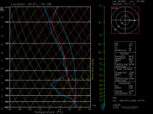
As a forecast sounding taken from near the Iowa/Minnesota/Wisconsin border will show, shear profiles will be conducive to tornadic activity.
Such activity will be more likely in any discrete supercells that are able to form in the early stages. With CAPE in excess of 3000 J/kg, these discrete cells will likely quickly grow upscale into clusters or lines, reducing the tornado threat and transitioning to a primary damaging wind threat. In addition, cool temperatures aloft and strong updrafts lend to the possibility of hail.
If you reside in this area and you’ve gotten rain and/or storms this morning, it’s important to know you most likely are not done for the day. A second round will initiate this afternoon packing the threats mentioned above. Be weather aware today with multiple ways to receive warnings and a plan to shelter that can be executed quickly. Considering the fairly significant wind threat, plan to shelter for severe thunderstorm warnings as well, not just tornado warnings.
Stay aware and safe!
