Multi-Day Severe Threat: March 30
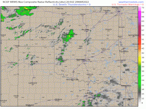
Today’s severe threat, which I discussed in a blog posted this morning, is just now kicking off.
At the time I’m writing this blog, no storms are currently meeting or exceeding severe thresholds, but we can see convection firing off the dryline. Though tonight’s severe threat hasn’t organized quite yet, we’re still going to broach the subject of tomorrow’s threat as it has the potential to be extremely impactful and is something to be aware of in advance.
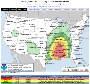
Via SPC
By now, you’ve likely seen this graphic shared hundreds of times on social media, and for good reason. Tomorrow’s expected severe storms have the potential to significantly impact a fairly large portion of the Eastern US.
But what, exactly, are the threats I’m referring to?
Unlike last week’s event in which the moderate risk (red) was mainly tornado potential driven, this week’s event is largely wind-driven.
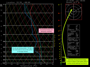
- Strong winds will be present not only in the mid-levels, but in the lower levels as well. Based on this forecasted sounding, which is the GFS and likely smoothing things out a bit, ~40 kts of shear will be available between the surface and 850 mb. That is an incredible amount of low-level shear.
- Instability is somewhat limited, however, the excessive shear is expected to overcome that issue and serve to organize the updrafts as they form.
- The low-level shear will also serve to enhance rotation, especially with surface winds backing from the SE. Thus, tornadoes, some strong, are possible within the line.
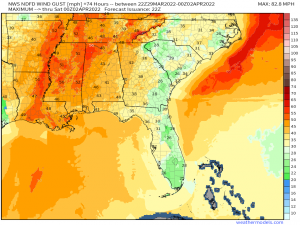
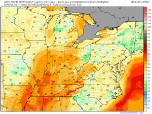
- Dry air and a strong flow in the mid-levels give us a damaging wind threat. The GFS estimates ~55 kts at 700 mb in this sounding, but some CAMs suggest up to 75 kts at 700 mb. If those winds mix down to the surface, gusts over hurricane force – 75 mph or greater – are possible, making this a significant wind risk.
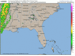
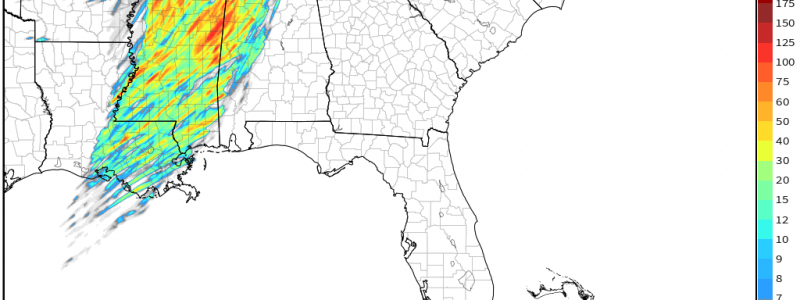
As mentioned in the previous blog, a weaker version of the QLCS will be ongoing in the morning hours. As the day dawns and the low level jet begins to pump in warmth and moisture, that line will eventually enter into a much more favorable environment. By late morning or early afternoon, severe weather should begin to blossom.
Due to the linear nature of the threat, damaging winds, potentially up to or exceeding hurricane force, are the main threat. However, strong low-level shear and surface winds from the SE will serve to enhance rotation and a few potentially strong tornadoes can be expected within the line.
It is important to note that this line will be moving very quickly. As QLCS tornadoes are historically harder to warn since they spin-up quickly at times, you’ll want to be ready to act on your plan to shelter as you may not have much lead-time. In addition, given the forecasted strength of the storm-related wind gusts, I would HIGHLY suggest sheltering for a severe thunderstorm warning as you would for a tornado warning. Straight-line winds can do just as much damage as a lower-end tornado, if not more. Expect trees and powerlines to be blown down. Power outages, perhaps wide-spread, are likely.
If you check out that simulated radar loop again, you’ll notice a few discrete cells forming in the Deep South out ahead of the line at times. This is a possibility and would carry an elevated tornado risk given the shear if they can form and survive. However, they are unlikely to last long as the line will be moving extremely quickly and should be able to easily overtake them. Whether or not these discrete cells actually form is still somewhat unknown. Instability is expected to be relatively limited and perhaps not enough to incite development in the open warm sector.
One other important note:
Winds ahead of the line’s arrival are forecast to be particularly gusty. This could bring down powerlines or trees before the storms even arrive. Keep your devices charged and make sure you have batteries for your weather radio so you can still receive warnings if power is lost before the storms.
This is still an evolving forecast as many mesoscale details that can have significant impacts on the forecast (changes in instability, pockets of surface heating, outflow boundaries) won’t become clear until tomorrow. Stay tuned to your local NWS and broadcast meteorologists for the latest on your specific area.
