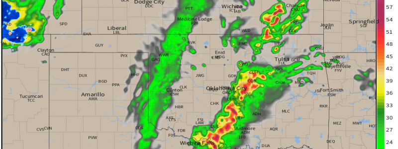
Multi-Day Severe Threat: March 29
Another multi-day severe threat is expected to kick off today in the southern Plains. This event, though similar in location to last week’s event, is somewhat different in the threats it presents. Let’s discuss what is expected for today (Tuesday).
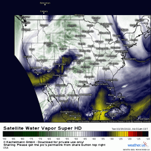
A deep-digging trough currently traversing the desert southwest will move east today, providing the upper-level support for multiple days of severe weather.
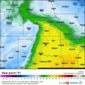
Ahead of this trough, moisture will begin streaming northward into the Plains and Deep South from the Gulf of Mexico.
Dewpoints in the upper 50s/low 60s are likely as far north as southern Nebraska, setting the stage for some relatively weak destabilization.
A dryline located in western TX/OK/KS will sharpen and move east throughout the day. Storms are expected to begin firing off this dryline by the evening hours.
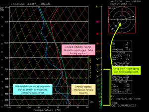
We can gather a few things about the expected atmosphere from this forecasted sounding.
- Moisture return may remain rather sluggish until the overnight hours when the low level jet strengthens. This leaves us with limited instability. We’ll need the mechanical forcing from the dryline or the cold front to get things moving.
- A strong capping inversion is expected to remain in place. Instability is limited, as mentioned above, and additional forcing will be required to break the cap. This greatly limits the possibility of pre-frontal development in the open warm sector. Discrete mode is not favored.
- A layer of dry air exists in the mid-levels. Strong winds will also be found in this layer, especially as the wind field strengthens in the overnight hours. As dry air entrains into the developing storms, these winds can mix to the surface. Damaging winds are expected to be the primary threat.
- Shear is expected to be more than adequate. Though a linear mode is favored over a discrete mode, embedded supercells or spin-ups in the line can put down a few tornadoes. Winds backing from the SE can enhance rotation, aiding in the development of tornadoes.
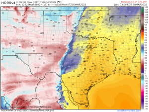
I mentioned that a linear mode is favored, however, there is one area that may carry a greater risk of embedded supercells, albeit briefly.
As the LLJ really cranks up in the overnight hours, a small plume of richer moisture is forecast to be in place near the northern Texas/southern Oklahoma border. This more favorable environment may allow storms to strengthen and consequently carries a slightly higher risk of tornadic activity.
As far as timing goes: expect convective initiation in the late afternoon or early evening.
Rapid upscale growth into a line is expected. Damaging winds are the main threat, though hail and a few areas of rotation embedded in the line leading to a few tornadoes are possible.
The line will continue to push east through the overnight hours but is expected to weaken somewhat toward the early morning hours as any instability ahead of the line is lost to overnight stabilization.
This is at least a partially after-dark event so be sure to have ways to receive warnings that will wake you. Be ready to act on your plan to shelter as well, if need be.
Though this line looks to be weak in the morning hours of Wednesday, it will enter an environment later in the day that will allow it to present a rather potent severe threat. Look for a blog discussing Wednesday’s outlook either later tonight or early tomorrow morning. Stay tuned!
