Multi-Day Severe Outbreak Likely This Week
Ah, Spring. The season of warmer, longer days, greenery in bloom, the allergies that come with it, and multi-day severe events. Yes, that’s right. We are facing down the threat of our first real multi-day severe outbreak of the season. Whoever has been praying for severe storms to chase is looking at possibly getting their wish in a big way this week.
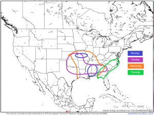
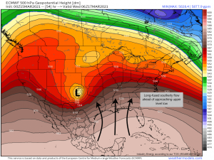
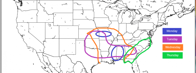
Though the risks will vary in coverage in intensity from day to day, these areas are the ones we will be watching today through Thursday for severe weather. Why? Two separate systems are inciting a long-fused southerly flow across the south, priming the atmosphere for destabilization. If the warmth and moisture being brought in is the gunpowder, the upper level low that will make its way east this week is the match.
We’ll take a look at each of the risks in my blog today. We’ll discuss today in detail since it’s the current threat and then discuss the set up for the next three days. We’ll refine those forecasts as each event becomes the current event in the following days in subsequent blogs.
Monday
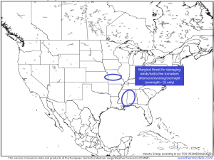
The strong closed low that brought severe weather to Texas on Saturday and huge snow totals to the Front Range yesterday will transition to an open wave today as it ejects northeast. As it lifts, warm air will continue to be brought in to the southern US as far northwest as Missouri, which is where we see our first possibility for severe weather.
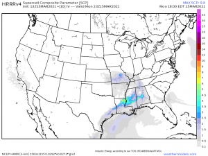
This threat is somewhat lesser as, currently, this area is experiencing temperatures and dewpoints in the mid-40s and these aren’t expected to be able to recover much beyond the mid-50s. Still, with proximity to the low and its associated forcing, CAPE possibly approaching 1000 J/kg, shear around 40 kts, and lapse rates approaching 8 degrees C per km, the potential exists for the formation of a few supercells. Given the lapse rates and the cold air aloft, severe hail may be the greatest risk out of these storms, but with the shear being decent, a tornado or two can’t be ruled out. Expect storms to form later this afternoon and persist through the evening hours until the low passes to the northeast.
The more favorable environment for severe weather exists across parts of MS and AL where temperatures and dewpoints are already in the 60s and expected to rise further with continuing southerly flow. A weak cold front is making its way across MS this morning, bringing some sub-severe storms. This line will move east into AL through the afternoon where the front is expected to stall out across northern AL/SE MS. Along this boundary, stronger storms will be able to form this evening into the overnight hours. With lapse rates approaching 7 degrees C per km, CAPE approaching 1500 J/kg, and shear around 40 kts, a few supercells are possible. The capabilities of the boundary-related forcing is somewhat uncertain, as it will be weakening as the evening progresses. But, should supercells be able to form, a few tornadoes are not out of the question. These storms will likely occur near/after dark so please remain weather aware through the evening. Just because the sun has set doesn’t mean the threat is over. Have multiple ways to receive warnings including those that will wake you if need be.
Tuesday-Thursday
After today’s events, an upper level low will begin to approach from the west. As it does so, long-fused southerly flow will begin priming the south for severe weather. The low will set off that severe weather in different areas each day, from west to east, as it moves, beginning Tuesday with the southern Plains. Wednesday, however, is expected to be the biggest event of the next four days and it looks to target “Dixie Alley”.
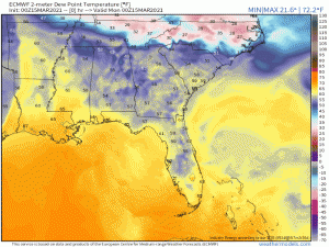
Why Dixie Alley specifically? Well, take a look at the gif above. Notice how the area from LA to GA has constant moisture advection and high dew points over the next 4 days. Though a stationary front parks itself across northern AL, MS, and GA, bringing dew points down a bit there, nothing happens in the southern half of those states to “flush out” the warm, moist air. So, essentially, it just sits there for multiple days, waiting for a spark (in the form of the approaching low) to set it off. So it is here that the most widespread, possibly dangerous, severe threat will set up.
As I mentioned earlier, we will address each day’s threat separately as they evolve, so expect to read about tomorrow’s in Jacob’s blog, Wednesday’s in my blog, etc.
***Ahead of this event, I cannot stress enough how anyone and everyone needs to be fully prepared. Reread the blog I put out on severe weather preparedness and make sure you’ve taken each step. Tell your friends, tell your neighbors. Monitor your local meteorologists’ forecasts and check in on the SPC’s forecasts (link here, for those who need it). Rely on the NWS for the issuance of warnings. News stations will do wall-to-wall live severe coverage when there are tornado warnings active in an area. This is a good way to keep up with real-time development. Many of these events have the possibility to occur after dark so awareness and preparedness is ABSOLUTELY ESSENTIAL. ****
Stay tuned to our blog/twitter over the next few days. We’ll do our best to keep you informed!!
