Multi-Day Potential For Severe Storms Across The Southern Plains
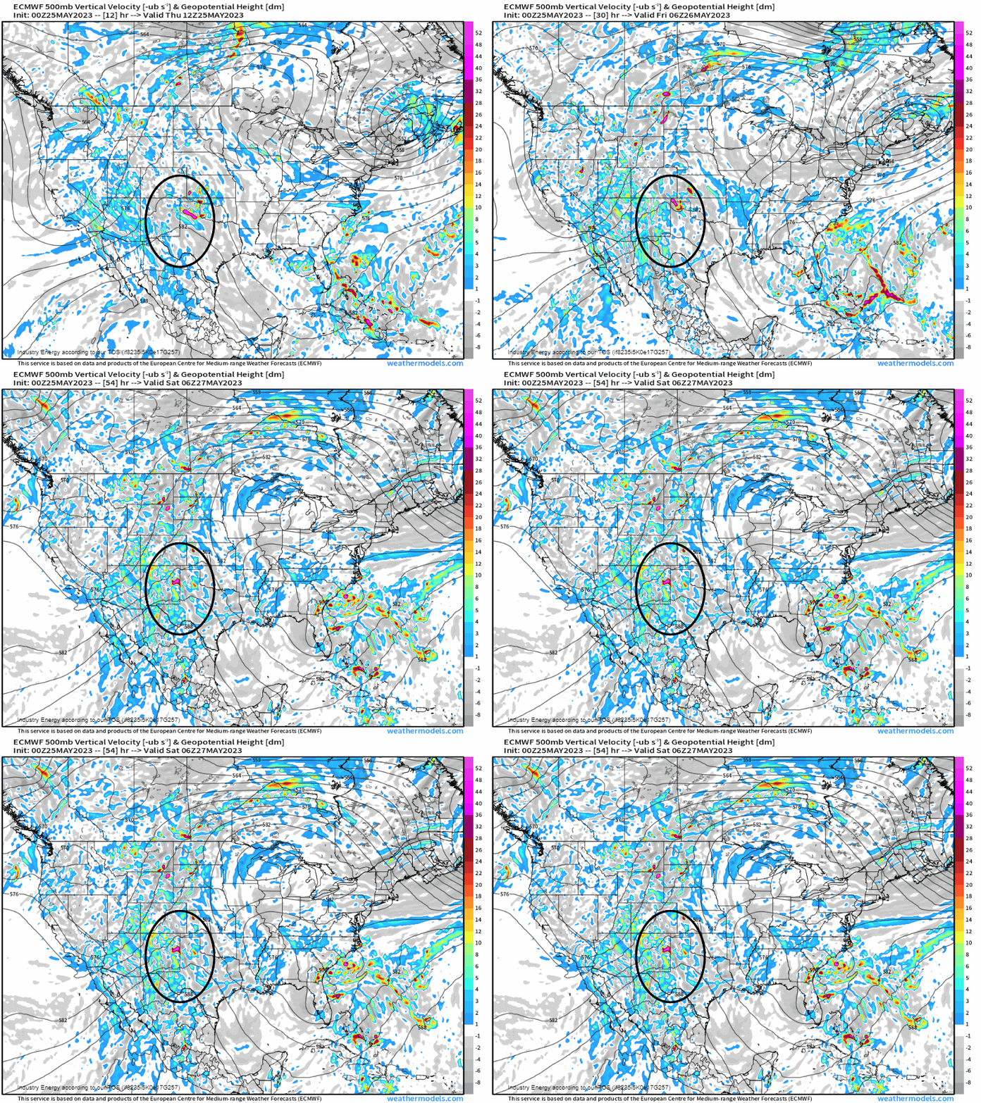
Across the southern Plains – mainly between I-25 (that runs from NM up to WY) and I-35 (this runs from TX up through OK into KS), we’ll be dealing with a somewhat similar pattern each day into Saturday. We identify aloft at 500mb first, where it’s highlighted. In this area is located downstream of a lee trough (i.e. troughing in the lee of the Rockies), where small pieces of energy followed by a more notable shortwave propagating across the TX panhandle tomorrow, will allow forcing for ascent.
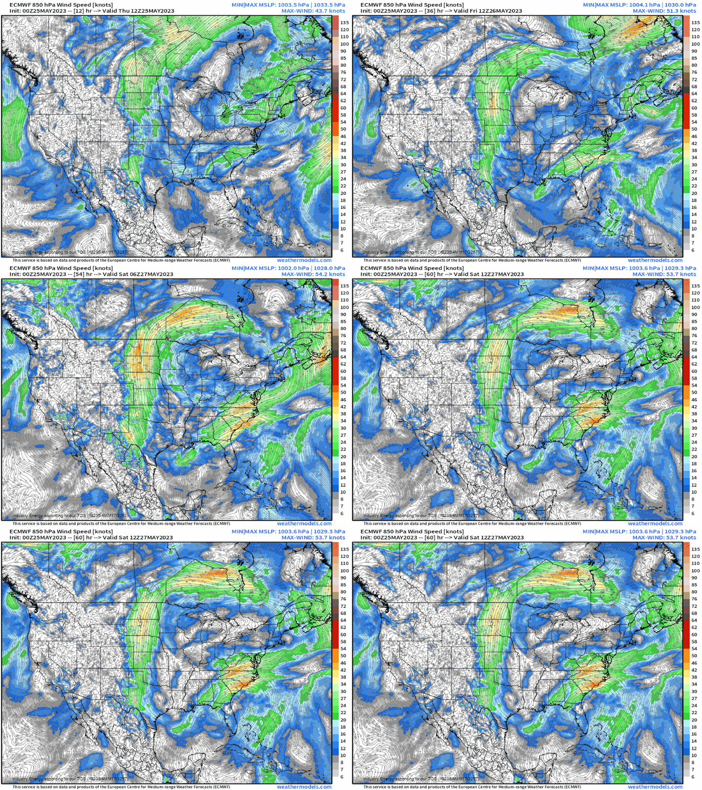
At 850mb, notice a unique mean low level flow paying attention to the Plains. Notice how we see the streamlines in a SE to NW trajectory? This not only advects in moisture (nicely aligns with the persistent swath of 50’s and 60’s dewpoints from TX to the Dakotas), but now provides instability because of the moisture. The reason for this flow is due to a ridge that’ll circulate across the Great Lakes, where due to the clockwise flow allows for this with a cut-off low across the Southeast exacerbating the flow into the Gulf. Then from there, parcels cross the Gulf, and we end right back into the Plains!
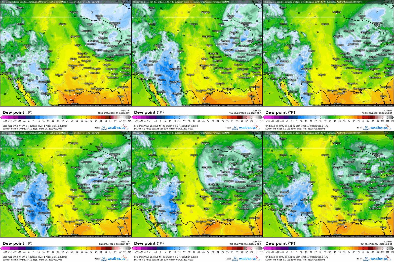
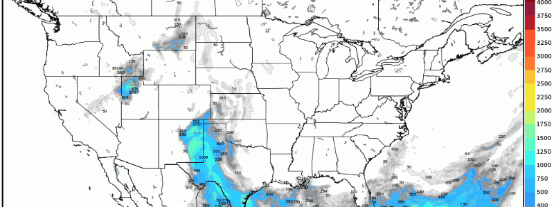
As we mentioned the moisture aspect, it’s not coincidental that instability aligns nearly identical to the swath of dewpoints that is focused today and tomorrow across western TX, eastern NM, and up into eastern CO and WY.
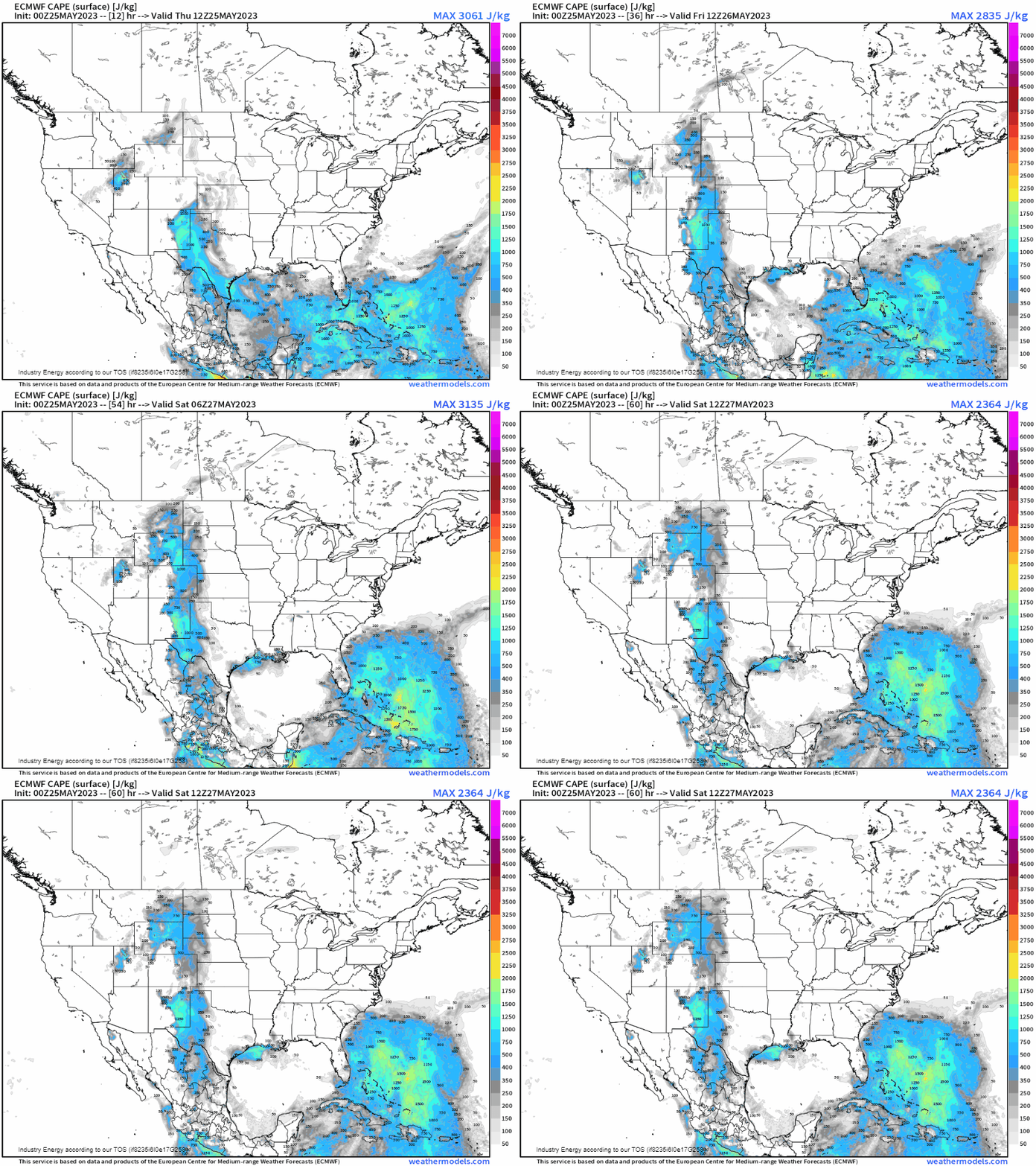
With moderate buoyancy (SBCAPE > 800-1000 J/kg), especially tomorrow across eastern NM and the TX panhandle with the aforementioned shortwave, diurnal heating, and a belt of sufficient to favorable deep layer shear (~20 knots is sufficient, we tend to look at the 25 – 40 + knot range that supports supercells and maintains updrafts), we’ll see this culmination manifest a few isolated supercells today becoming more scattered tomorrow and again into Saturday.

Today, we expect some isolated supercells across eastern NM into the panhandles of TX and OK with splitting cells likely given the orientation of the shear.
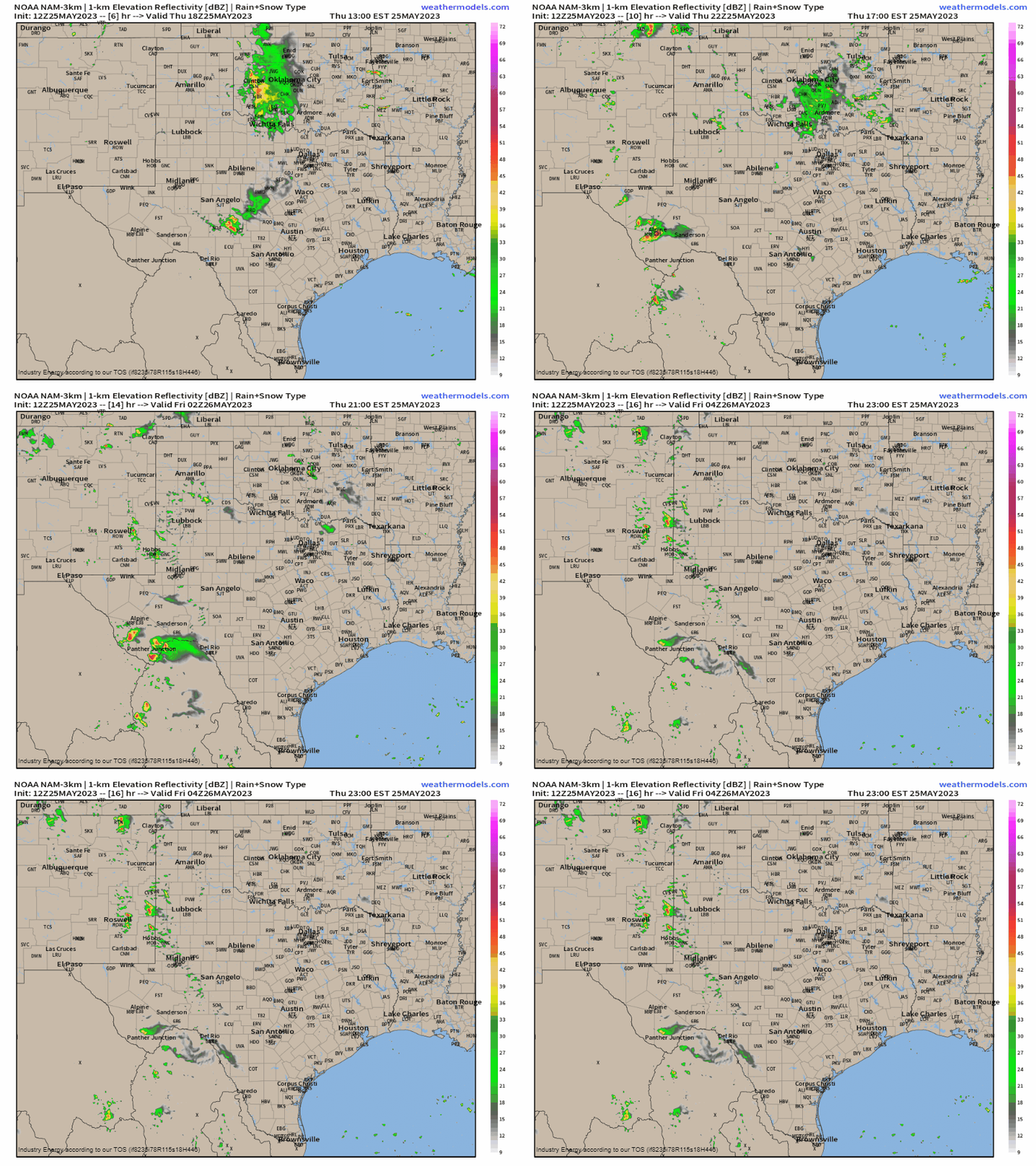
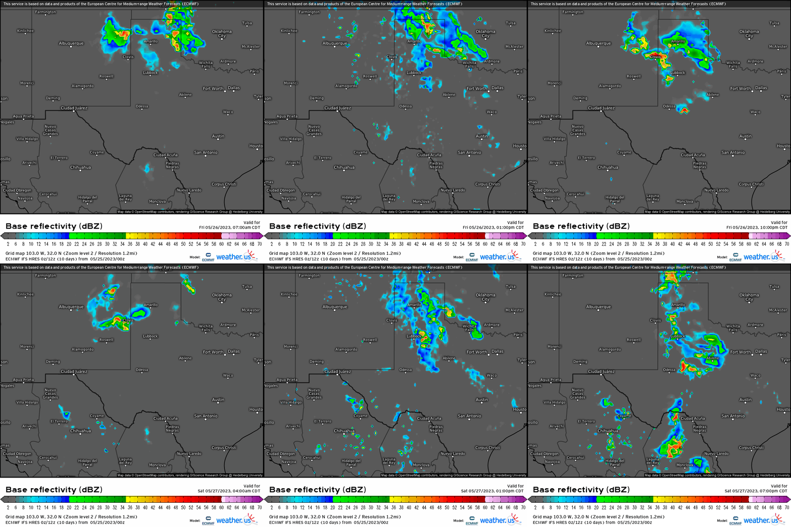
Then tomorrow, we see more of a threat for scattered convection in the form of supercells and clusters that brings hazards including large hail, gusts over 50 mph, and even a few tornadoes possible. While not as potent as Friday, Saturday also will see similar hazards though more favoring hail and winds.
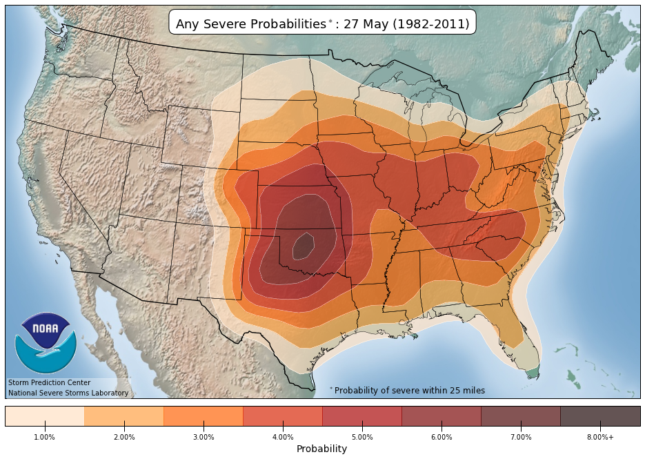
While it shouldn’t come as a shock, we’re approaching the month of June and that means severe weather climatology favors the Plains according to the SPC climatology page. A snapshot of the end of May reveals this, before shifting west as we flip the calendar to June.
