Multi-day, Multi-state Severe Threat Kicks Off This Afternoon
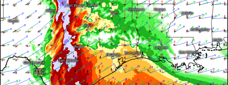
A multi-day, multi-state severe threat is expected to kick off this afternoon in Texas. Jacob wrote extensively on the set up in his blog yesterday, so be sure to read through that if you’re curious how this all is coming together. We’re going to talk about timing and what to expect today and tomorrow.
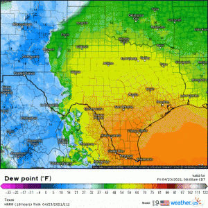
Energy approaching from the west that will aid in the development of a surface low later today will first serve to force a dry line to surge eastward across Texas this morning/afternoon.
(gif) Link
This will be the forcing for the initiation of the first round of storms. As the dry line shoves into warm, unstable air, storms will begin to fire. A second round, driven by the formation of the surface low further north over Oklahoma, is expected to materialize later this evening.
Dry Line Storms -Round 1
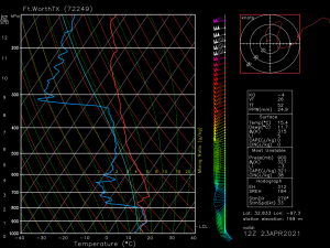
An observed sounding from the Dallas, Texas area taken this morning at 12Z show us the atmosphere, while displaying speed and directional shear, is capped. That means that we will need enough instability and/or forcing to break that cap before we see any serious storm development. We will be relying on the forcing along the dry line as it shoves east along with the low level flow bringing in moisture and any breaks in the cloud cover to assist in destabilizing the atmosphere.
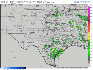
(gif) Link
Expect a slow, scattered start to the convection early this afternoon as that cap starts to break. Once it does break, though, quick upscale growth in a primed atmosphere will allow scattered storms to organize into a larger, messy blob. For this reason, the main tornado threat will come in the earlier stages, before the transition into a mass of storms, perhaps around the Dallas/Fort Worth area. Large hail could also be possible inside these storms. However, once the transition occurs, wind damage will become the primary threat along with some more scattered hail due to the frigid temperatures aloft. Tornadoes remain possible from embedded supercells in the mass, but are somewhat less likely than the earlier stages.
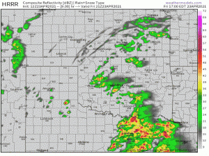
This mass will perpetuate eastward through the rest of the day and into tomorrow. Latest runs of the HRRR suggest it will evolve into a bowing line as it moves through Louisiana into Mississippi and Alabama during the overnight and early morning hours. The main threat associated with the line at this point in it’s evolution will be damaging winds, though a short-lived tornado can’t be ruled out with any apparent “kinks” in the line.
Round 2- Initiation Ahead of the Front
Later in the evening, the approach of upper level support from the west combined with the back part of the dry line is expected to fire off a second round of convection around the area of the SE Texas panhandle/western Oklahoma.
(gif) Link
Atmospheric recovery enabled by continuing theta-e advection and the continued, delayed, push of the northern extent of the dry line behind the first round will serve to fuel this round. Initially, these storms are expected to develop into supercells with the threat of very large hail due to frigid air aloft. Though with shear still in place and surface winds backing from the southeast, a tornado or two is also possible.
These discrete cells are expected to quickly evolve into a smaller MCS and the threat will shift to damaging winds. The 12Z HRRR suggests a nasty, bowing line that could be packing some fairly significant winds.
This would be a good time to remind everyone that winds inside a severe thunderstorm, especially inside a bowing line, are often no joke. They can do as much damage as a weaker tornado. I would highly suggest that if you find yourself under a severe thunderstorm warning today, you shelter as you would for a tornado warning.
Overnight-Tomorrow
As mentioned earlier, this activity will be shifting eastward through the overnight hours. I’ve already mentioned the damaging wind risk – though it mostly depends on how well it can hold together. The greater instability will mainly be in south-central regions of LA, MS, and AL, and this is where the threat remains the highest.
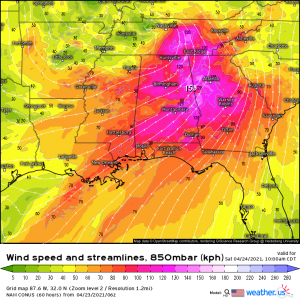
However, we still have the second line/cold front to contend with. Behind the first line, the SSW’erly flow will persist.
So the question here is: exactly how much can we destabilize again before the second round arrives? This is going to depend on the coverage of the first round, the duration of the first round, and if we can clear out and get breaks in the clouds to allow the daytime heating to assist with further destabilization. If we can recover sufficiently, a second round of severe weather from roughly AL to the SC coast is possible.
Current guidance suggests recovery will be sufficient and we will indeed have an afternoon severe threat to contend with. However, the evolution of the first wave further into the southeast along with its duration is still largely unknown. We could be facing an entirely different situation in the morning OR it could play out as the models suggest. As always, the atmosphere will do what it wants to do with very little regard for what the models think. I’ll leave it to Jacob to sort out the forecast in the morning once we see how the first wave evolves.
That was a long post so here’s a summary:
Two rounds of storms are expected today. The first fires this afternoon off a bulge in the dry line in central Texas. The second fires off the back half of the dryline/ahead of a cold front later this evening. Both rounds retain a tornado/large hail threat early and then transition to primarily a damaging wind threat. This all moves east and will affect LA/MS/AL through the overnight/early morning hours. A second round of severe is currently expected from AL to the SC coast, but depends on atmospheric recovery post-first round.
Some of the winds inside these storms could pack a punch and do some decent damage, so I strongly encourage sheltering for a severe thunderstorm warning as you would for a tornado warning. Have multiple ways to receive warnings including at least one that will wake you since part of this threat will exist overnight. Have a plan to shelter and be ready to execute it if need be.
Stay safe!


Thank you Meghan.