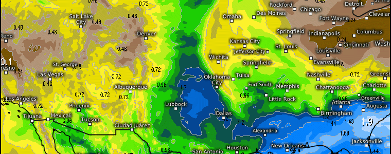
More Rainfall On the Way This Week Across The Central & Southern Plains
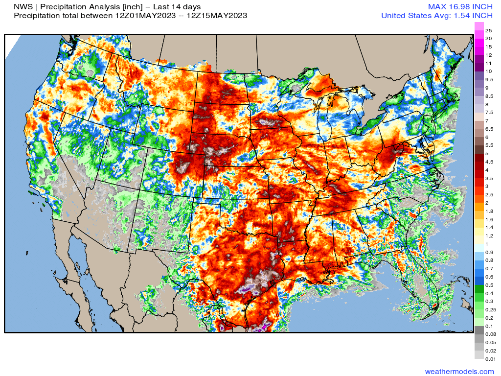
Thanks to an upper air pattern that was characterized as a trough west (southwest), underneath an omega block across the Pacific NW (Rex Block), and ridge to the east – this pattern in particular rendered an auspicious environment for heavy rainfall and waves of moisture in between the trough and ridge across the Plains and Deep South. Over the last 14 days, we can see simply where the rainfall has accumulated relative to the rest of the U.S. regions. We’re about to add more this week!
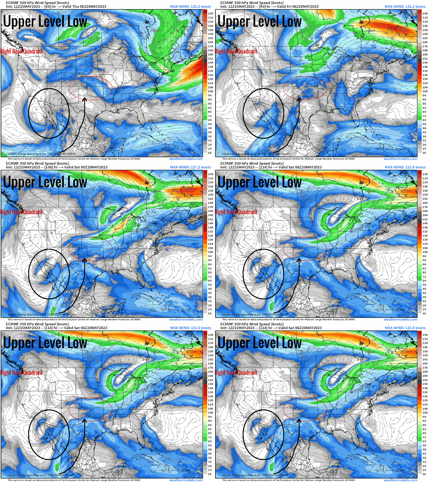
First, lets identify the main features involved that’ll lead to a wet pattern. We have an upper level trough that’ll shift in from the Eastern Pacific, and rotate within the vicinity of Baja, CA. This will usher in moisture from the Pacific, as we see the jet stream advect northward. To the north, a polar jet feature will skirt across the Rockies and northern Plains. As it does so, we’ll see upper level divergence manifest as a result with the right-rear quadrant of a jet streak superimpose itself over the area of interest outlined further exacerbating an antecedent favorable environment.
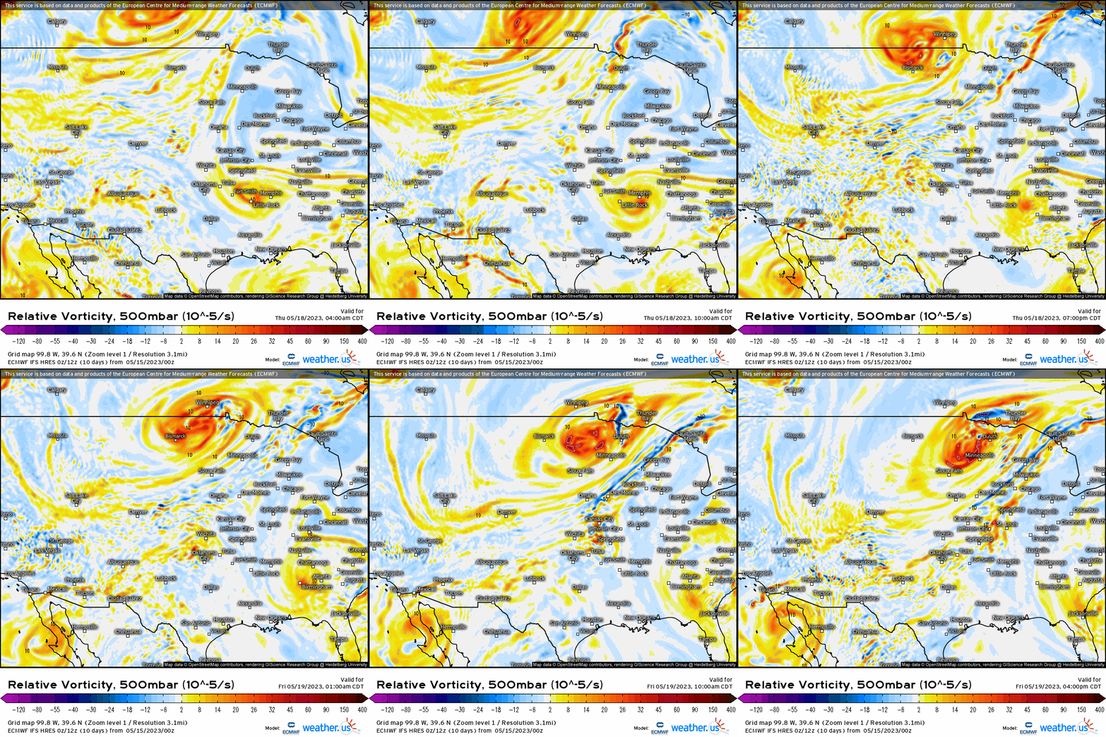
Making our way down to 500mb, we see not only the polar trough dig down and press off to the north and east, but there are a few subtle shortwaves or impulses that eject from the ULL off the Baja Ca. peninsula, but also some positive vorticity advection digging on the backside of the polar trough creating forcing for ascent.
At the surface, we actually have two boundaries; a stationary front draped from NM across the TX panhandle into OK, while a notable cold front (as a result of the digging polar trough) advects southward. With synoptic-scale lifting via the front and shortwaves “riding the boundary”, we create a very favorable environment for precipitation and the ingredients are all there to allow for heavy rainfall to manifest, along with some thunderstorm cluster development with over a 1000 J of CAPE forecasted to build with all that moisture advection.
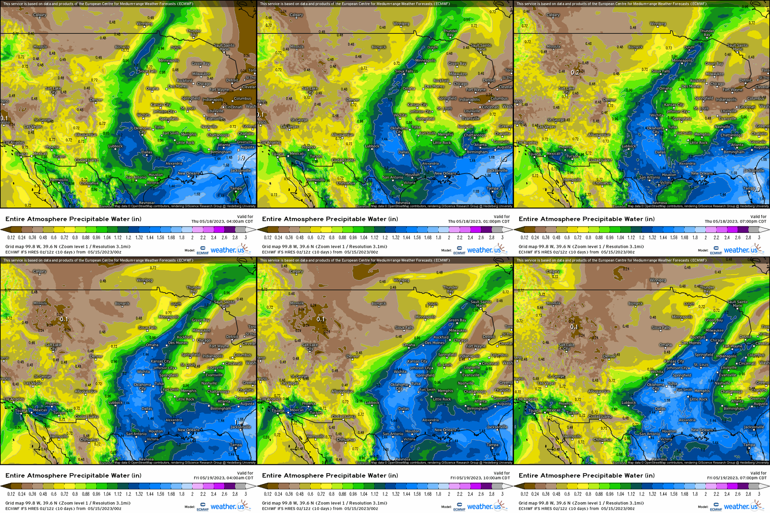
From a moisture perspective, notice no lack thereof with PWAT’s exceeding 1.2” across a large swath across the Plains, conducive to heavy rainfall.
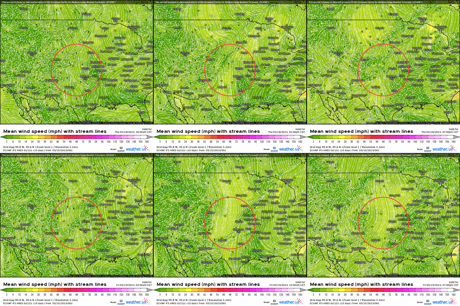
Not to mention, we’re looking at a case of training convection with shear oriented more parallel with the front. As we combine all of our ingredients together, we get a consensus for rainfall to exceed 2” in placed across CO, NM, northern TX panhandle, and into southern KS before making it way into MO and AR.
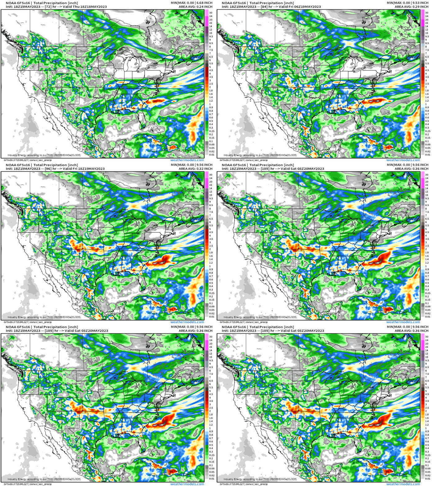
Unfortunately, for this region, the pattern looks to remain active as we head into our last full week of May before we begin to see changes.


