More January Severe Weather
It appears that, once again, it is time for our weekly January severe weather threat.
As mentioned in previous blogs, it’s been a strange January with more warmth and (weekly) severe weather. And, right on time, we have another threat looming for tomorrow into Wednesday.
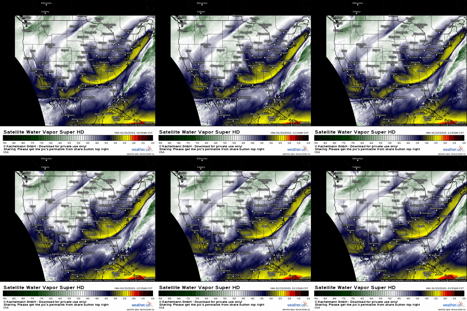
As currently evident on water vapor imagery, we have a positively-tilted trough digging into the Southwestern US.
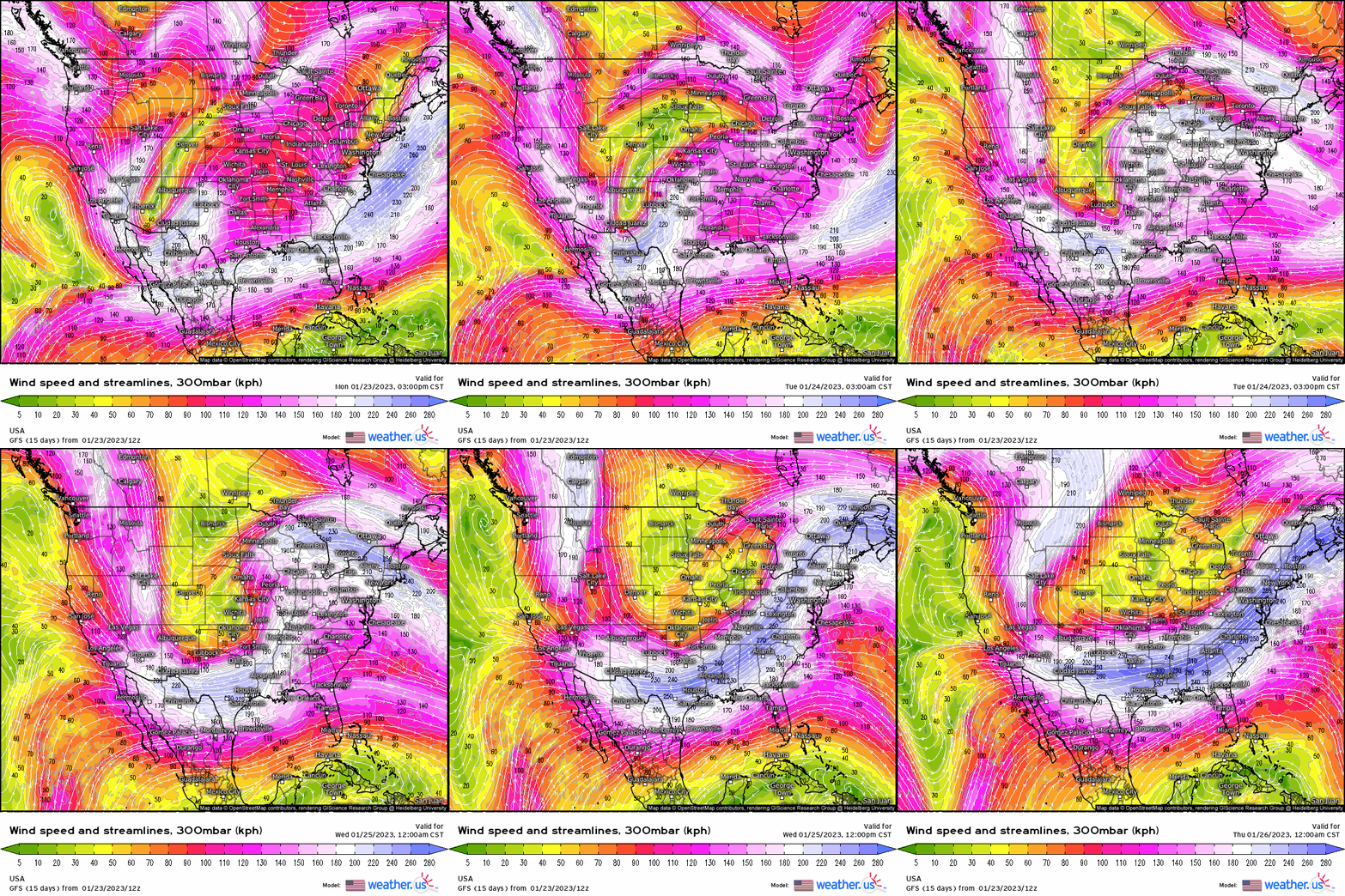
The aforementioned trough will continue to progress eastward. Eventually, it takes on a negative tilt on Tuesday before lifting out northeast on Wednesday.
What we have, when viewed from the 300 mb level, is the makings of what could be a potent, widespread severe weather threat.
However, something doesn’t quite line up in the lower levels.
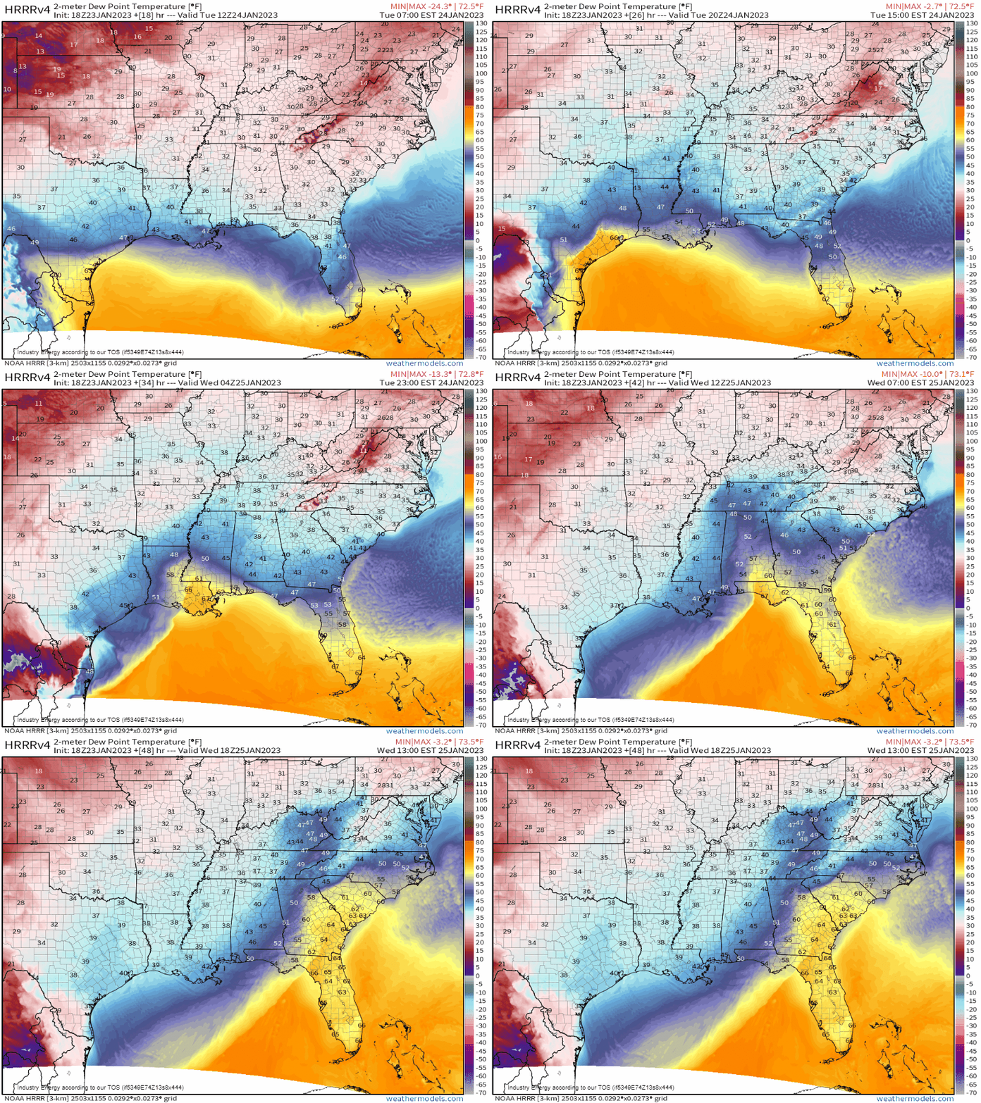
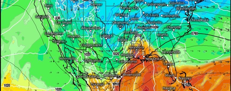
High pressure currently located in the Plains states will slide east and then northward ahead of the incoming system. It will serve to suppress the moisture return on Tuesday, keeping adequate moisture confined to those areas close to the Gulf of Mexico from SE Texas to the Florida Panhandle.
On Wednesday, some moisture is allowed to flow further north along the Southeast coast. However, dewpoints in only the upper 50s/low 60s will serve to limit the threat somewhat.
Where moisture is adequate on Tuesday though, the threat is shaping up to be rather potent.
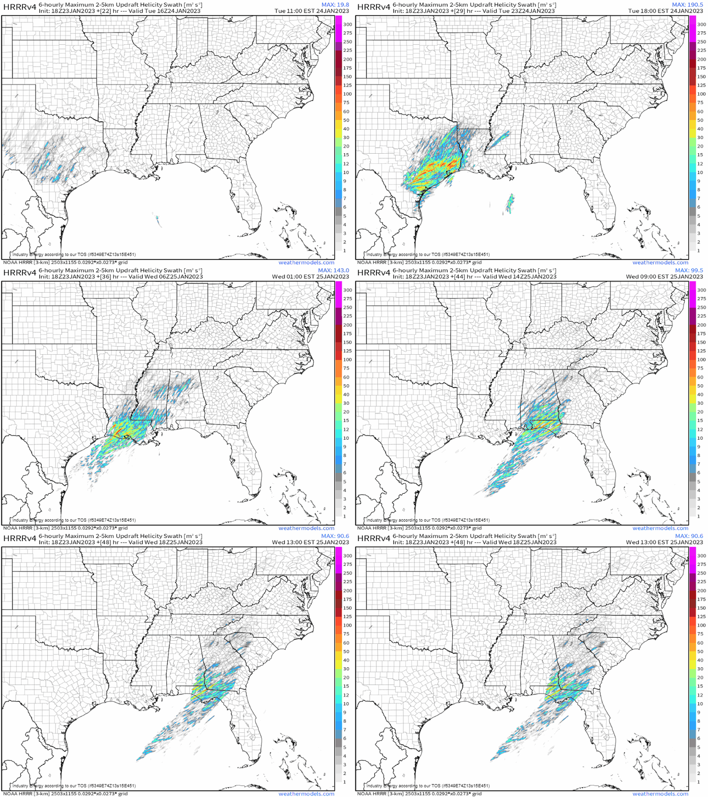
As the warm front lifts over land Tuesday early afternoon onward, adequate moisture will meet strong shear and excellent storm-relative helicity. CAPE will be limited as cloud cover from a morning round of rain will limit any surface heating, but the amount of shear in the atmosphere is expected to make up for it. This will be a high shear, low CAPE (HSLC) event.
Some of these types of events have a history of producing significant severe weather in this region. Just because there isn’t a lot of CAPE available doesn’t mean we should ignore this threat.
Due to the forecasted lack of CAPE, damaging winds are billed as the main threat. A strong tornado or two shouldn’t be discounted if we can end up with just a little more CAPE than forecast. With the shear as strong as it is, it likely won’t take too much energy to make things spin. Sustaining them, however, may take a little more.
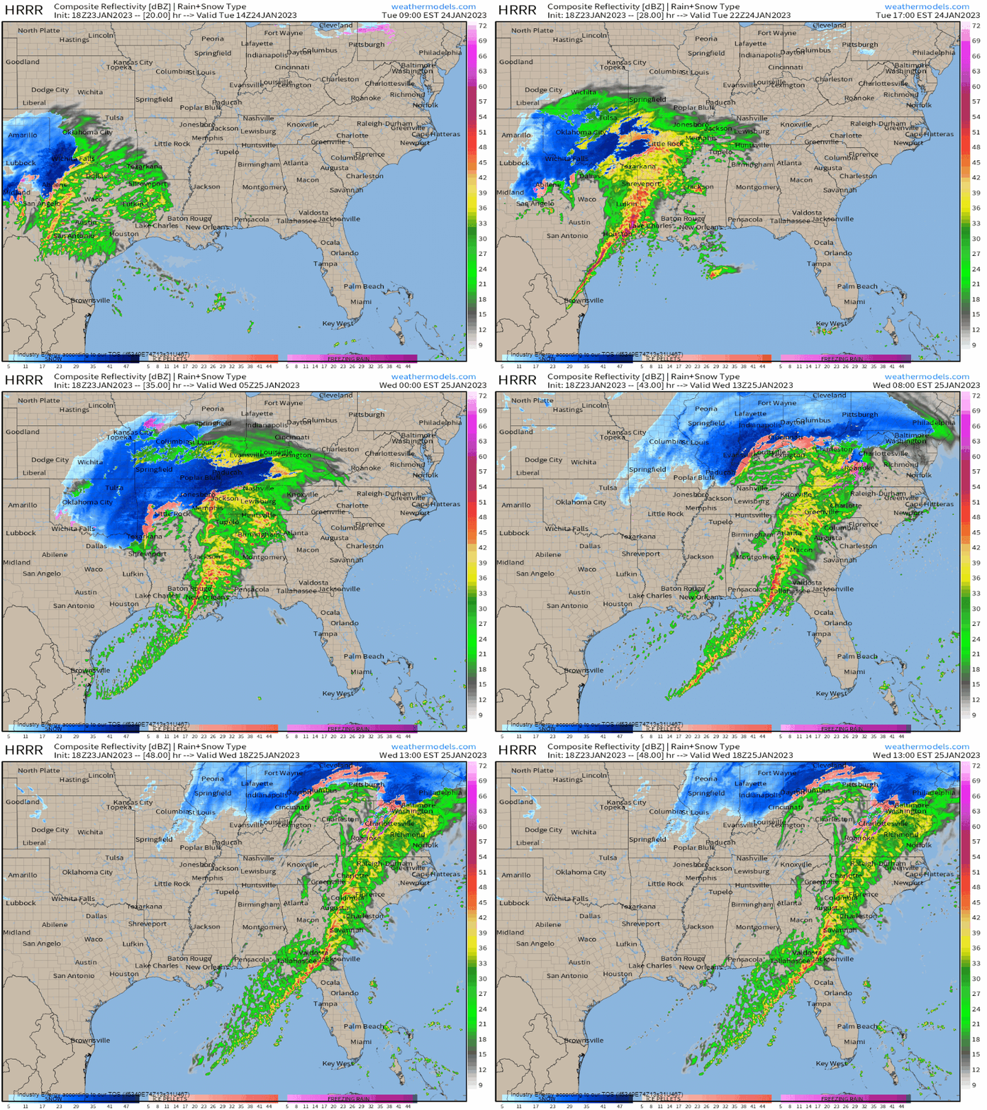
As far as timing goes, storms should begin to blossom in the Houston region in the late morning/early afternoon. As they shift east into more favorable conditions and the surface low deepens, the threat will increase through the evening hours and into the after-dark hours.
Have multiple ways to receive warnings tomorrow, including at least one that will wake you if you’re expecting severe weather after dark.
The threat will wane some toward the early morning hours, but is expected to pick up again (slightly) as the line enters better conditions east of the Appalachians Wednesday afternoon. For now, isolated severe weather is possible from the Florida Panhandle to the Delmarva.
Keep an eye on how the forecast evolves through the evening and into tomorrow. Just a little more heating can change a few things for some people. We’ll update you if necessary!


