More Heavy Rain and Flooding for the South
Stormy weather from this past weekend will unfortunately carry over into the week, especially for the Deep South. I mentioned a possibility of widespread flash flooding issues in my blog on Friday and unfortunately, that looks to be the case at least through the first half of this week.
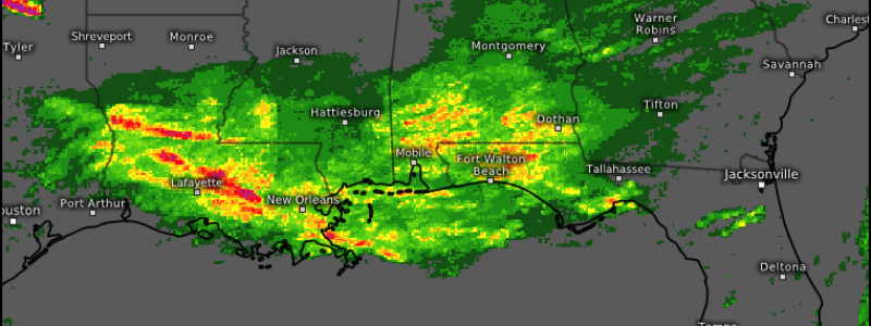
Very persistent, often heavy, rain has been falling across the south today with a focus mainly on the southern parts of Louisiana, Mississippi, and Alabama. Thankfully, the heaviest rain has so far been avoiding water-logged central Alabama. They saw far too much rain (in the vicinity of 6 to 8 inches) last week and do not need more. That’s not to say the rest of the south does, though. It has been rather soggy here for weeks and there seems to be at least a few more days of wet weather in the cards as well.
High pressure settling into the Great Lakes/Midwest will slowly force a frontal boundary south, closer to the Gulf Coast, where it will stall for the first half of the week. The result will be a very moist airmass parking itself over the deep south and wave after wave of training storms soaking the area.
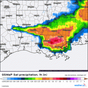
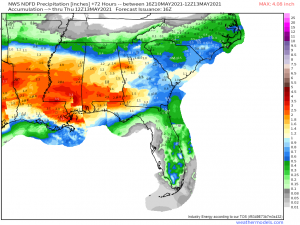
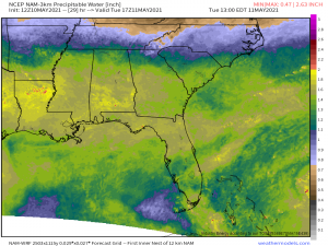
Some models go a bit over the top (looking at you, HRRR and NAM) with a wide swath of 6+ inches from LA to AL over the next 4 days. The global models are a bit more subdued with a large area of 2 to 3 inches. The one I’ve chosen to highlight is the NWS NDFD and is a good “middle ground” prediction of generally 1 to 3 inches with locally heavier amounts. The higher end is definitely possible, considering the available moisture (see map below), but not a certainty. A more likely scenario is small pockets of higher rainfall totals where we see training, heavier storms.
That said, it doesn’t ultimately matter how much rain we see from this. The deep south is saturated and any extra heavy precipitation is going to have the potential to cause flash flooding issues, be it one inch or six inches. The severity of the potential flash flooding will hinge on the intensity, duration, and total rainfall seen.
An air mass with PWAT values like this in place for days on end is indicative of a good environment for flooding problems. Flood warnings are already out for a few rivers in western LA/eastern TX along with a few in Arkansas. No flash flood watches have been posted over larger areas just yet, but I wouldn’t be shocked to see a few of those issued in the next day or two.
If you’re located near a river that is already running high, be sure to monitor the conditions over the next few days and have a plan if you are in a flood zone.
Flash flooding can’t really be predicted so it’s hard to have a plan for that beyond “turn around, don’t drown.” I know, it’s a cheesy phrase. But take it seriously. Don’t drive through floodwaters as they may be deeper than they appear. What’s more, the road could very well be washed out underneath the surface and you’d never know as you won’t be able to see it beneath the muddy, often fast-flowing waters. Also, keep in mind that it only takes 12 inches of water to float an average-sized car. Don’t risk it.
The stalled frontal boundary should retreat southward by Friday, giving the south a chance to dry out. Unfortunately, the drier weather also comes with cooler temperatures. Though I suppose below-average temperatures are somewhat preferable to constant rain and flooding.. The return of a warmer, more moist environment is on the horizon, at least currently, for the following week so that relief may be short-lived.


