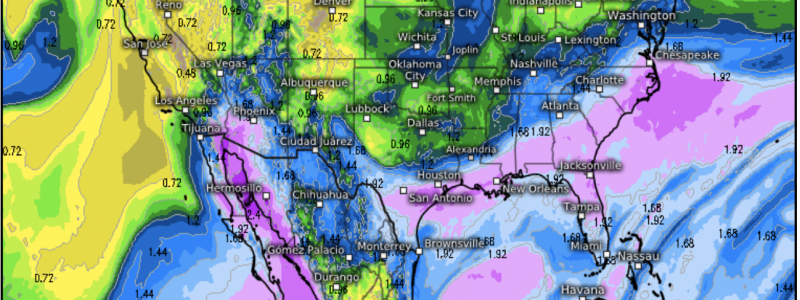
Monsoon Season to Get A “Boost”
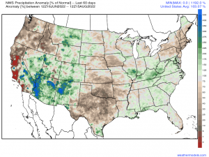
While some places like the Northeast and Deep South have seen consistent dry conditions leading to localized droughts, the Southwestern states have seen in excess of 250% above normal of their climatological rainfall accumulation since June.
Going forward into the upcoming weekend and early next week, an active Monsoon pattern is imminent with an addition of a moisture source via the tropical disturbance that made landfall near Corpus Christi, TX this past Sunday.
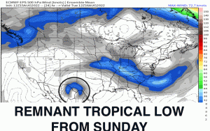
The 500mb mid-level synoptic pattern features a favorable position of a ridge that’ll slowly propagate toward the southwest from Southern Great Plains and into the Deep South. As it does so, the steering pattern surrounding this anticyclone will advect moisture from both the Eastern Pacific and Gulf of California. In addition, an influx of tropical moisture can be traced within the mid-level flow as an embedded shortwave trough circles around the periphery of the ridge axis as annotated below.
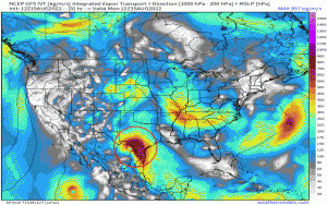
We can trace this additional moisture source and general moisture advection in the form of water vapor within the atmospheric column using integrated water transport. It’s essentially akin to using the PWAT product whereby you’re following the moisture within the flow. I’ve highlighted the tropical low remnant from Monday, and watch how it meanders and becomes absorbed into the atmospheric flow.
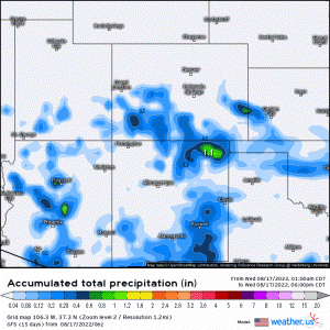
As what to expect, several inches of rain appear likely across AZ, NM, and into the panhandle of TX through this weekend. Isolated and scattered storms are expected during the afternoon hours especially and continuing overnight for some localized areas amidst a deep subtropical moisture influx.
With a continuation of an active stretch beginning this weekend and into early next week, areal average heavy rainfall appears likely that’ll lead to flash flooding concerns. Complex terrain and burn scars are most susceptible to rapid run off and flooding. The threat looks to begin across the Great Basin at the end of this work-week and transitioning into the Southern Rockies by the end of the week and into next week before relatively drier air advects into the region toward the end of the work week.
