Monday Thru Wednesday To Feature Severe Weather Across Plains; Growing Concerns With Severe Threat For Wednesday
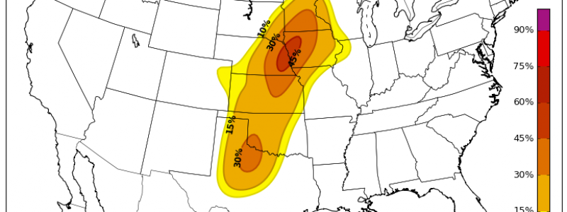
As we close out the month of April, we have already broken a historical record. There has never been another start to a year that has not seen a tornado in the state of Oklahoma this late in the year. That may all change in over the next three days as a severe weather, potentially both widespread and significant, is likely to evolve across the Great Plains. Here is a look at the latest convective outlooks from the Storm Prediction Center in Norman, Oklahoma for Monday, Tuesday and Wednesday.
Moisture and parcel buoyancy are especially critical when measuring the state of the atmosphere, relative to instability. If we take a look at few of those measures, we can see about where the severe threat will focus over the next several days.
First, let’s take a look at CAPE (Convective Available Potential Energy) or how buoyant a parcel of air can be in a column of air within the atmosphere. We see with the latest model data that CAPE measures begin to peak around Monday evening across the southern Plains and surges north into the central Plains during the day on Tuesday and continuing into Wednesday.
Second, a snapshot of the moisture present in the atmosphere will how saturated a parcel of air will be. The higher the dew points, the riper the atmosphere becomes and favorable for instability. We can see, through PWAT (Precipitable Water) output, a river of moisture being pulled in from the Gulf of Mexico into the southern and Central Plains through the beginning of the week which will add to an already unstable environment.
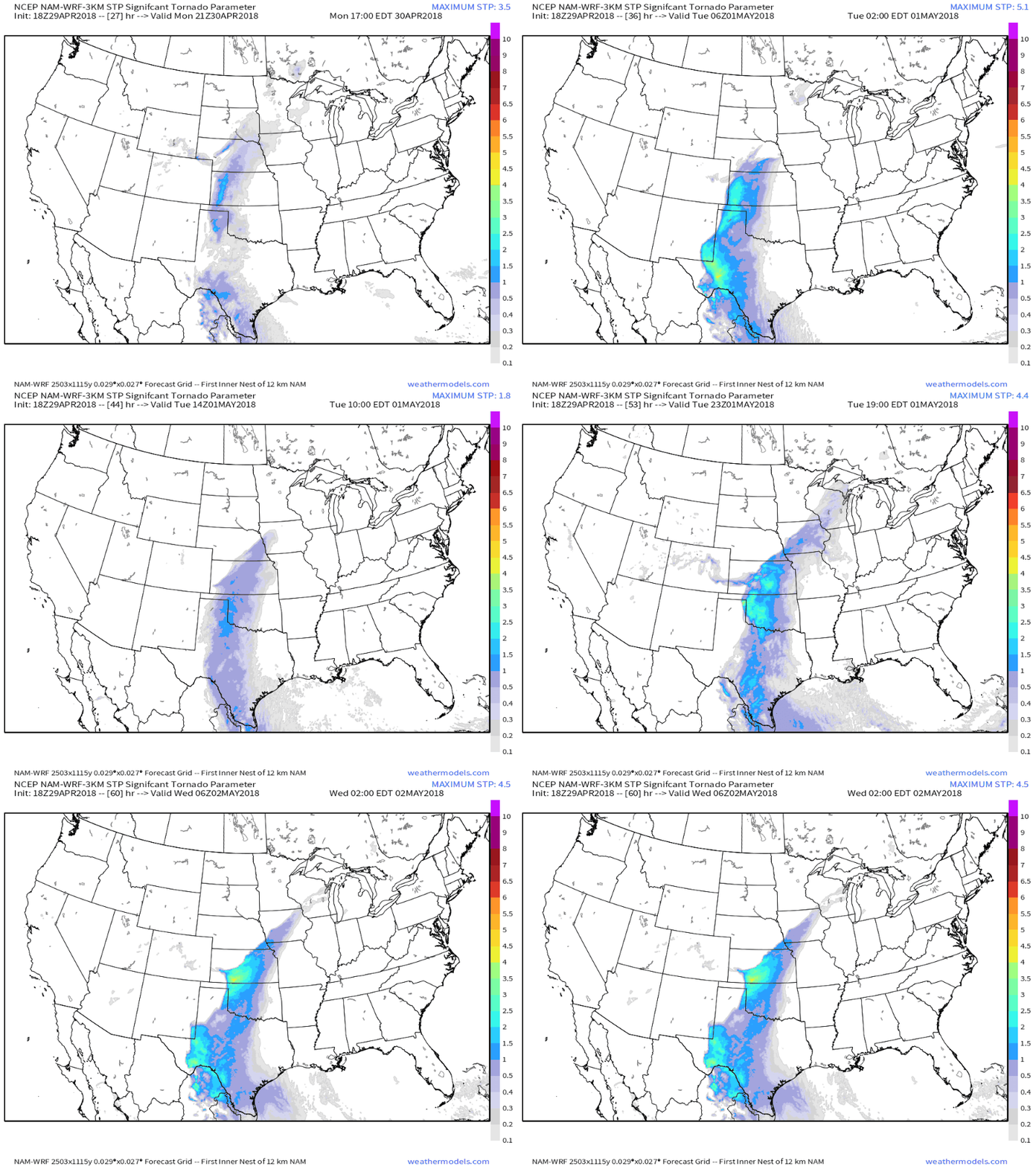
Hi-resolution model data suggest elevated STP (Significant Tornado Parameter) values beginning Monday afternoon across the southern Plains. Using the STP index, any value of “2” or greater suggests an elevated threat of a strong, violent tornado (EF3 or higher).
Looking at the multi-day severe threat across the Plains over the coming days, Wednesday, early on, appears to be most impactful based on model data sets and analog data. While things certainly can and will change between now and then, the threat is certainly there. Based on model output and analogs, Wednesday could see a widespread, significant severe weather day evolve. Not too often will the meteorologists at the SPC issue a 30% risk outline 5 and 6 days out. The instances where they do, we must pay attention, as the threat is warranted. The latest SPC forecast discussion text certainly suggests a very real and potentially significant threat could materialize on Wednesday. I’ve bolded a line of concerning text (NOTE: SPC original text was not bolded)
Thunderstorms are likely to be ongoing in a warm advection regime
   from eastern NE into northern MO, aided by a 50 kt low-level jet.
   This activity may reinforce the boundary, and or shift it a bit
   south. Precipitation by the models contain quite a bit of variance,
   with some models showing storms forming around 18Z over KS. Some of
   this may be an artifact of steep lapse rates aloft combined with
   moist mid to upper level profiles. In any case, high clouds may be a
   concern regarding heating as forecast soundings have consistently
   shown substantial high cloud potential. Still, 2000-3000 J/kg MUCAPE
   is expected across the warm sector due to robust low-level moisture
   and steep lapse rates aloft. Shear profiles will strongly favor
   supercells, including the threat of tornadoes and very large hail.
   ECMWF hodographs depict large streamwise vorticity in the lowest 1km
   with significant tornado potential across the 30% area. Storms
   should focus along the dryline and also the front/outflow across KS.
   Other severe storms are expected during the evening across
   west-central TX where a southeasterly low-level jet will exist bring
   moisture westward where temperatures aloft will be cool. Hail and
   wind is most likely there.
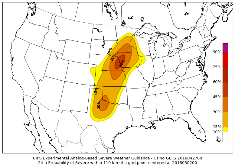
Finally, analog data gives us great insight into similar events that have occurred under similar atmospheric conditions. Using such historical data, we are able to render probability values for “all” modes of severe weather including hail, damaging winds and tornadoes. This particular analog output is for Wednesday. As you can see, this could evolve into a very active, widespread and potentially significant severe weather day in a series of severe weather days for the week. Now is the time have your severe weather safety plans in place and ready to go at a moment’s notice. There is no need to panic, always think with a calm and clear mind so that you have the ability to make the most sound decisions when weather is at its worst.


