Mid & Long Range Chaos in Models, What We Do Know!
Take a look at the three ensembles below; the GEPS, GEFS, and EPS all display the mid-level height pattern differently (to an extent) in the medium range. What this does alone, being that they’re ensembles so individual members are “perturbed” to find all solutions and explore uncertainty for a time period that can help give a forecaster a sense of confidence or a hint toward a type of a solution.
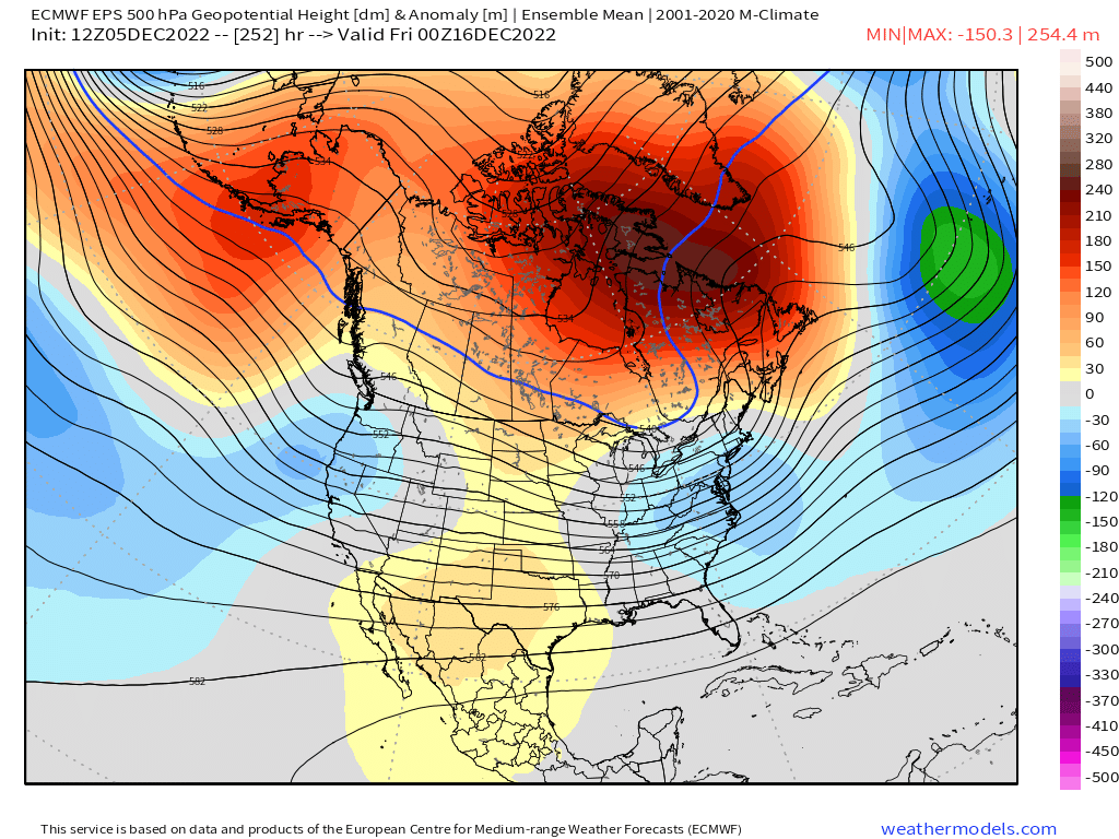
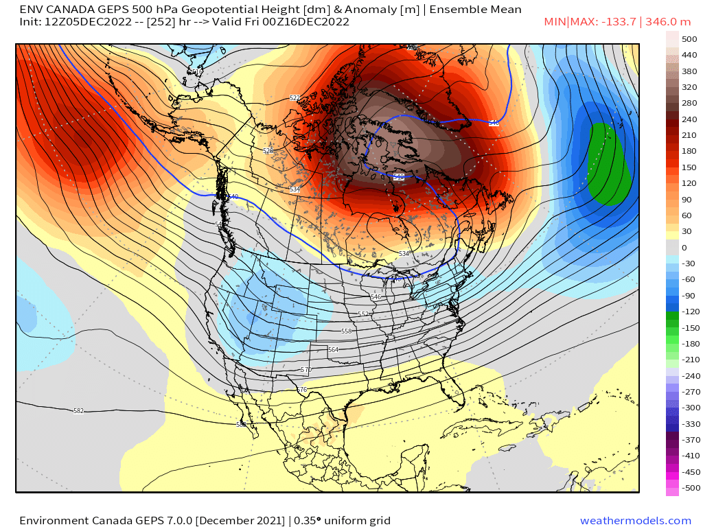
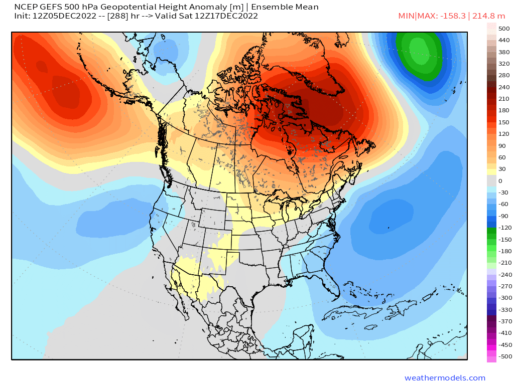
This retograding block, or -NAO is causing significant chaos within numerical weather models, and most especially deterministic models. The ECMWF shows a completely different height evolution than the GFS as shown below:
GFS shows the initial block, but becomes replaced by lower heights, and that deep ULL to the west of Greenland is the tropospheric polar vortex by the way! Notice the persistent lower heights and deep troughing off the west coast (hint hint).
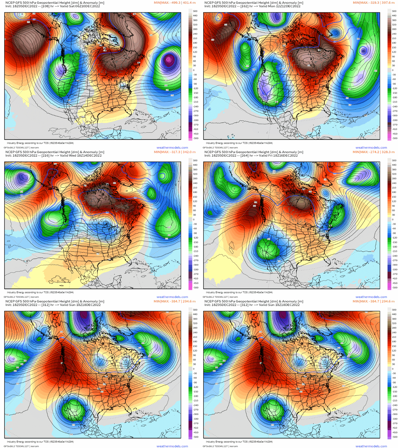
ECMWF on the other hand, maintains the block and allows it to persist from Greenland into Southern Canada. This verbatim supports a snowier and colder storm track east of the Rockies.
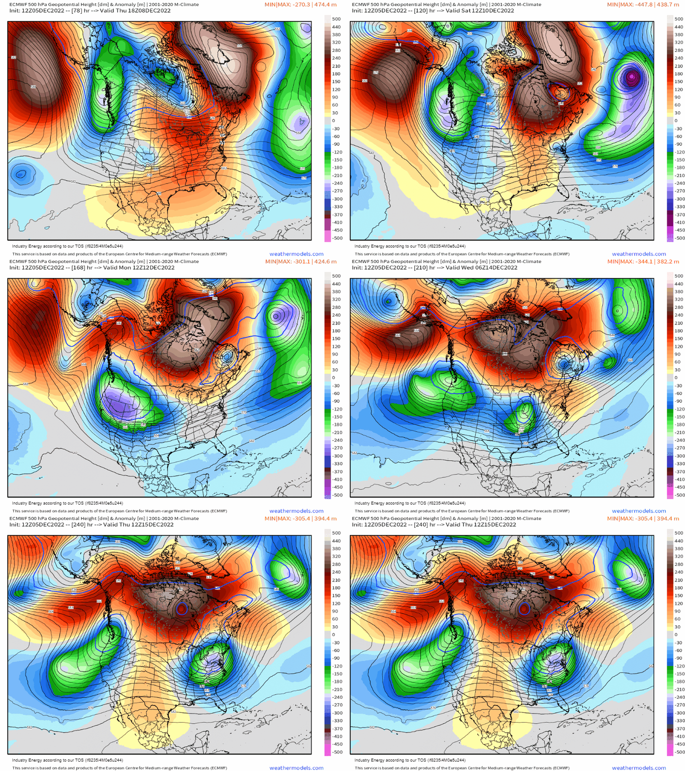
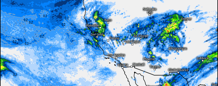
As you can see, there’s a lot of model discrepancy and the reason for it is simple: an anomalous pattern produces anomalous results. That type of retrograding block, which physically already throws the atmosphere into a hectic state, causes large differences even in the short-term! So we must beware of model solutions, and try to focus more in the short-term than the medium because many forecasters can easily get burned! However, what is actually more than certain is what a block in the first place does upstream (i.e. west coast). The blocking over the top allows the jet stream to be suppressed and remain active with persistent shortwaves rotating through and into the west coast, flooding places such as the Cascades, Sierra Nevada, Intermountain West with heavy snow and lower elevation rainfall!
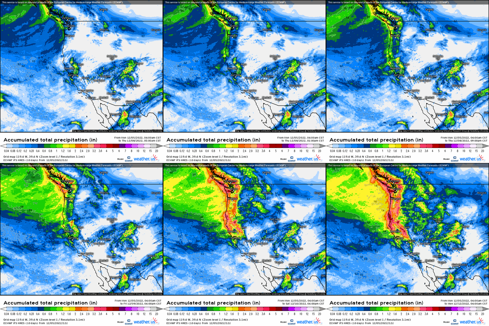
Feet of snow will occur through the weekend in those aforementioned higher elevation regions, while in the lower elevations near sea level will see at least an inch of rain, if not more through the weekend as well!
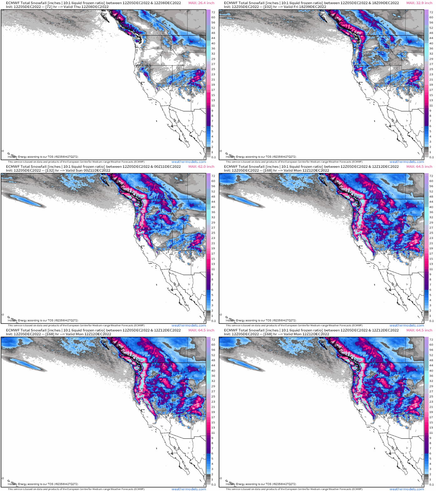
So while we know what’ll at least be certain in the short to even medium term regarding the west coast, there is a lot to be uncovered in the medium to even long range east of the Rockies. Despite a -NAO and an anomalous ridge, while it does support with higher-than-normal confidence for a cold and snowy pattern for the eastern 2/3rds, there still is considerable uncertainty in how exactly it all pans out! At least if you’re planning a snow activity trip in the west, you’ll have plenty of snow!


