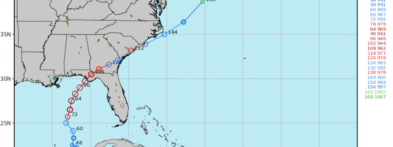
Michael Forecast to be a MAJOR Gulf of Mexico Hurricane and Landfall along Florida Panhandle
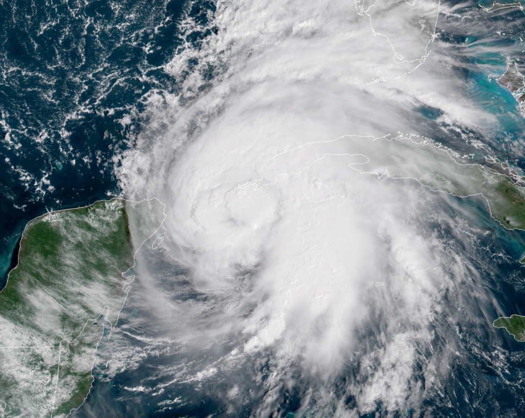
Satellite imagery at 3 PM EDT is showing convection surrounding a clearing eye … just west of the tip of Cuba over the very warm Caribbean waters …
View our Mesoscale GOES-16 visible imagery during the day here (Last 45-minutes) –> Loop Link.
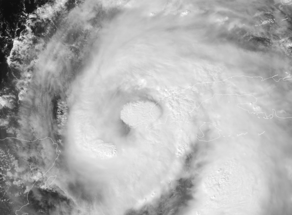
Hurricane Michael just before 3 pm EDT on Monday with hot towers surrounding a clearing eye on visible imagery (GOES-16 Mesoscale) from @weatherdotus
2 PM Monday model update –>
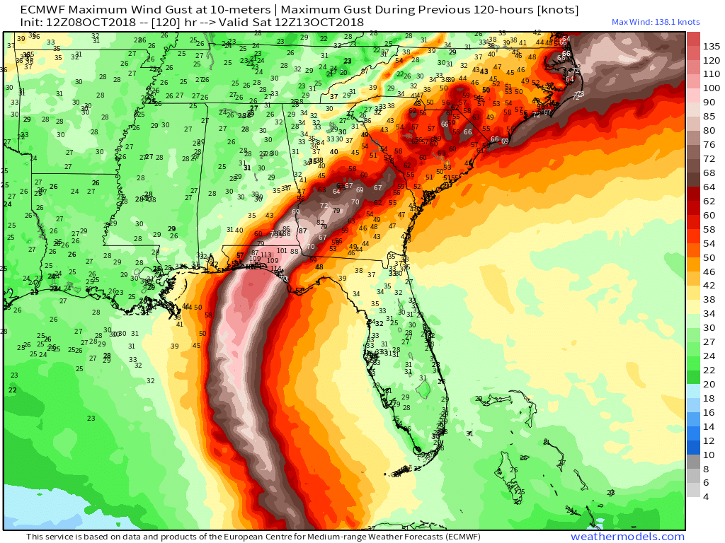
The 12z global model guidance has arrived with little change in track or intensity up until landfall late Wednesday/early Thursday along the Florida Gulf coast somewhere between Pensacola and Apalachicola. The main highways or evacuation routes include US-98 right along the coast and Interstate 10 about 30-40 miles inland.
The HWRF and ECMWF models both indicate a landfall of 941-945 mb (strong Category 3) pressure and winds of > 100-knots near Destin. Usually we see storms lose their punch or weaken prior to landfall along the northern Gulf Coast, but Michael may be a notable exception.
11 AM Monday update –>
My fears have been realized that Hurricane Michael will become a major or intense storm in the Gulf of Mexico over the next 3-days and make landfall in the panhandle of Florida.
The track and timing of landfall is narrowly focused on the coastline between Destin and Apalachicola — which is just SSE of Tallahassee. I lived in this area for > decade and experienced nothing in terms of hurricane activity. However, I moved to Atlanta and 2-months later, Hurricane Hermine blew through the city leaving it some areas without power for more than week due to trees and debris strewn all over neighborhoods. Tallahassee is a “tree city” still horribly at risk for major damage from a Hurricane.
NHC forecasts the landfall at 105-knots which is a mid-range Category 3 hurricane.
The eye is visible in day time “True Color” satellite imagery from @weatherdotus … Loop –> Link
I am currently testing and processing the 06z ECMWF ensemble data soon available to subscribers at WeatherModels.com …
8 PM Sunday update –>
The NHC has increased the maximum intensity expected to 85-knots prior to landfall in the panhandle of Florida. I would expect this to increase from Category 2 to 3 or possibly 4 as Michael undergoes rapid intensification — not a guarantee yet.
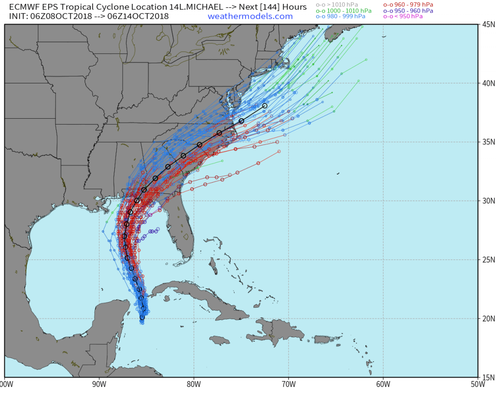
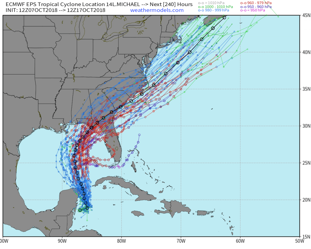
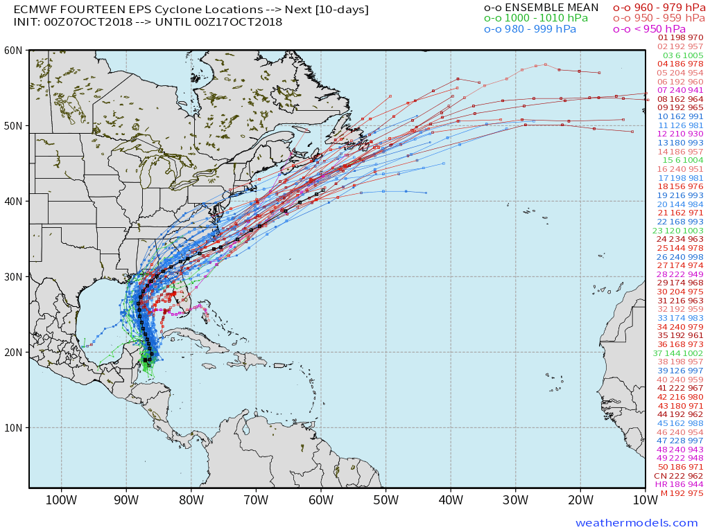
The ECMWF Ensembles were a mixed bag of results this afternoon. There are tracks of many varieties (slow|fast|left|right) all a function of the intensity and initial location of the developing low pressure area. Thus, with 51-members in the ensemble, it is best to take the mean as the most likely track location of landfall, at least until there is a noticeable shift to the East (most likely).
Sunday morning 11 AM –>
Overnight weather models (GFS, ECMWF/EPS, UKMET) all indicated a powerful hurricane in the Gulf of Mexico this week. The next name on the list is Michael. The National Hurricane Center has initiated advisories on Tropical Depression 14L and does have a 70-knot Category 1 hurricane making landfall (11 AM Sunday discussion) along the Florida Gulf Coast near Panama City.
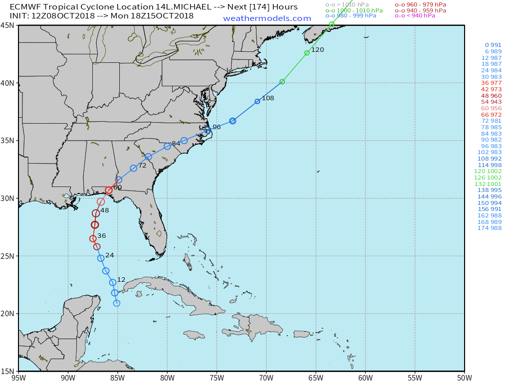
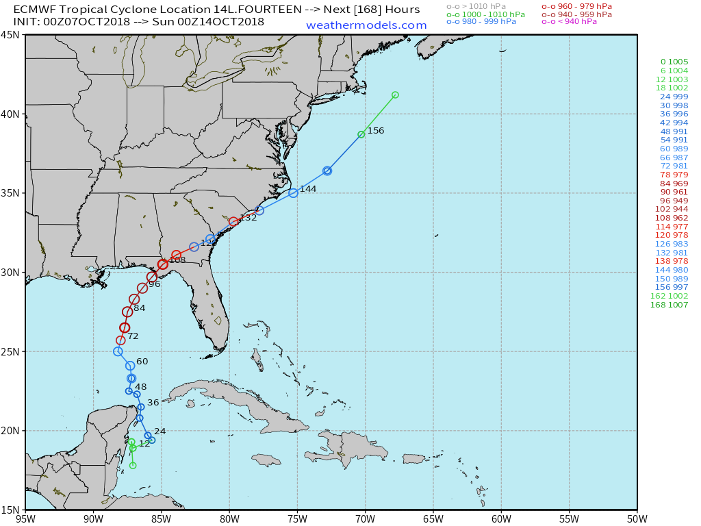
ECMWF guidance has a 944 mb Central Pressure prior to landfall which would be a major hurricane. Note from the single track ECMWF chart the rapid development over the warm waters of the central Gulf of Mexico from hours 60-84 (starting Tuesday).
The main negative for stronger hurricanes in the Gulf especially in October is deleterious vertical wind shear. With the seasonal change into autumn, upper-level winds e.g. jet stream are much stronger than mid-summer and can tip over or shear apart developing storms. However, the wind shear is expected to abate and instead provide an exhaust mechanism aloft to enhance the intensification of the storm.
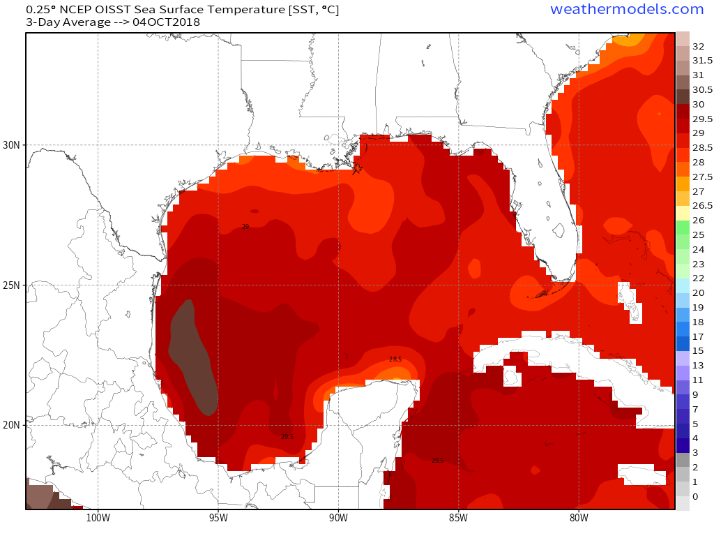
Sea-surface temperatures are still very warm in the Gulf well in excess of 29C sufficient for any category of hurricane.
Based upon the model trends, location and time of year, Hurricane Opal from 1995 immediately comes to mind. Over the next 24-48 hours, we will have a better idea about the intensity at landfall primarily based upon the ability of “Michael” to rapidly develop initially.
Real-time spaghetti tracking will be available at https://weathermodels.com for the duration of the storm.
Real-time satellite imagery from the newest GOES satellites is available: Daytime visible 3-hour LOOP … and nighttime Infrared LOOP.
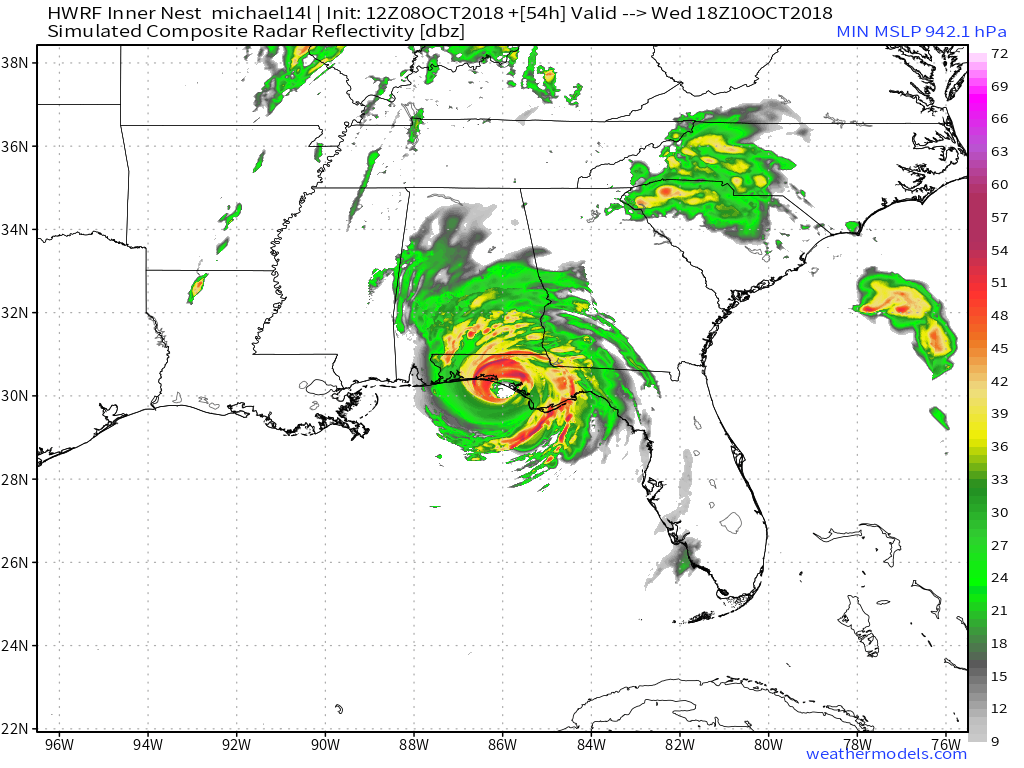
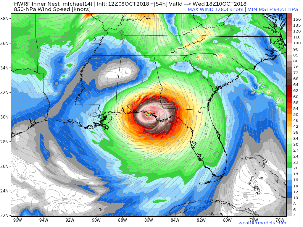


Will the core development or shear win?