Looking ahead to Memorial Day Weekend
The beginning of Summer travel season will be underway starting by Thursday/Friday of next week with a very busy Memorial Day weekend for beaches, parks, and picnics. Obviously, the weather is a major concern especially if it looks like it could be a complete washout, otherwise, it’s just a nuisance. Unfortunately, while hurricane season doesn’t officially start on June 1st, we’ve already had some trouble in the Gulf of Mexico providing boatloads of rainfall for Florida, the southeast and now the Middle-Atlantic as copious tropical moisture streams north.
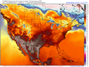
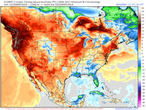
First the good news, focusing on Saturday’s forecast temperature maps from the ECMWF 12z (parallel) available to preview here: (Link)
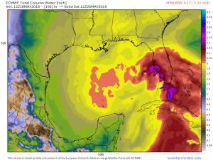
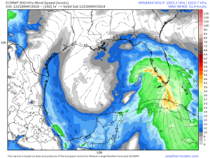
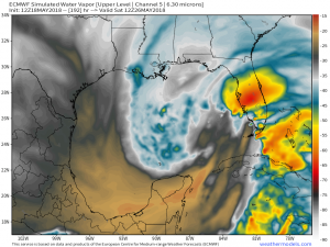
Coast to coast warmth with above normal temperatures. That means mostly 80s from the Canadian border to much hotter over the Southwest and Texas. The only exception may be associated with a tropical disturbance over the Gulf of Mexico that could bring a washout to south and central Florida. Yikes! The Eastern US would see daytime thunderstorms as air mass is very juicy for late-May.
Right now, the area of low pressure would be sheared and interacting with an upper-level low to the west. The environmental conditions for normal hurricane development in late-May are not especially favorable in the Eastern Gulf of Mexico. The sea-surface temperatures are also marginal at about 25°C and slightly below average. But don’t confuse the lopsided disorganized appearance for low-impact — plenty of rainfall will occur in the Caribbean-origin tropical air directed right at Florida.
New models are always arriving at https://weathermodels.com and I encourage you to use the slick interface and compare/contrast many global models coming this Hurricane season.


A Blog? Nice!
It will be great to see more than 140 characters in a segmented discussion. Thanks for doing what you and your team do Dr. Ryan. It is appreciated by many!
Kudo’s!