Long Duration Heat Wave Inbound: Desert Southwest, Great Basin, and Intermountain West
With what has been an active several weeks of monsoonal moisture across the Desert Southwest, a significant pattern change will emerge this week and has already begun.
A dangerous and excessive heat wave has its sights on places such as the of the Great Basin, Mojave Desert, Sonoran Desert, and a large majority of the desert Southwestern states this week and extending through Labor Day Weekend.
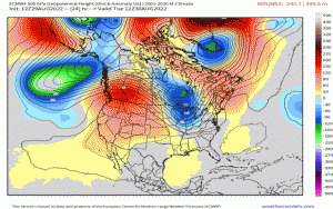
Here below, displays the z500mb geopotential height pattern anomaly through next week. There are two prominent aspects to this synoptic pattern, specifically focusing west of the Mississippi River Valley:
- A +594 dam anticyclone manifests and builds over the Intermountain West. Statistically, this geopotential height value is subjected in approaching the max climatological percentile (e.g. touching record-breaking territory). From a standardized anomaly perspective, this is modeled to be greater than +2 sigma ridge (i.e. 2 standard deviations above the climatological mean) – rather anomalous for this time of year!
- The ridge essentially oscillates within the mean-flow, even slowly retrograding toward the Northwest and even strengthening by Labor Day Weekend. This equates to the bulk of the heat translating gradually toward the Northern Plains by later this weekend.
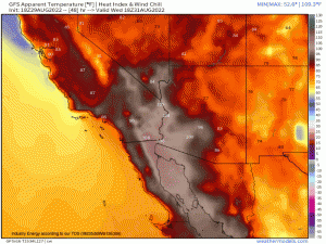
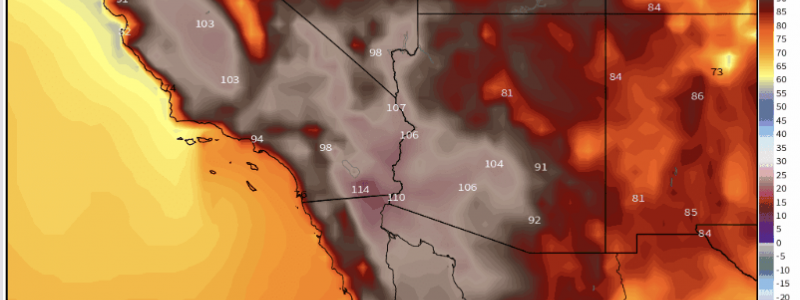
Max surface temperatures will be running anywhere between 10-20*F above normal, with heat index values approaching over 105*F! There’ll likely be numerous records broken heading into the latter half of the week. The GFS for example, shows heat indices persistently over 100*F through the weekend and into next week.
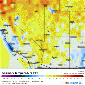
In terms of the anomalous surface temperatures, notice the preponderance of the darker shades of orange and red where verbatim, the GFS shows temperatures exceeding even 20*F above normal in some spots!
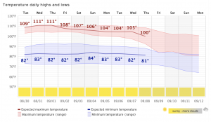
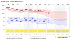
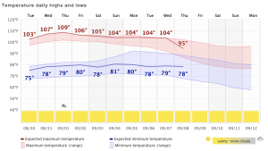
What makes this even more dangerous, is the fact that there’s no relief at night. Forecast lows for the large portion of this area will not dip below 80*F, and with the lack of precipitation during this stretch exacerbating local droughts to add, solar insolation will quickly heat up the the dry air since energy isn’t “consumed” by moisture within parcels; therefore, parcels quickly heat up.
Just to show the persistence of this heat wave, here are three locations via meteograms that show the excessiveness of this dangerous heat that extends right into next week. Take note of the nighttime lows.
Las Vegas, NV
Phoenix, AZ
Fremont Valley, CA
It’s critical to know that heat is the #1 leading weather-related killer in the U.S. To mitigate heat-related risks, try to adhere to some of these guidelines:
- Wear lighter-colored clothing that is also relatively thin.
- Reduce any outdoor activities, especially during the afternoon hours and reduce time in the sun.
- Stay hydrated throughout the day!
- Go to where the coolest location is in your residence if you don’t have A/C; also look for cooling shelters if need be!
- Check on elders and neighbors that you may know aren’t fully capable of helping themselves, or could struggle.
There’ll be a light at the end of the tunnel as long-range signals, with the support of ensembles, show moisture returning and lower-than-normal heights indicating a breakdown of the ridge.
