Let It Stop, Let It Stop! April’s Third Snowstorm Targets Northeast for Wednesday
Ten years ago today, one of the most prolific severe thunderstorm outbreaks of the decade brought large hail and severe wind in a huge swath from Texas to Ohio, as a major squall line evolved amidst a huge hot and moist warm sector. It exemplified the kind of hyper-active, warm, muggy spring pattern caused by persistent western US troughing, which framed that devastating month ten years ago.
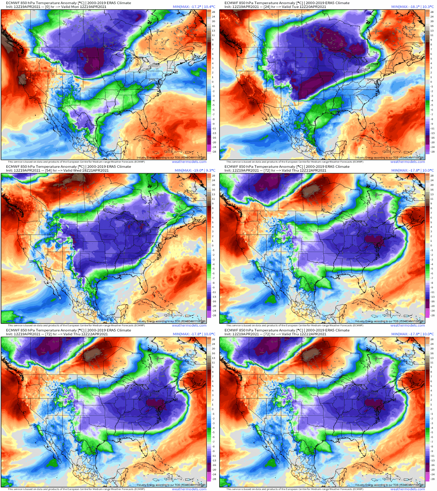
This month has been, and will largely continue to be, the opposite of that, as long-duration blocking in the northern Atlantic has kept persistent troughing glued over the east coast, with ridging in the central US. This sets the stage for a number of introductions of frigid air into the eastern US, which often permit the type of baroclinic instability that can spawn snowstorms.
Even by the standards of this chilled April, an impressive one of these cold air intrusions will spill into the central and eastern US over the next two days.
This cold air outbreak will spread daily record lows and hard freezes across the plains and midwest as it dives east behind a strong, slow moving cold front.
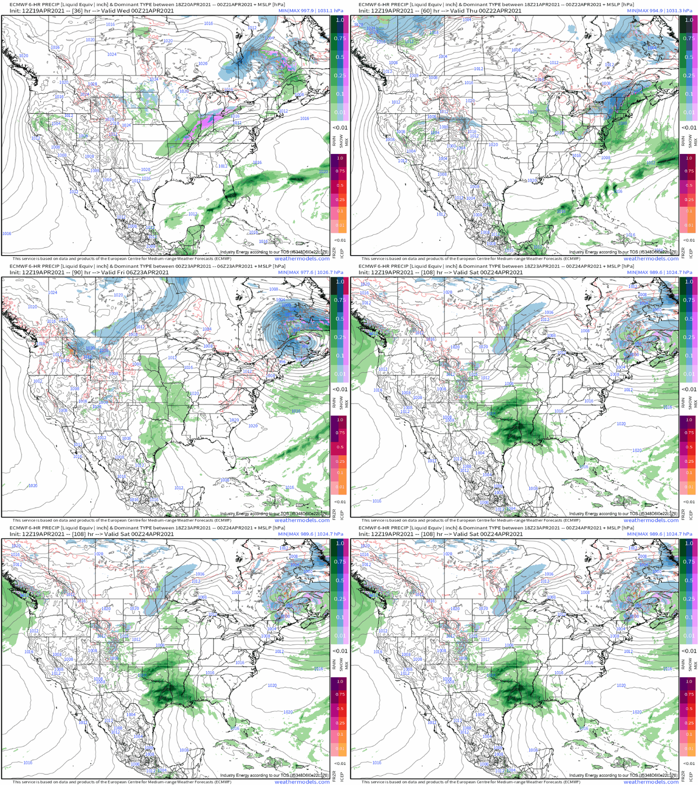
As the front becomes increasingly parallel oriented to midlevel flow late Tuesday, and as the temperature gradient across it remains quite high, surface low pressure development will occur near the Ohio valley. This development will be encouraged by divergence ahead of a pivoting midlevel shortwave along the diffuse closed blocking low near the North Atlantic, a feature of increasing importance as the storm develops.
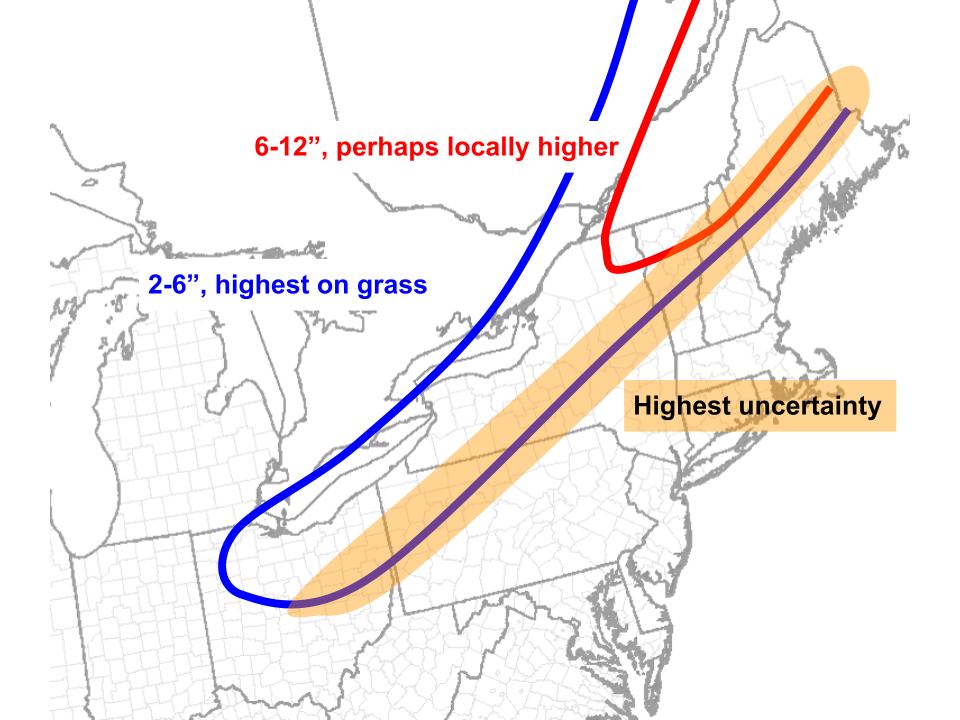
As the system moves quickly northeast, increasingly favorable orientation with respect to forcing aloft will strengthen it and allow increasingly intense precipitation banding to commence to the low’s north. With a seasonally frigid airmass in place, snow should have no real problem accumulating in a swath from Ohio and Pennsylvania northeast, through west New York and into northern New England.
As the surface low matures beneath increasingly consolidated midlevel troughing, it’ll tuck northwest while the precipitation shield becomes more symmetric over Maine, a pattern typical of such mid-life intensification. The low’s increasing strength and sudden incentive to remain relatively immobile will correspond with more intense, long-lasting snow banding kicking back into parts of northern New England into Thursday, with heavy snow blown by winds to near-blizzard conditions. Yeesh.
Especially where more than 6″ of snow can fall, this late-season storm that’ll pack increasingly strong winds with northeast extent could very well lead to power outages for some.
Not what anybody wants nearing May.


