Late Season Snow for Interior Northeast Thursday
An unfortunately familiar springtime pattern will pounce on the east coast this week, dropping temperatures across much of the CONUS and even introducing a chance for significant accumulating snow across the interior northeast Thursday and Friday.
Blocking in the North Atlantic has sent the North American jet stream into a tizzy, with the result being messy synoptic-scale weather. Large scale troughing of unusual orientation has already enveloped the northern third of the US, ‘flattening’ flow at-large and generally pushing temperatures from summer-like into seasonal to below average levels.
As the week wears on, a southerly excursion of polar air aloft’s last gasp will send frigid midlevel air pivoting deep into the northeast. The result will be a further plunge of temperatures over the next couple of days, especially along the interior’s topography.
The result will be twofold. First of all, a direct injection of this cold air above-ground will cause surface temperatures to react accordingly as well, and temperatures will average ~8ºF below average. This may not sound like much, but it’s still noteworthy because it’ll send nighttime lows below freezing in and around topographical support.
This is especially significant when combined with the other thing supported by closed low ejection
– cyclogenesis in the lower atmosphere.
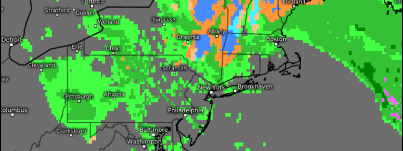
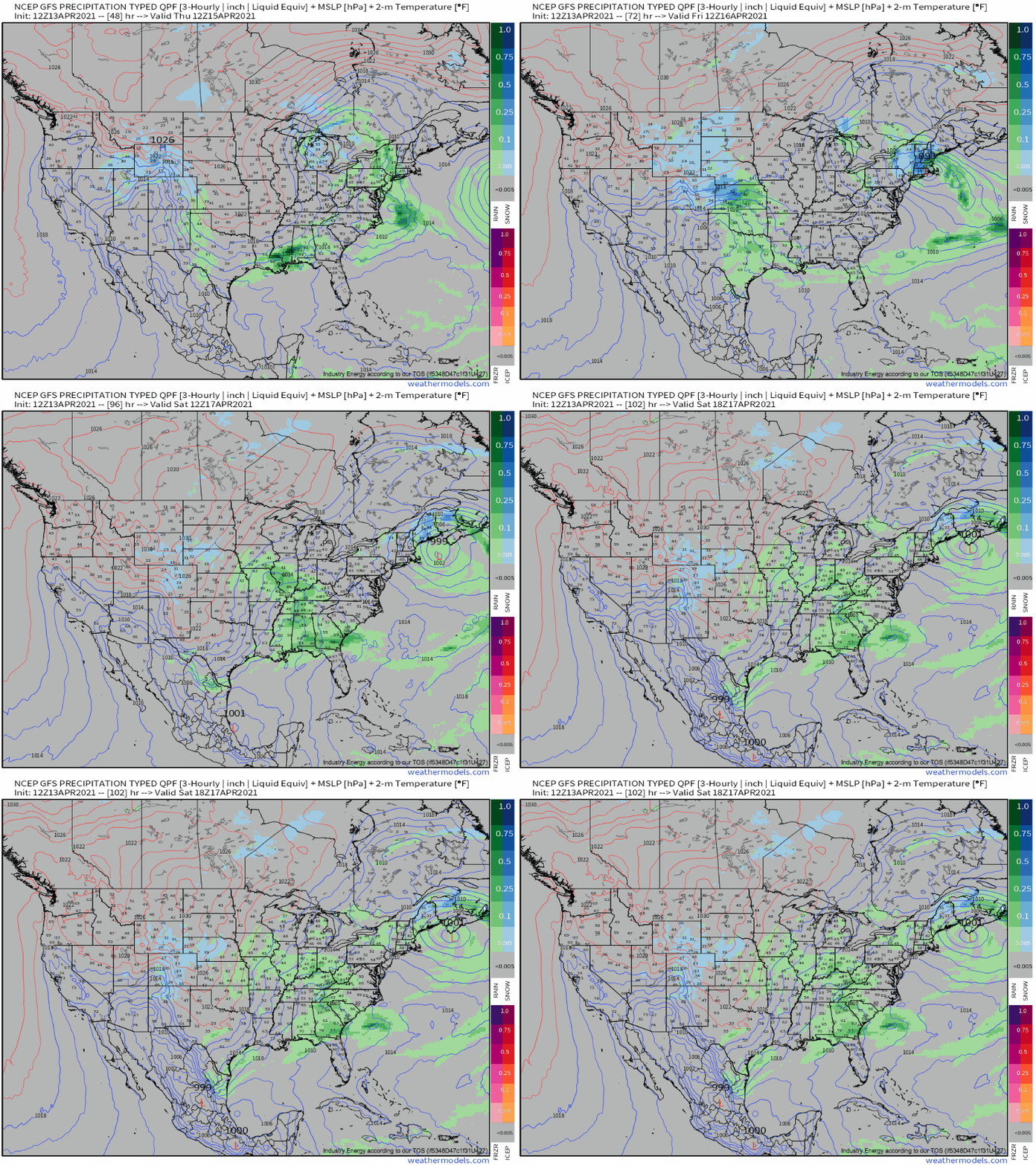
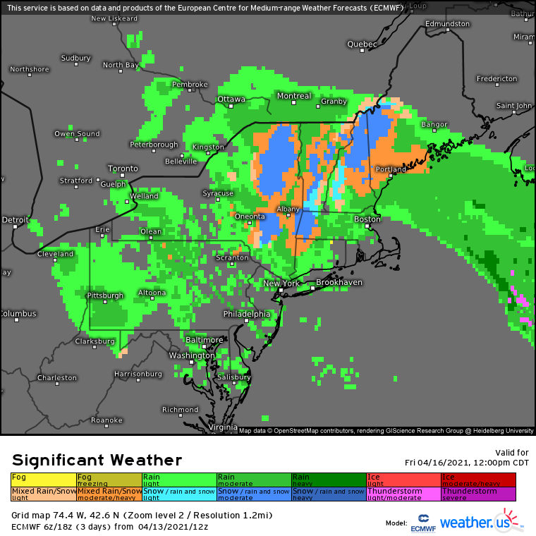
This cyclogenesis will actually end up occurring along the cold front draped beneath the initial, largely occluded cyclone, and it will burrow under the closed low near Long Island on Friday. As this secondary low develops, occludes, and begins to pull away, it’ll wrap precipitation into the northeast that will be cold rain for many, and moderate, dense snow for some.
Where, exactly, will see this snow depends in large part on surface temperatures, obviously. These will be lowest where mountains are able to suppress temperatures, like over the Catskills and Berkshires; and in a sweet spot to the low’s north, where dynamical cooling amidst falling precipitation overlaps with northwesterly advection.
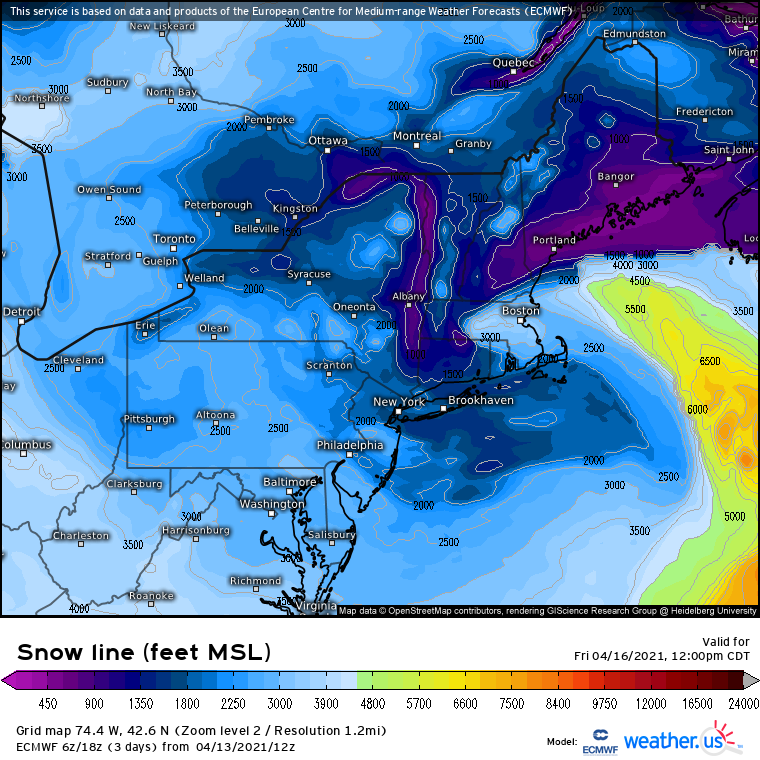
In almost the entire northeast, the freezing level will remain off the ground:
Which will present main snowfall regions along the spines of the northeast’s most known peaks.
Some accumulations to 6″ are possible at the highest elevations, but a more widespread coating to 3″ is likely in the hills and peaks of New England.
Stay tuned!


