Late-Season Fire Weather Again Threatens California
I feel like I’ve written the same blog about SoCal fire weather twice (1, 2) in the last two weeks, and this is about to make it an even three.
This is because, as rain continues to not fall across much of California, southwestern portions of the state remain vulnerable to the type of Santa Ana wind event that can relatively easily bring the region conditions quite favorable for fire growth.
As regular readers know by now, the process works like this:
- Months of dry weather leave fuel, like plant matter, extremely flammable.
- A ball of cold air in the midlevels shoves south through the western US, creating a zone of strong convergence over the Great Basin region.
- A strong dome of surface high pressure slides south in response to the increasing convergence, but is forced to remain east of California’s terrain.
- This damming of high pressure by the mountains forces a strong westerly pressure gradient to develop across SoCal
- Powerful offshore flow develops in response to the PG, which produces strong wind gusts. This alone helps foster an environment favorable for fire weather.
- As the offshore flow is forced downslope along the topography towards the coast, it contracts and warms. As this warming is not accompanied by an increase in moisture, the air becomes very dry. This low-relative humidity air is the second significant atmospheric contribution to favorable fire conditions.
This process looks likely to repeat tomorrow and Tuesday.
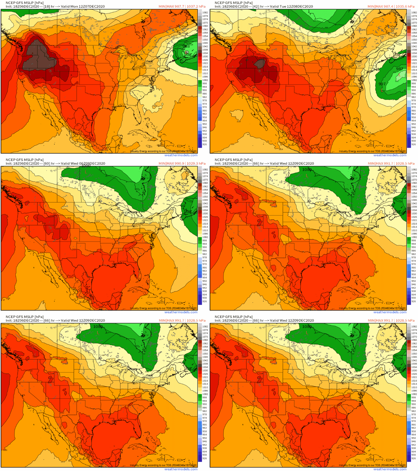
As a closed low descends south along the west coast, powerful surface high pressure will develop south into the Great Basin.
You know what this means- trouble ahead!
As the high pressure slides south, it’ll force a strong pressure gradient along the damming SoCal mountains, which can be seen to an extent on the map I’ve posted above. This gradient, surprise surprise, will push brisk offshore flow.
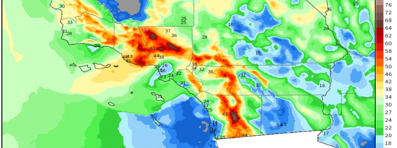
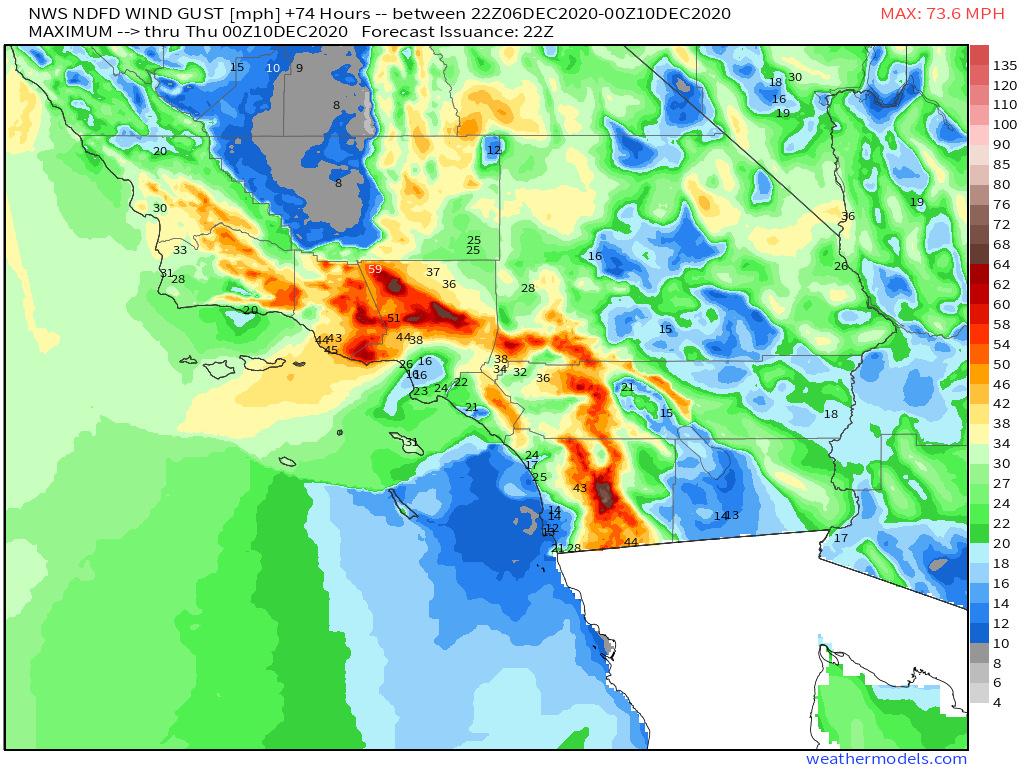
The rate of this flow depends to a large degree on the size of the pressure gradient. And as this looks to be a pretty strong PG, intense wind gusts will be possible. 
These strong winds tomorrow and Tuesday will serve to potentially whip up any burns into intense conflagrations. And, as I’ve mentioned, they’ll also hold the key for establishing very dry air over SoCal as they move downslope and dry.
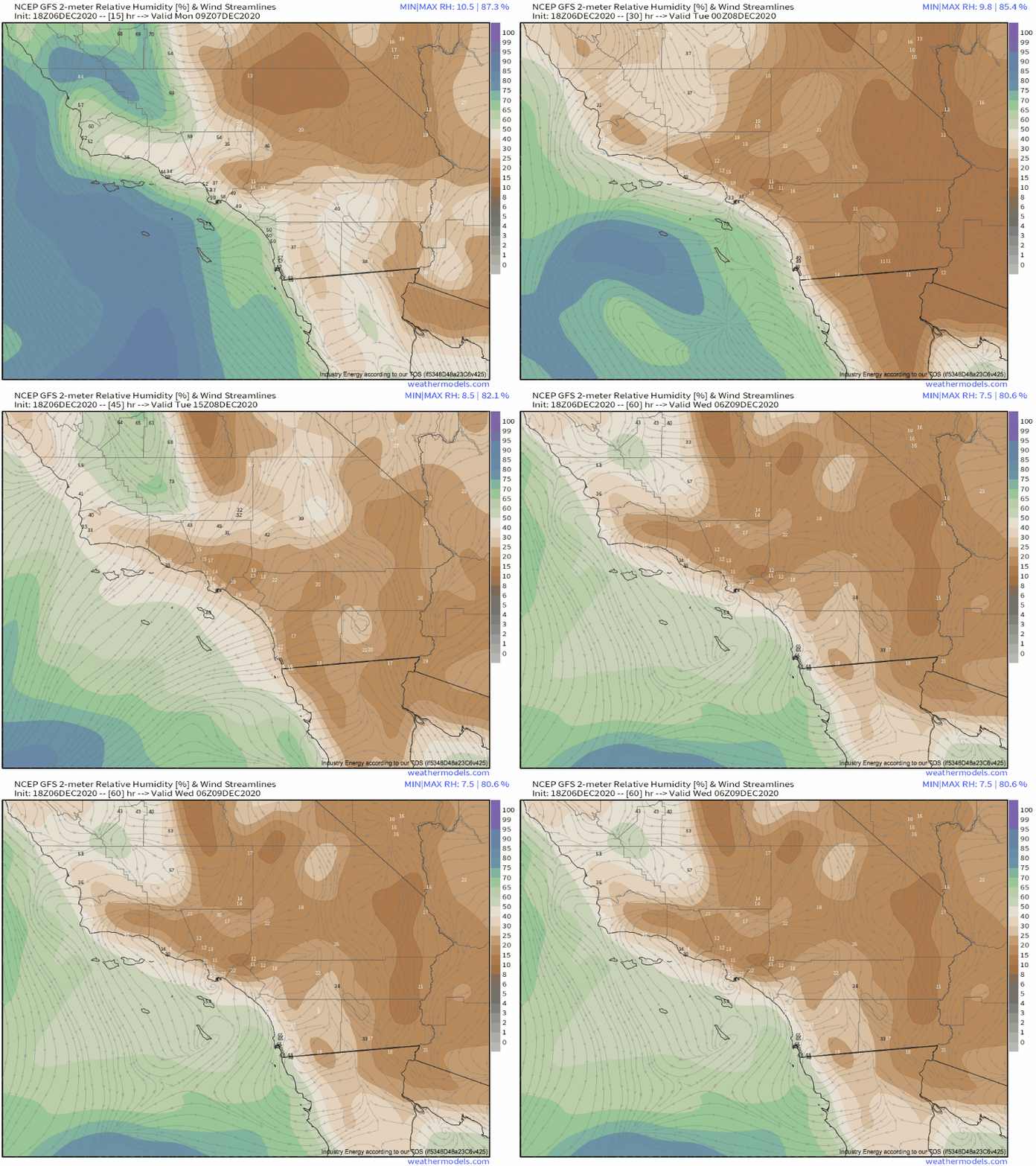
As the PG really gets going early tomorrow, so too will the dry air machine. Take a look at the evolution of relative humidity over the next couple days!
Clearly, a very dry airmass will become established. Combined with the gusty, offshore flow, this is the type of weather that can significantly exacerbate the spread of any fires that form, making them incredible difficult to fight and contain.
This is, as I’ve mentioned, the third strong, fire weather producing Santa Ana wind event in the past two weeks. As ridging continues over California, preventing any rain from wetting SoCal fuels and allowing troughs to continue diving south along the Great Basin, this pattern of consistent fire weather will remain largely in place. There is a chance of respite after around a week and a half out, with some models depicting a large west coast trough bringing the type of Pacific moisture infusion that can serve to end fire season. Fingers crossed for the folks of SoCal! This pattern is brutal!
We’ll keep you posted here and on twitter if significant developments arise. Of course, those in the area should be sure to heed local evacuation notices, and be sure to have multiple ways to receive information.


