Labor Day Weekend Outlook Across the Country
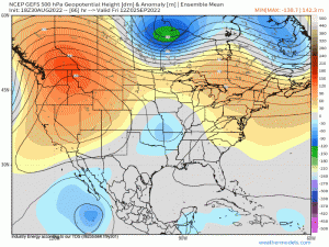
The general height pattern across the CONUS this Labor Day weekend, is poised to be relatively “tame”. Beginning Friday, we’ll be dealing with ridging on both sides of the coasts with the western mid-upper level heights remaining anomalous for this time of year producing record-breaking heat embodied by a heat wave. On the East Coast, it’ll be a somewhat different story as Canadian high pressure will build into the Great Lakes region, making it feel very fall-esque especially with nighttime temperatures falling into the 50’s and 60’s. A mid-level trough will settle into the Midwest before gradually decaying & filling across the Deep Southern states. By Saturday and Sunday, the western ridge amplifies and slowly shifts poleward while the western Atlantic ridging weakens as a broad mid-level trough swipes across Southern Canada, eroding the western periphery of the ridge axis. Below also displays a notable area of lower heights southwest of Baja, CA that’ll have to be monitored as an East Pacific tropical cyclone will likely form by the end of the week, but as of now it does appear if anything forms, it’ll pass just to the Southwest of the region. By Labor Day, we see large-scale ridging & above normal heights dominate across the majority of the nation, with below normal heights spreading toward the Deep South.
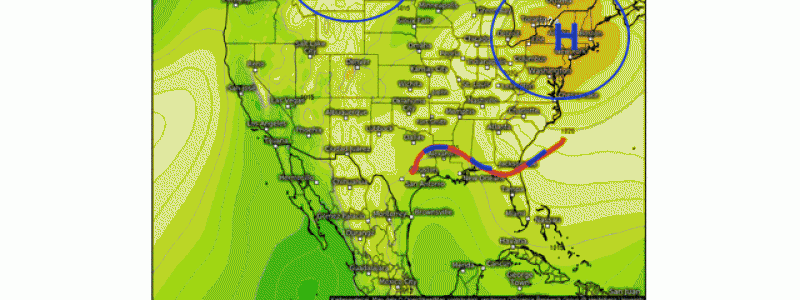
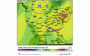
At the surface, using MSLP and annotations to highlight the most prominent synoptic features from Friday through Monday:
Two large areas of high pressure will prevail across the Northern Rockies/Intermountain West and across the Northeast. The former will render well above average temperatures while the latter will yield seasonable to slightly above average temperatures. Mainly precipitation free for both of these regions. The main activity will be situated across the Southeast into the Deep Southern states as a stationary front will meander through the weekend and will be reinforced. This’ll provide up to several inches of rain anywhere from Texas, along the Gulf Coast, and to the coast of the Southeastern states. Localized 4″+ amounts are likely across SE TX and up into LA as a result of a very moist, tropical air mass with high precipitable water.
Through the weekend, we see mainly high pressure west of the Rockies and a large sprawling high pressure across Southern Canada, ushering in a cold front. This front may spark some pop up showers and storms along and east of the Appalachian Mountains, while the stationary front across the South doesn’t budge much, if at all. By Labor Day, a large center of high pressure is seen building once again into the Northeast providing seasonable temperatures and clear conditions. West of the Mississippi River Valley, we see similar conditions with several areas of high pressure. The main active weather pattern will still remain situated across the Southeast and Deep South with locally heavy rain, but below average temperatures where clouds and precipitation will remain present.
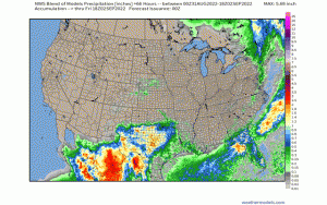
Here below, is the NWS blend of models regarding precipitation output. Notice that more than approximately 60% of the country remains relatively precipitation free, except across the entire south and that aligns with the fact that a stationary boundary will linger through the weekend. Along the East Coast, however, we may see some storms and showers, along with some higher values of humidity via frontal boundary toward the latter half of the holiday weekend.
For the most part, the weather will cooperate with many areas looking to do outdoor activities and a string of manageable days for the holiday weekend. The good news above all else – the tropical depression that was dubbed Invest 91L, will end up recurving away from the U.S. and no tropical threats are imminent this weekend!
Have a safe and happy holiday weekend!


