Invest 95L: Beneficial Rain?
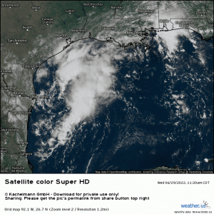
Despite briefly looking as if it may be getting its act together yesterday, Invest 95L in the northwestern Gulf is lacking truly deep convection and remains disorganized as of this afternoon.
This comes as no surprise to forecasters as we expected the ceiling for this disturbance to be definitely no higher than a weak tropical storm, but more likely a tropical depression.
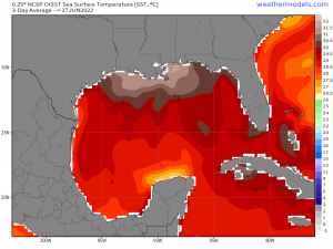
Though 95L sits/has been over the exceedingly warm waters of the north-central and northwestern Gulf, both shear and time are working against it.
95L came into being from leftover frontal energy in the Gulf, not far offshore. At no point in its short lifespan has it been over truly wide open, deep, warm waters. Its short trip from the north-central Gulf to the northwestern Gulf has kept 95L relatively close to shore.
While this doesn’t necessarily greatly hinder development, it likely doesn’t help either. Considering the short time 95L has had over water, it would have needed to rapidly intensify to develop into a formidable storm, especially as its core (or what core exists) is expected to really interact with the coast as early as Thursday AM. Time and shear made that impossible.
However, as we have seen many times in the past, a disturbance doesn’t need a name or a classification to cause problems. The aforementioned problems usually come in the form of excessive rainfall leading to flash or river flooding.
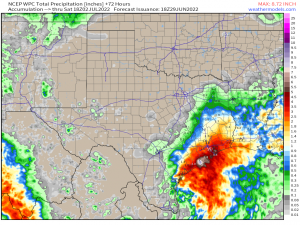
Heavy rain is a near certainty with a sluggish low as it takes its time coming ashore.
The disturbance is, at least at the moment, rather sheared with most of the convection residing on the northeast/eastern sides. The heaviest rain will then likely be found northeast of where the center comes ashore.
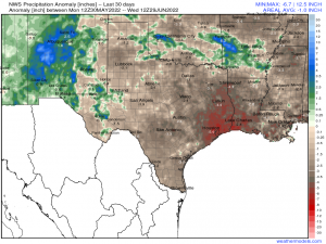
For places like Houston, TX and even Lake Charles, LA, this may actually be good news.
Though I’m sure they would prefer that it doesn’t all come at once, this rain, in the long run, will be rather beneficial for this area as they are facing a large deficit due to an extended period of drier-than-average weather.
Of course, drought or no drought, heavy rainfall can still lead to flash flooding, especially if the same area receives heavy bands repeatedly. This possibility will need to be monitored as the disturbance comes ashore.
You know the drill by now: please don’t drive through flood waters. Depth can be deceptive and you have no way of knowing if the road has been washed out underneath. Don’t risk your life. If you know an area that tends to flood, plan your route around it.
While high winds aren’t expected to be a concern…
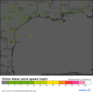
Off-shore stations are picking up sustained winds near 30 mph with higher gusts.
That’s still enough to bring down a few trees or powerlines, especially if the ground becomes saturated. Power outages should always be a consideration with any landfalling storm. Heavy rain and gusty winds are a winning combination in terms of potential power outages.
After 95L, the Gulf looks quiet again for awhile. Consider this a “practice” storm before we really get into the core of hurricane season.
Stay tuned to our blog and Twitter feed! We’ll update you if anything changes significantly.
