Invest 90L: The Tropics Awaken
You may have noticed by now that we officially have our very first area of interest, dubbed Invest 90L, in regards to tropical development on the NHC’s map.
But before anyone goes and gets all worked up over potential development, let’s look at this disturbance and why it won’t be that big of a deal, relatively speaking.
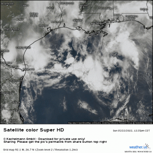
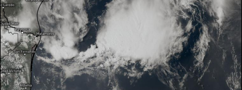
If you watch the satellite loop again, you’ll notice a few things.
- First: it does, in fact have a center. It can be found southeast of the tip of Louisiana, just spinning away.
- Second: it is displaying a decent amount of convection, especially over the last two hours or so.
- Third: that convection is displaced from the center. That’s not really where you want it to be for tropical development.
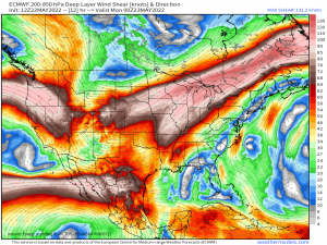
The system is fighting some shear, which is succeeding in pushing its convection away from the center. This is bad news for a tropical cyclone.
Unlike supercells, tropical cyclones do not need shear to organize them. In fact, they do much better when there is little to no shear present. Tropical cyclones must be vertically stacked to function at peak efficiency. The maximum amount of vertical shear a TC can withstand without being weakened is thought to be around 20 kts (10 meters per second).
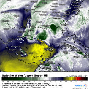
Besides the wind shear, another obstacle Invest 90L faces is dry air.
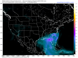
Not only do we have very dry air trying to intrude from the southwest, but we also have the Saharan Dust to consider.
This dusty air from the Sahara Desert has been blowing into the Gulf Coast for the past day or so. Desert air is dry air, and dry air tends to suppress tropical activity.
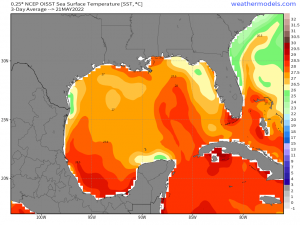
One thing Invest 90L has going for it is SSTs in the Gulf.
Almost all of the Gulf is above the 26.5 degrees C/80 degrees F threshold required for tropical development. If that were the only requirement, it might have a chance.
It isn’t though, and with Invest 90L’s proximity to the coast giving it limited time before land interaction, shear to fight, and dry air around, development at this point in time is really unlikely.
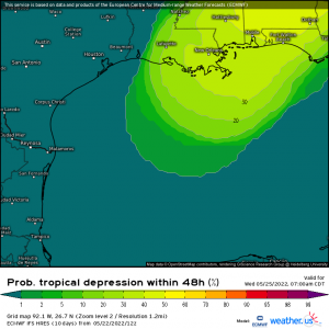
The NHC gives it a 10% chance of development in the next 48 hours and, as evidenced by the graphic above, the EPS more or less agrees.
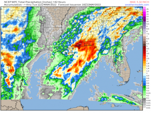
A word of caution, though. Just because this storm will likely not receive a name or official TC status doesn’t mean that there won’t be impacts. Sure, there won’t be hurricane force winds to contend with. But heavy rain and onshore flow resulting in some coastal flooding are pretty much a guarantee as well as gusty winds (likely under TS force) causing scattered power outages.
The heaviest rain will, of course, be felt along the coast where it makes landfall. As it exits northeast, additional fairly heavy rain is possible over the Southeast.
Some of this region has seen repeated pop-up thunderstorms bearing heavy rain already this weekend. The ground will likely remain saturated between now and whenever the remnants of 90L move through. Flash flooding could occur much faster than it normally would.
Let’s not forget about onshore flow/surge and coastal flooding. The Florida panhandle may see some surge in the early morning hours as the system moves on shore. This may impact locations particularly sensitive to rising water levels. If you’re in an area like that, be cautious and keep that in mind.
The Southeast has been abnormally dry lately, so the rain is needed. Though maybe not that much all at once. Either way, stay safe!
