Intense Severe Weather Possible in EML-Overrun Northeast
I’ve long mused that the single biggest factor differentiating severe storms in the Northeast from those in the Central Plains is the latter’s proximity to the source of a seemingly insignificant airmass: the warm, dry air that forms atop the plateaus of the desert Southwest and northwest Mexico. Called the elevated mixed layer, or EML, this airmass is known to create a ‘cap’ of warm air a few thousand feet off the ground, above which very dry air rises deep into the midlevels.
This combination produces some interesting effects on the thermodynamic profile of the atmosphere- it changes the way a parcel of condensed water vapor can rise through its environment.
First, the very dry EML air is associated with a rapid rate of environmental cooling with height. This means a parcel warmed by condensation will be much more buoyant than its surroundings, promoting a relatively high degree of potential energy and resulting instability.
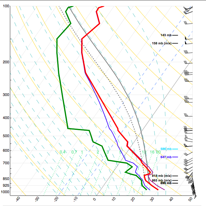
Check out how an EML can impact instability on a vertical profile of the atmosphere in these skew Ts. The first, from UCAR, shows an EML and the resulting thick, deep instability associated with high midlevel lapse rates. The second, also from UCAR but edited by me, shows how removing the EML dramatically reduces instability, even if we keep surface temperature and dewpoint the same.
Source: UCAR
EMLs also often feature a ‘cap’ of warm air, which prevents all but the most intense lift from triggering updraft development and can help extreme instability develop uninhibited by showers and weaker storms. The result is often an airmass pristine and deeply unstable by the time stronger vertical velocity (ie, a cold front) or mixing breaks/reduces the cap enough to allow storms to develop.
This combination is why many see EMLs as essential to the development of deep, intense, dangerous convection. But the airmass is easily degraded by convection, and so requires a fairly tranquil advection regime to arrive where it must go- easy for the central US, which exists one day away from the high terrain that produces EMLS, but much more difficult for places like the Northeast that are several days downstream. For an airmass of the type to arrive in New England, it must be advected by a regime either kinematically tranquil or stock-full of subduction, neither of which are typically associated with widespread severe thunderstorm activity. And so the Northeast is often forced to choose: a regime unfavorable for severe weather capable of bringing an EML to our doorstep, or a regime favorable for severe weather that’s long since dissolved the EML with convection thousands of miles upstream? In my opinion, it’s the biggest reason that we don’t often see violent tornadoes in these parts of the US.
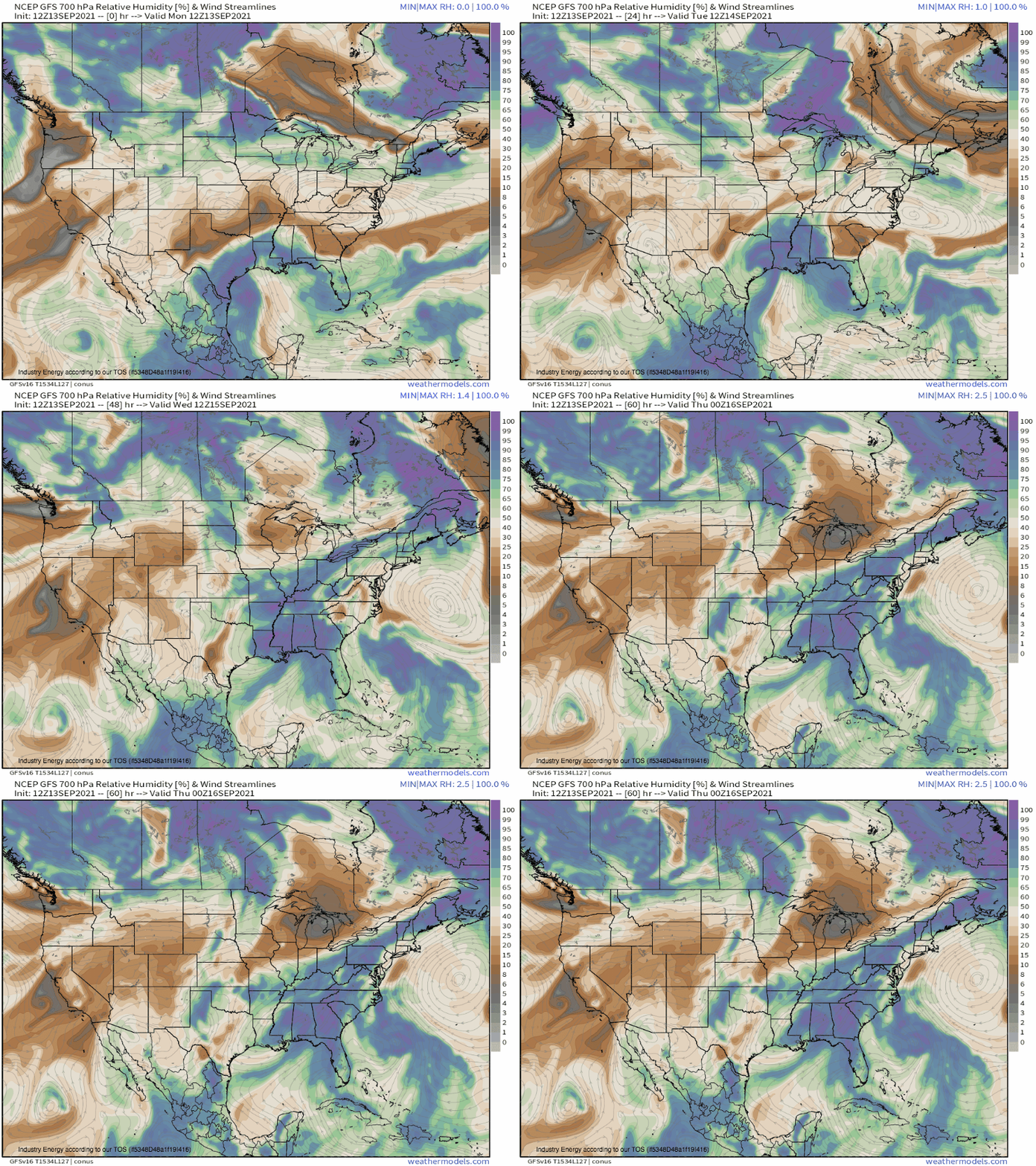
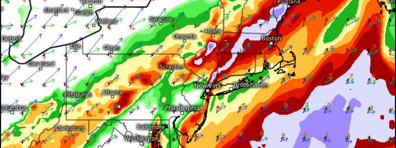
But an occasionally threaded needle is inevitable in an atmosphere as constantly active as ours, and one looks probable today. It comes as an EML, advected from the West amidst flow unfavorable for convection, was allowed to simmer in a subsidence regime over the mid-Atlantic while more impressive midlevel flow approached from the east. In ‘storing’ our EML (seen here in warm-sector 700mb humidity minima), this midlevel setup allowed us to have the cake and eat it too.
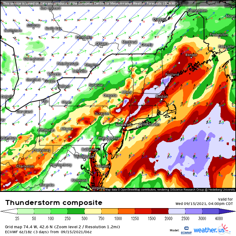
The aforementioned speedy midlevel flow will promote impressive wind shear to 50 knots, as low level flow builds amidst an increasingly steep pressure gradient from the strengthening cyclone to the north. Midlevel and low level flow will be largely parallel in a lot of the region, but both will be fairly high in magnitude, and will overlap a seasonably impressive tongue of instability.
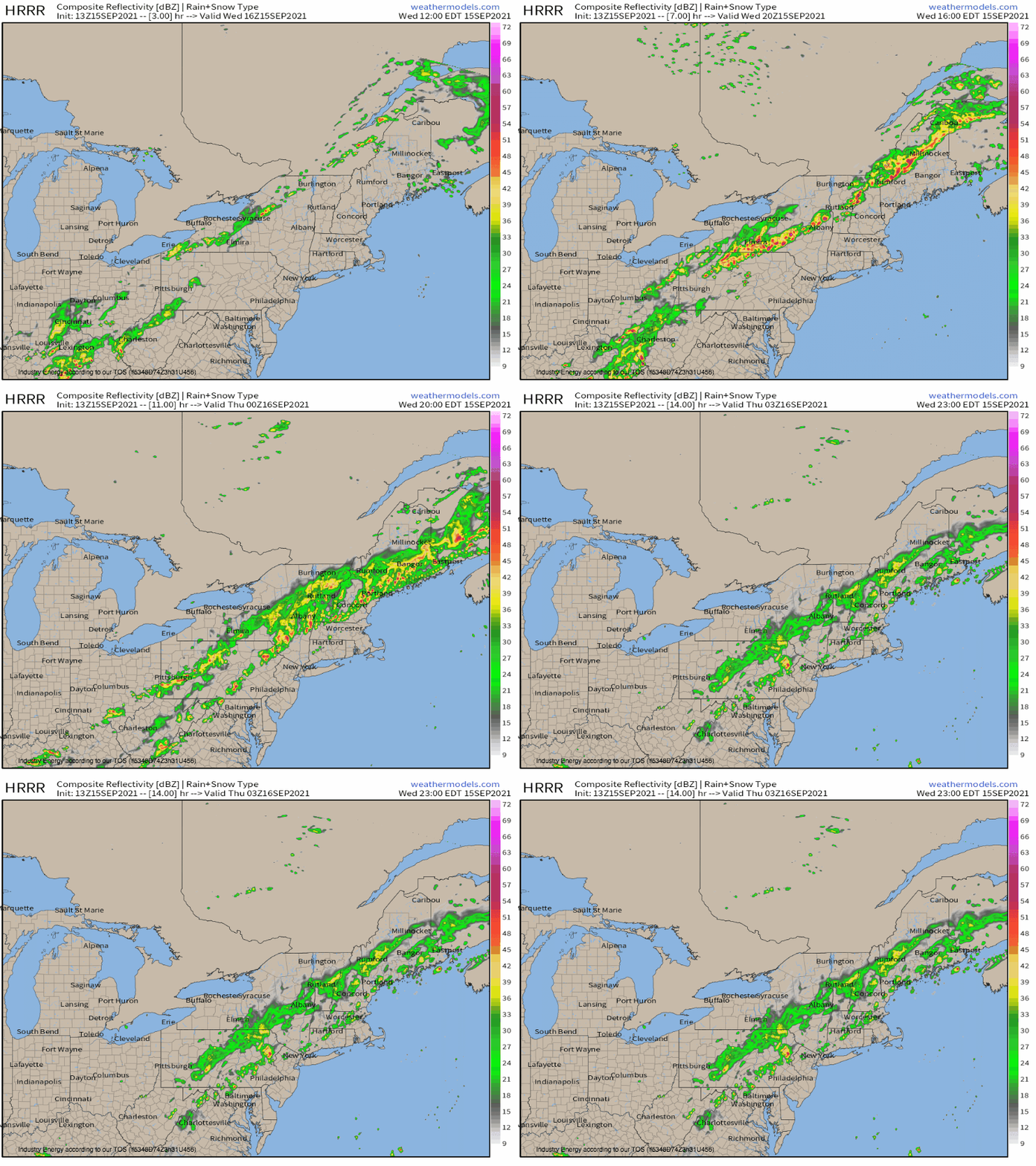
This won’t be a perfect outbreak for sure- flow too weak, and solar heating too far gone, will keep this from being a blockbustah. But, as convection develops along a cold front today, it will exist in an environment quite unusual for the Northeast, especially this time of year. Fairly straight hodographs and a linear mode along a surfing cold front should lower tornado threat some, but a couple instances of supercell development amidst favorable shear and instability could well produce. More pronounced will be the threats for damaging wind and large hail, both of which could be scattered to widespread as convection develops along a cold front today. And, given the instability in place, instances of significant wind or hail unusual for this part of the country could occur- perhaps somebody could even see hail exceed 2″.
