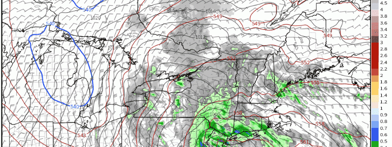
Intense Nor’easter Set To Blast Northeast
Did somebody say amplified?
It feels as if that’s the word of the week around North America, as a series of tightly wound cyclones smash the United States with an array of dangerous weather. Be it a record-intensity low bringing California a damaging atmospheric river or an intense shortwave smashing the Missouri river basin with strong tornadoes, the atmospheric amplification of late has already proved quite impactful.
Significant weather will continue this week as another energetic midlevel cyclone spins up over the mid-Atlantic, inspiring a fierce coastal storm that will likely overspread parts of the Northeast with damaging winds and very heavy rain over the next 72 hours.
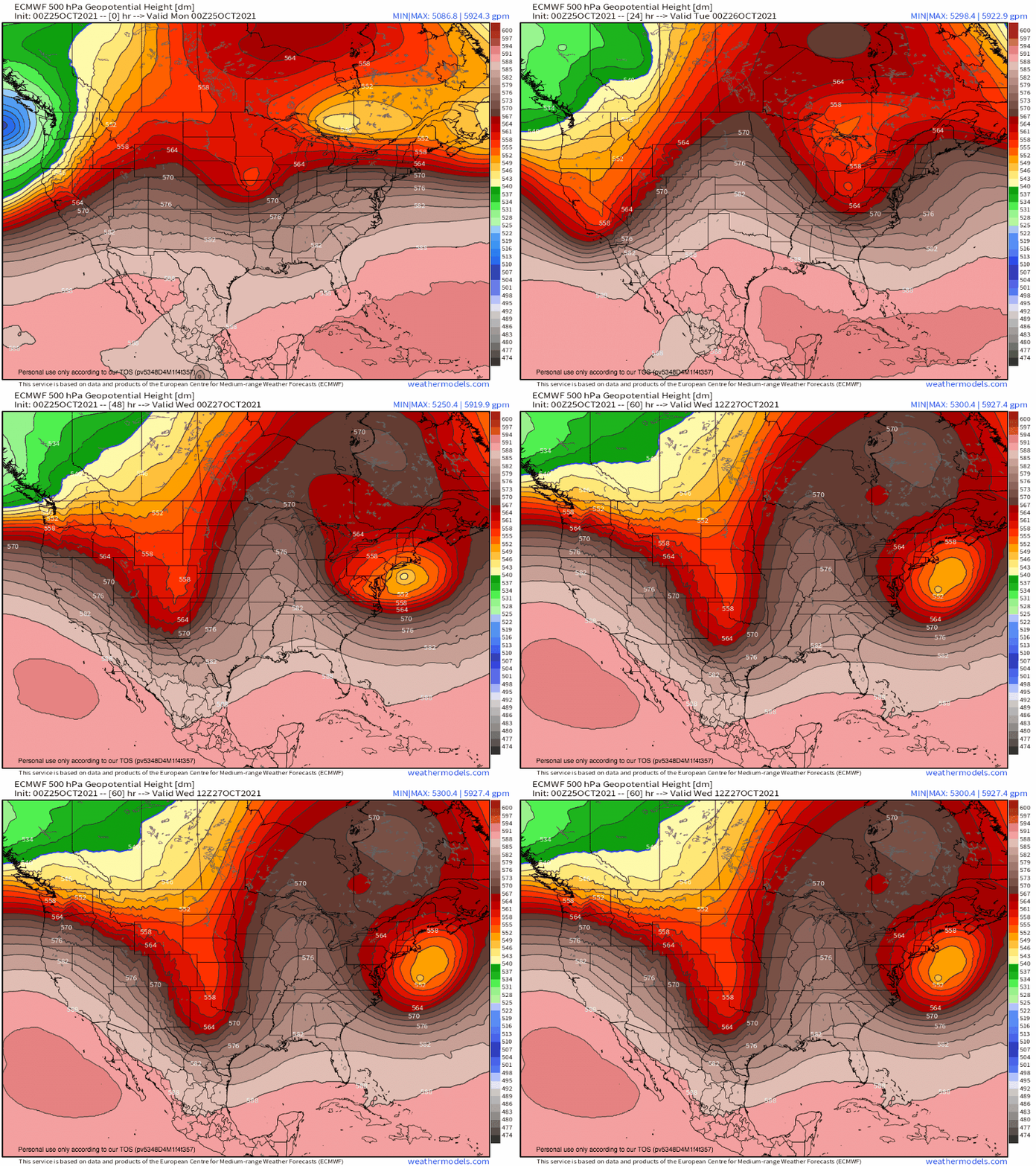
The vigorous spinup will start from above, as the trough that brought damaging tornadoes to the central US yesterday begins to coalesce with a retrograding upper level low, itself squeezed to the south of highly anomalous Hudson Bay ridging. As the two phase atop dramatic temperature contrasts inherent to the Autumn coast, a dramatic coastal storm will develop.
Notice how maximized divergence off the mid-Atantic coast lasts from tonight well into Monday, staying fairly still all the while. This means that, closer to the ground, a fairly unusual cyclone progression will batter the coast for an abnormal length of time.
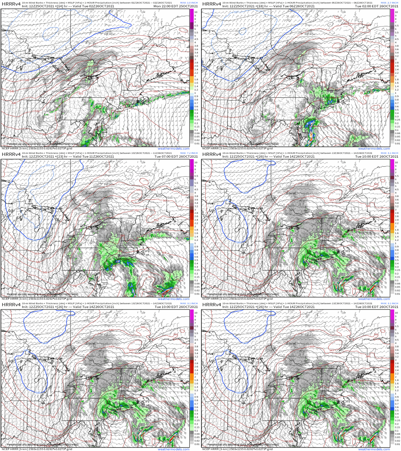
Initially, as fairly weak ascent associated with the initial trough overspreads the Northeast, a steadily deepening but not overly intense surface low will push through the northern mid-Atlantic. An associated warm front will lift through southern New England, overspreading much of the area with moderate rain that should continue expanding in scope with the intensification of the initial low.
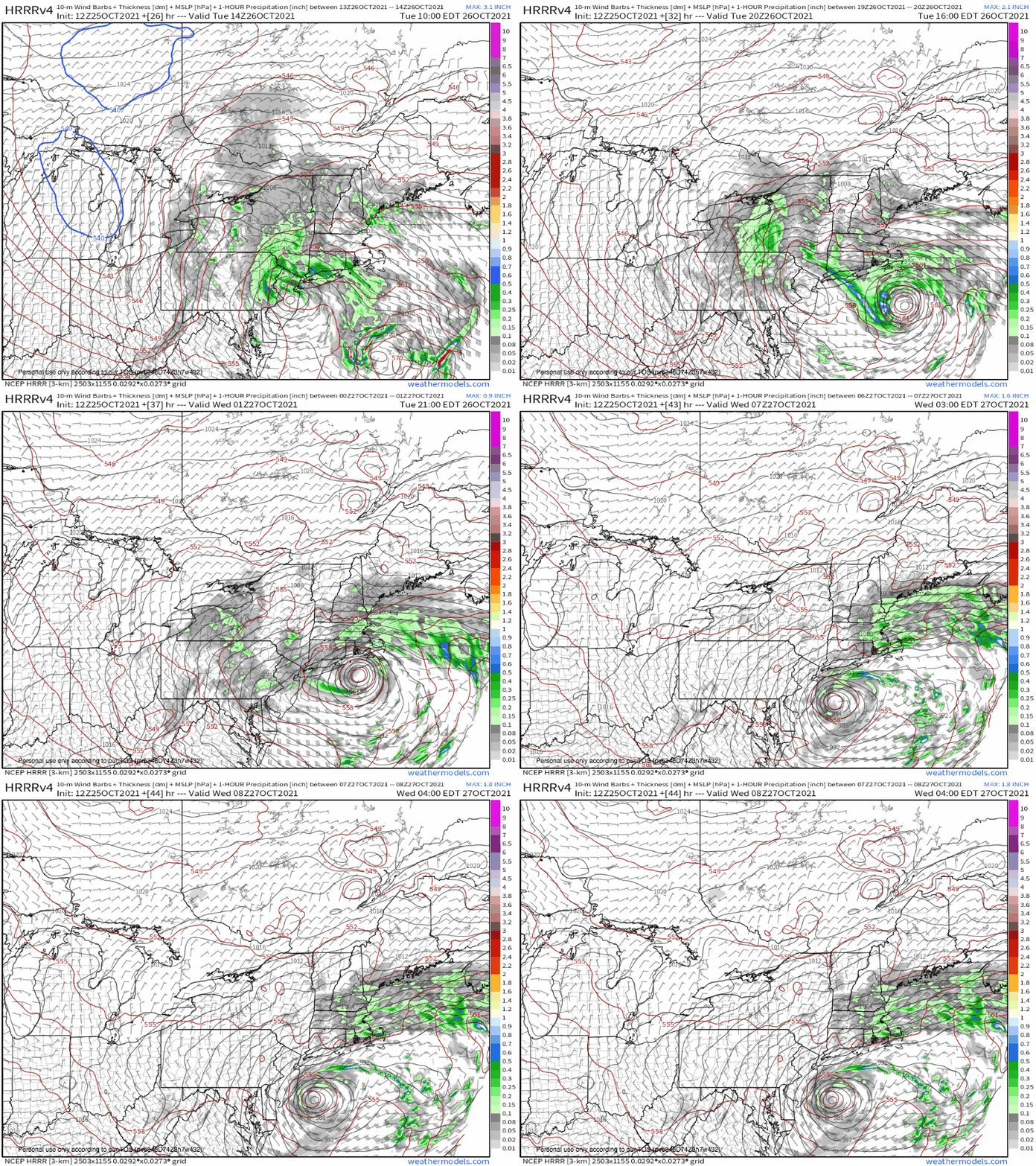
As this first low burrows into northern New Jersey, stacking beneath the phasing cyclone, a secondary surface low will intensify in the zone of ‘fresh’ divergence east of the midlevel low. This second low, beneath massive diffluence and located atop a sharp baroclinic zone chock full of warm-sector latent hear release, will quickly become much more intense than the first. It will likely deepen at about the upper envelope of climatology, swinging cyclonically towards Cape Cod, around the upper level cyclone.
Between these two surface lows, a line of intense convergence will develop where southerly and easterly winds smash together. Moisture streaming towards this front will be lifted into a narrow zone of relatively heavy rain, which will pivot very slowly around the mid-Atlantic low Tuesday. Where this sets up, rain totals could end up locally exceeding 6″. Elsewhere, a heavy rain event driven predominantly by a combination of shallow convergence and coastal friction lifting North Atlantic moisture will leave a widespread 2-5″ of rain across Southern New England.
This sort of long-fused, moderate to heavy rain event may lead to fairly widespread flood concerns. This will mostly take the form of water ponding on roads, basements, and in vulnerable yards; but could lead to some instances of flash flooding that may prove genuinely hazardous.
Aside from flooding, all this rain will excessively saturate the region’s forested soils. In combination with trees that still sport an unusual number of leaves, the wire/tree interface that is New England’s power grid will be at heightened risk for outages. This is problematic due to the high wind risk that could accompany the nor’easter.
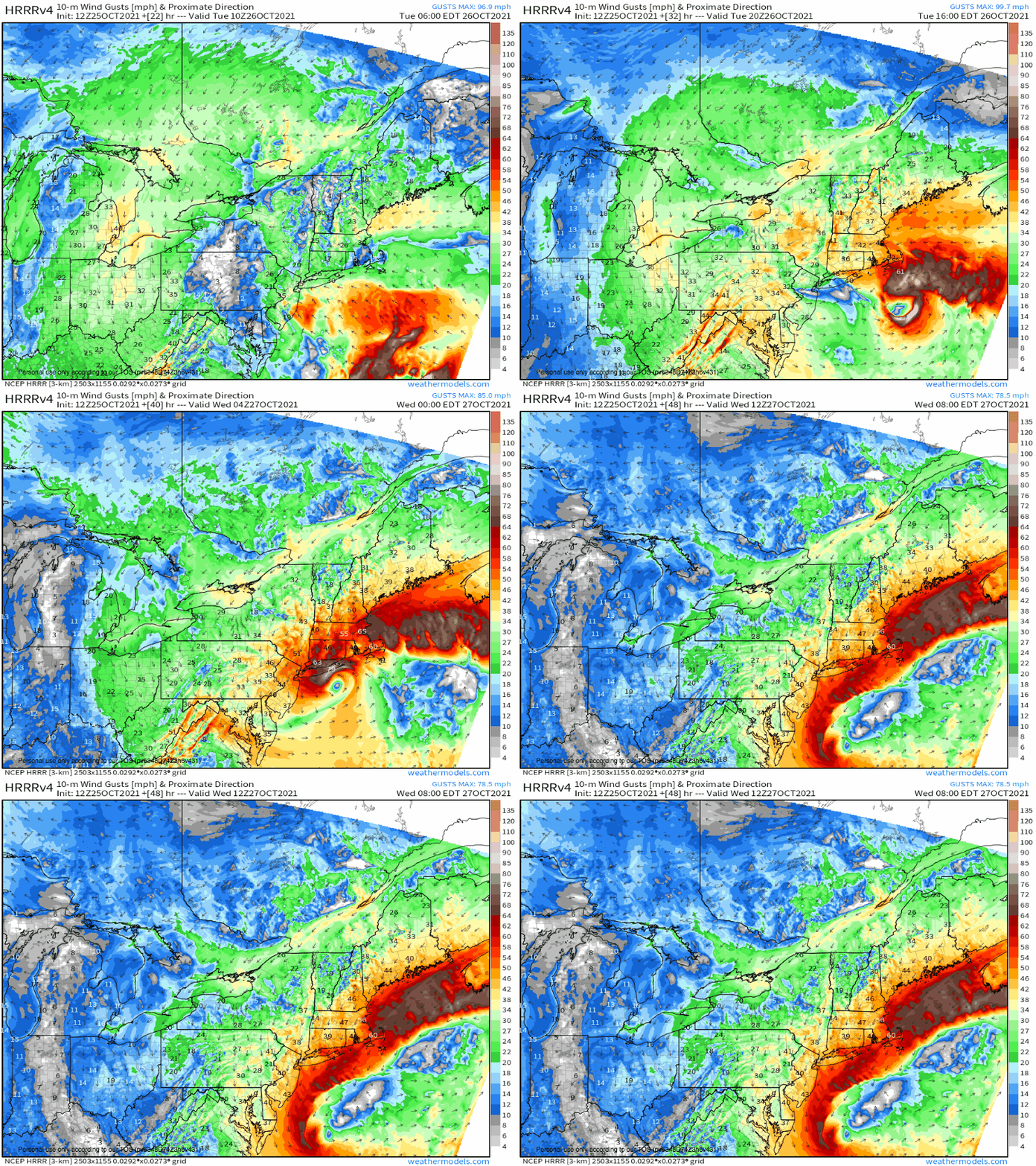
When the two surface lows dance offshore Tuesday into Wednesday, a very sharp height gradient in the low levels will develop to their north. As this zone of enhanced wind stretches and slowly pivots, moderate mixing will blast parts of New England with sustained winds to tropical storm force, and gusts that may even approach hurricane force. The unusual duration of these gusts will combine with aforementioned soil saturation and leaf foliage to promote scattered to widespread power outages.
Here’s a loop of one model’s forecasted wind gusts. It is only one solution, and it represents a fairly worst case. That being said, there is abundant evidence in this run and elsewhere that the storm this week could end up quite impactful.
