Increasing Heat For Many
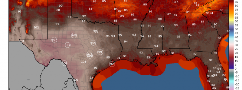
If you’re a regular reader of our tweets as well as our blogs, you’ll be familiar with the fact that Texas is currently in the middle of an impressive heatwave.
Today’s blog will address that in more detail. We’ll look at the larger pattern and the environmental factors contributing to the substantial heat. We’ll also look at who heats up next.
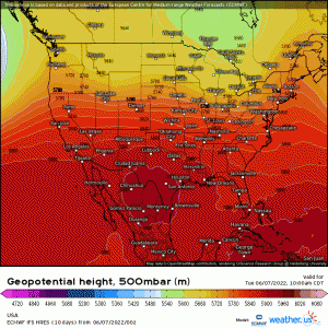
Currently, ridging is evident over the south-central US. The clear skies and southerly flow that ridging enables is what’s allowing Texas to heat up. But another factor is in play here as well:
Drought.
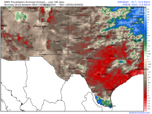
In the last 6 months, Texas has experienced a serious lack of rainfall. Most of western Texas is in extreme or exceptional drought.
Of course, it takes much longer than 6 months to build up to a drought like that. In fact, data from the last 365 days shows double-digit deficits in some parts of Texas. If you’re curious to know more, follow the link above to the Weathermodels Model Lab and check out the data for yourself.
Anyway, my point is that the ground is very, very dry.
As I’ve mentioned in previous blogs, dry ground and a dry atmosphere allows heat to climb to levels we wouldn’t generally experience if conditions were normal. Energy from the sun usually devoted to evaporation suddenly find itself with nothing to evaporate and instead goes into heating the ground and the air. This results in exceptional heat, assuming all other conditions are right.
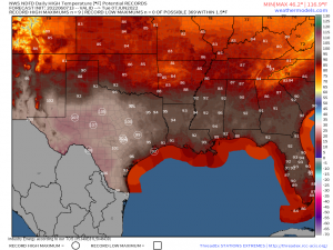
And so, another day of potentially record-setting heat is on tap for Texas.
Some, like Midland, TX, will challenge a record set back in the 1960s, while others challenge more recently-set records.
But today is the peak of the heatwave, at least for now.
Looking at the 500 mb heights map I shared at the beginning of the blog, we see the pattern start to shift.
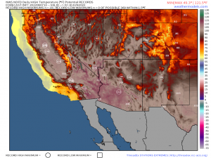
A trough will dig into the Great Lakes/Northeast region, forcing the ridge to retrograde west as well as amplify. By Friday, though Texas and the surrounding areas remain hot, the more potent heat has shifted west to the Central California valley and the Desert Southwest.
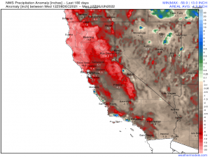
Once again, serious rainfall deficits leading to Extreme/Exceptional drought conditions will add to the heat, allowing temps to soar well into the triple digits.
Friday seems to be the potentially record-breaking, peak day for heat.
The reason for this: the amplifying ridge won’t linger. By the later half of the weekend, a trough arrives from the Pacific. This will force the ridge back east as it further amplifies, caught between the Pacific trough and lingering troughing over the Northeast (see 500 mb animation above).
Should this forecast verify, the amplifying ridge will allow intense heat and humidity to build for the central and some of the eastern US. However, with roughly a week to go, this forecast could change. For example: if the Pacific trough comes in less amplified than forecast, the ridge may not become as amplified, resulting in the heat not making it as far north. Remember that our atmosphere is a fluid – whatever happens upstream affects what occurs downstream.
For now, it would be wise to keep an eye on the forecast and prepare for anomalous heat. Make sure those AC units are working in your house and your relatives’ houses. If the forecast verifies, then you’re ready. If not, then you’re ready for when it does occur. Let’s face it, it’s summer. Heatwaves are a given; it’s just a matter of when and where.
