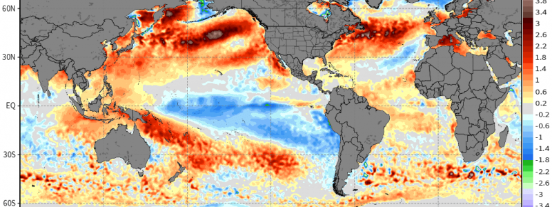
In Hot Water
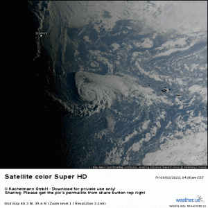
Tropical Storm Danielle is looking good on satellite this morning.
In fact, it’s the best-looking storm the Atlantic has produced so far this season. There’s even hints of an eye emerging. It’s likely that Danielle will be upgraded to hurricane status by mid-day.
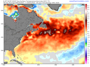
It seems odd that the best-looking storm of the season (so far) is so far north – around 40 degrees North latitude, actually. When we think of the North Atlantic, we think of colder ocean waters with temperatures not really capable of supporting, much less sustaining tropical development. So what then, other than favorable atmospheric conditions like a moist environment and low shear, is allowing Danielle to not only survive, but thrive this far north?
The answer:
A marine heatwave.
Marine heatwaves occur much the same way as heatwaves on land do. Extended periods of ridging allow temperatures to build and linger, heating the water. However, a marine heatwave as significant as the one above is much more impressive than any on land.
Why is that? Well, water has a higher heat capacity than dry land.
Generally speaking, it takes 0.2 calorie per gram to increase the heat of dry land 1 degree Celsius. Conversely, it takes 1 calorie per gram to raise the temperature of water 1 degree Celsius.
Simply put: water heats much, much slower than land. This means, in order to see a marine heatwave of the magnitude portrayed in the map above (water temps 4-5 degrees C above average), we would need a very long, very significant period of heating.
And it isn’t just occurring in the North Atlantic.
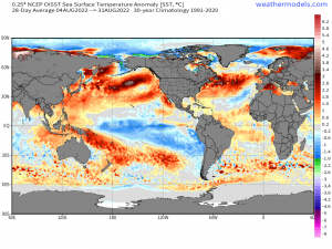
Marine heatwaves are occurring in the North Pacific, the Mediterranean Sea, and the Arctic Ocean. Some are even experiencing their warmest temperatures in recorded history.
These are regions adjacent to where we’ve seen extended heatwaves on land as well this summer.
Does this have implications on our weather? Absolutely.
As we’ve seen with Danielle so far, tropical cyclones will not only be able to form at higher latitudes, but thrive there as well. Although a storm like Danielle will usually become subtropical or even extratropical before it reaches Europe, it can still be a powerful storm that causes a lot of damage.
Water heats slower than land as we’ve discussed, but it also cools more slowly than land. This can affect coastal communities in the winter time.
Coastal temperatures are moderated by the surrounding water and its warmer temperatures. If the water is warmer than average, it stands to reason that winter time temperatures in these coastal communities will also be warmer. This could affect the amount of snow seen by these regions, especially if there isn’t solid Arctic air being pumped in while the storm is occurring.
A marine heatwave also carries effects outside of the realm of weather, like on the marine communities that call that stretch of ocean home.
Marine communities generally are in a very delicate balance. Specific conditions are required for the organisms that reside there to exist and thrive. Changes in water temperature of as little as 1 degree C can disrupt that balance. It may force the organisms to leave their habitat to search out more ideal conditions, or it may even cause species to die off. Either way, it changes the current balance in the oceans and will undoubtedly have far-reaching effects – not only on the oceans, but on humans as well.
We live in a changing world – and those changes will likely have a cascade effect of consequences we aren’t even aware of yet.
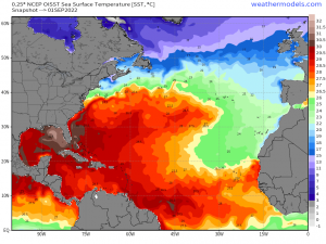


would above water temp off the northeast usa area have better chance for late sept and oct tropical or hurricanes in this area stronger they wont weaken as much and get stronger more because of warmer water temp. thanks
If a hurricane tracks toward the coast that far north, the warmer water temps will certainly help.
But if you’ll notice in the SST map, the 26.5 C line ends around far Southern NJ. So, as this theoretical storm crosses that line, it will begin to weaken regardless. However, the 26.5 C line IS farther north than normal due to above average SSTs.
So I guess the short answer is: disregarding atmospheric conditions and focusing only on SSTs, a theoretical storm tracking up the east coast would be able to hold on to its intensity longer, or weaken more slowly, than it would if SSTs were at normal levels.
Hope that helps!