Identifying Troughs By “Wavenumber”
As we head deeper into the winter season for the Northern Hemisphere, I felt it was pertinent to discuss what exactly it means to have a higher wavenumber rossby-wave pattern, and all that it entails.
If you were ever to see this reference maybe on twitter for example, which is likely where you’d see it, you’d have likely see a post with an image of the 500mb pattern attached. Whenever you look at the height pattern across any region, or in my example that I’ll show, you identify troughs according to their wavelengths (i.e. trough/ridge AKA rossby waves). The reason why I felt it was relevant to discuss this topic is because as we progress deeper into the winter season, baroclinicity – temperature contrasts in the mid-latitudes that form gradients between cold and warm – intensifies dramatically. This intensification of opposing air mass characteristics causes wavelengths to expand in the winter; therefore, troughs and ridges will expand and can lengthen in size and deepen in magnitude more then the summer months.
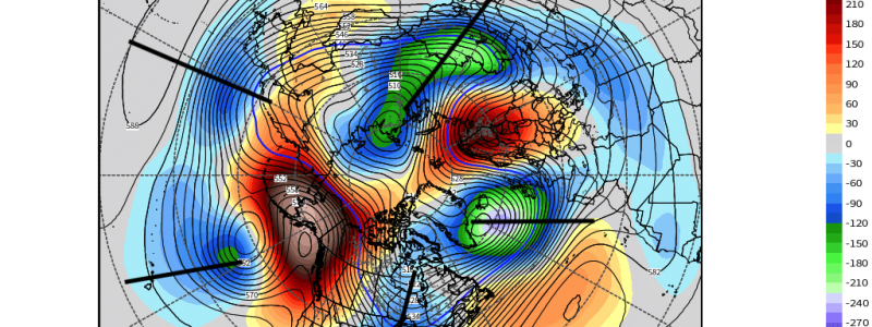
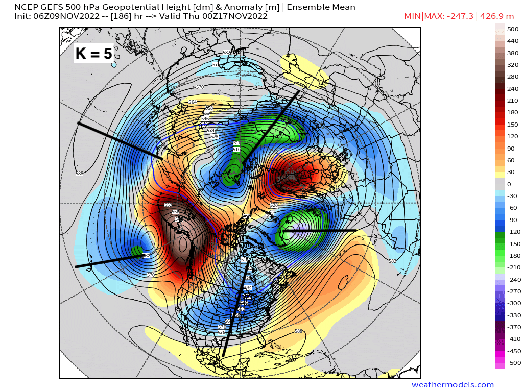
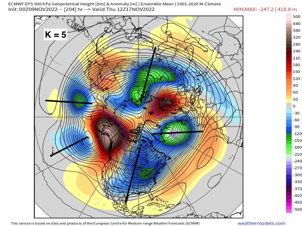
Lets take a look using the EPS and GEFS as an example for later this month. In these still images of the 500mb height pattern, as annotated to depict troughs, we have what you’d call a “wavenumber 5 pattern” (K = 5). Again, you identify where the troughs are with respect to their regions. A higher wavenumber indicates an active and chaotic hemispheric height-pattern, where more significant weather is taking place as opposed to a wavenumber 3 or so as an example. Typically, anything greater than a wavenumber 4 is indicative of higher chaos, meaning locations are prone to seeing extreme weather circumstances. The latter doesn’t necessarily even mean inclement weather; rather, it could cause record high’s or record lows (i.e. anomalous standing anticyclone) depending upon the type of synoptic pattern due to these extremities we see during the winter months! So next time you see this referenced, just know it deals with rossby-waves (troughs) and can now know whether or not the pattern may be more benign in nature or chaotic!


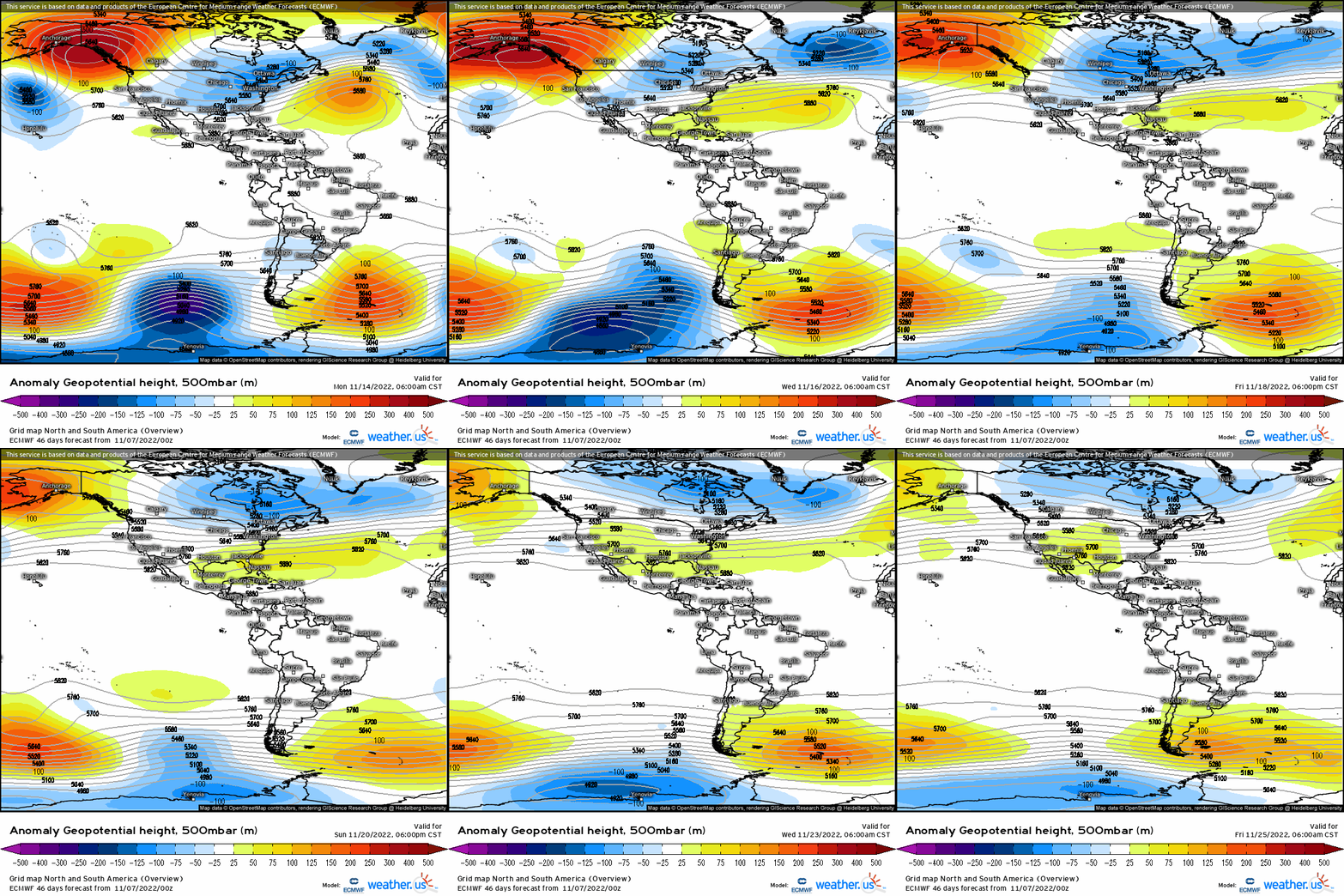
Speaking of Rossby waves, check out the omega block across Alaska (- EPO) that develops into next week, which will “seed” Canada with cold, arctic air and render strong troughing into the lower 48. This is much more reminiscent of a winter-esque pattern, and an active storm track as well so we’re bound to see more periods of wintry weather for places like the northern Plains, Great Lakes (lake effect), and possibly even the interior northeast! While a pattern change indeed, there are signs of a bit of a temporary break by Thanksgiving where we may see more ridging return along the Eastern Seaboard as the central U.S. trough pulls back west a bit. We’ll discuss more once we cross that bridge.


