Idalia To Become A Dangerous Major Hurricane In The Gulf
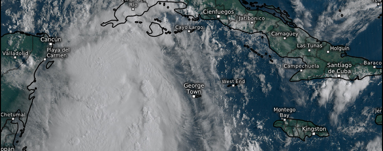
When we last checked in on what is now Tropical Storm Idalia, it wasn’t much to look at. Fast forward to this morning:
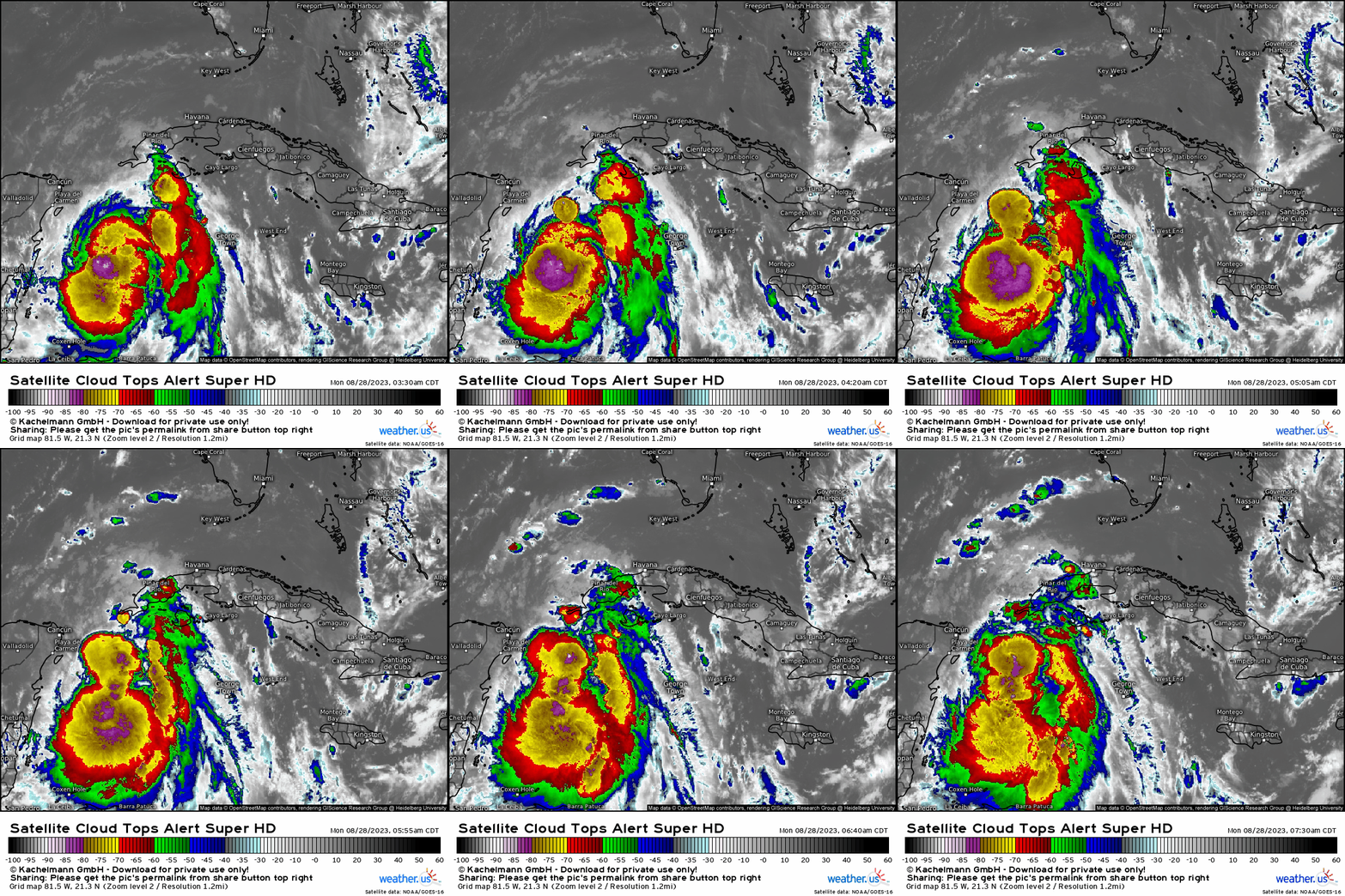
How quickly things have changed. If there’s one thing I’ve learned in 3 years of writing these blogs, it’s to never, ever bet against a ridiculously warm Gulf in August. Idalia now poses a very real, very serious threat to the Florida Peninsula.
How did we get here when it was originally forecast to be no more than a tropical storm or perhaps low-end cat 1?
Basically, this storm has caught every unlikely break it possibly could. Instead of spending time over the Yucatan as forecast, convection offshore was able to tug the center increasingly to the south-southeast. This gave it more time over water and more time to strengthen.
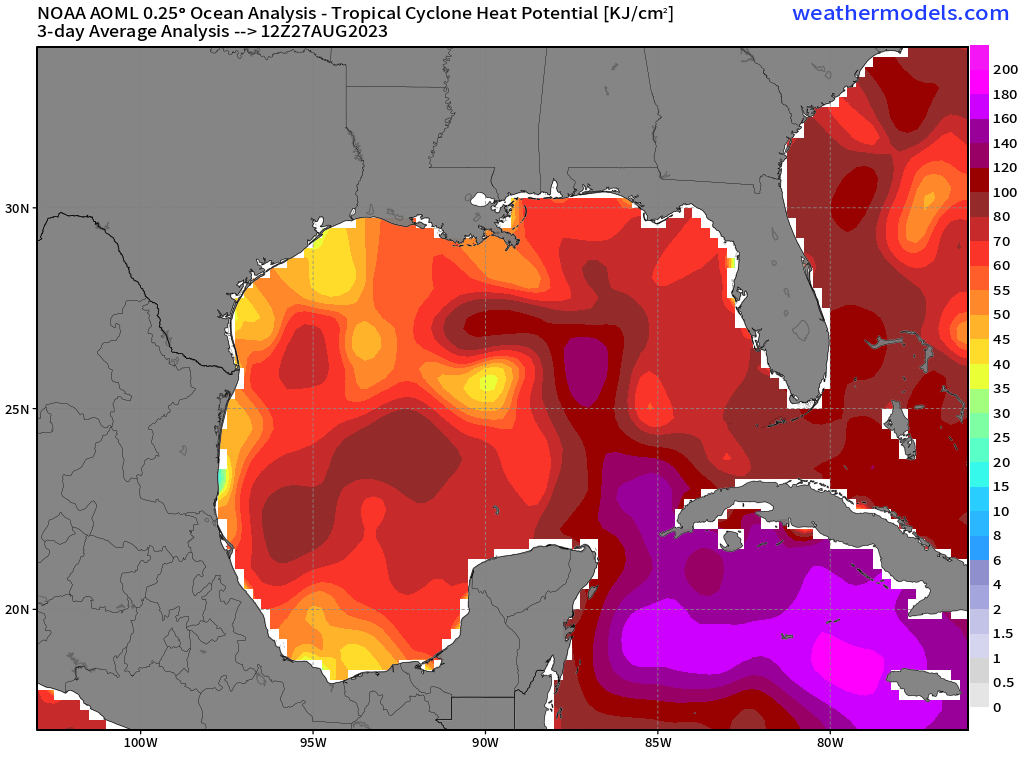
Idalia has been nearly stationary over a region of very warm water that also extends fairly deep. And, as you can see from the Top Alert loop above, it has taken full advantage.
The only thing keeping it in check at the moment is some northwesterly shear which has allowed the core to become tilted slightly to the south. However, that shear will lessen significantly in the next 24 hours and Idalia should then be in a position to rapidly intensify as it enters the incredibly warm waters of the Gulf of Mexico.
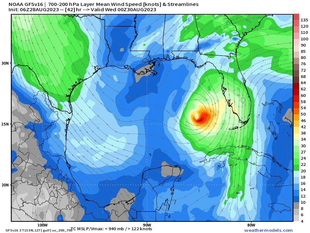
Idalia’s movement will be controlled first by a strengthening area of high pressure to its east, which will force it north. Next, a trough will swing in from the west, presumably pushing Idalia to the east and into the Florida peninsula.
The timing of this interaction is key. A slower trough could allow Idalia to move further north before making landfall, perhaps somewhere around the Panhandle/western Big Bend. A faster trough would push Idalia into the Peninsula sooner, making an eastern Big Bend/close to Tampa Bay landfall likely.
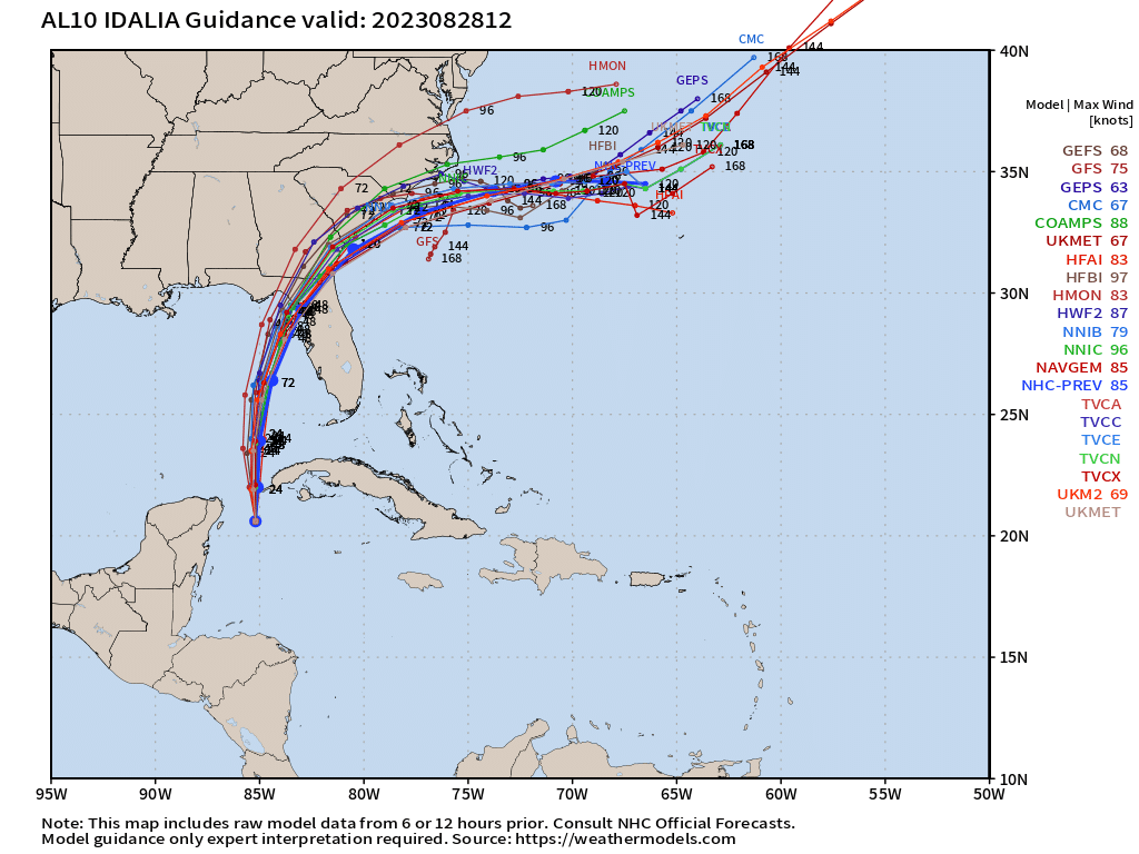
Tracks are fairly tightly clustered on a more eastern/central Big Bend landfall at the moment.
Understand, though, that if the timing of the trough changes, so will the tracks. It’s extremely important to stay up to date on the very latest forecast. If your info is more than 4 hours old, it’s no longer valid and you should seek the latest forecast.
Let’s pause here for a moment and talk about the NHC’s cone of uncertainty:
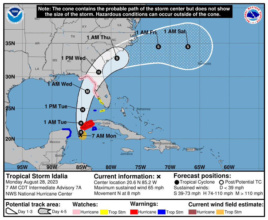
The cone you see on this graphic displays the possible location for the center of the storm. So, as of 9 AM Monday morning, landfall could come anywhere from roughly Apalachicola to Tampa Bay.
Any wiggle one way or the other could significantly change the impacts to the surrounding regions. For example: a landfall closer to but still north of Tampa Bay will greatly increase the storm surge potential. This is why it’s important to keep checking the forecast.
What this graphic does not tell you is the size of the storm. Impacts will reach far beyond this cone. Consult your local NWS and broadcast meteorologists for the exact impacts expected for your region – and make sure you’re constantly seeking out the latest forecast!
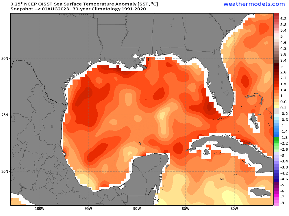
As mentioned, Idalia will track northward across an insanely above average Gulf of Mexico with very little shear to keep it in check. This introduces the likelihood of rapid intensification.
Idalia is now forecast to be a dangerous, strengthening category 3 hurricane at landfall. But remember, hurricane categories are based solely on wind speed and wind is not the most deadly portion of a hurricane – water is.
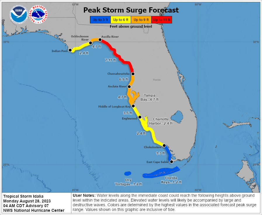
In a region where barrier islands are abundant and there are really no elevation changes to be found as everything sits near sea level, storm surge becomes a major issue.
Of most concern is the very flat, very low terrain of the Big Bend. Storm surge here could push well inland and (currently) could be up to 11 feet above regular tide level.
Another concern is the Tampa Bay region. A southeasterly flow around the hurricane will funnel water into the bay. The water will pile up and, with no other place to go, will flood both sides, potentially up to 7 feet above normal tide levels.
Remember: these estimates can change with any track wiggles. A projected landfall closer to Tampa will increase these numbers greatly. Conversely, a projected landfall closer to the Panhandle will decrease them somewhat.
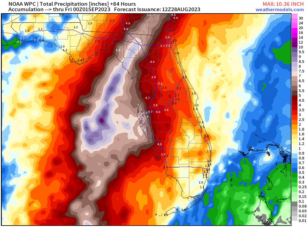
Additionally, we need to consider rainfall and the freshwater flooding it will no doubt cause. As rivers and streams swell and run-off tries to make its way back to the Gulf, it will have nothing to do but pile up further as the storm surge comes in.
Remember: water is the most deadly component of a hurricane. If you are told to evacuate today or tomorrow, please do so immediately. Make sure you know what zone you are in and are ready to go if activated. You can find your zone and other helpful information here at Know Your Zone.
Use today to finish any preparations and evacuate if need be. As Idalia begins to approach tomorrow, conditions will deteriorate rather quickly.
I will publish an update later tomorrow with the latest track and hazards expected as this potentially dangerous storm closes in on the coast. Stay safe and prepare now!


