Ida Quickly Organizes on Approach to Cuba
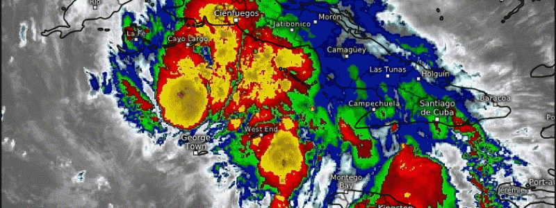
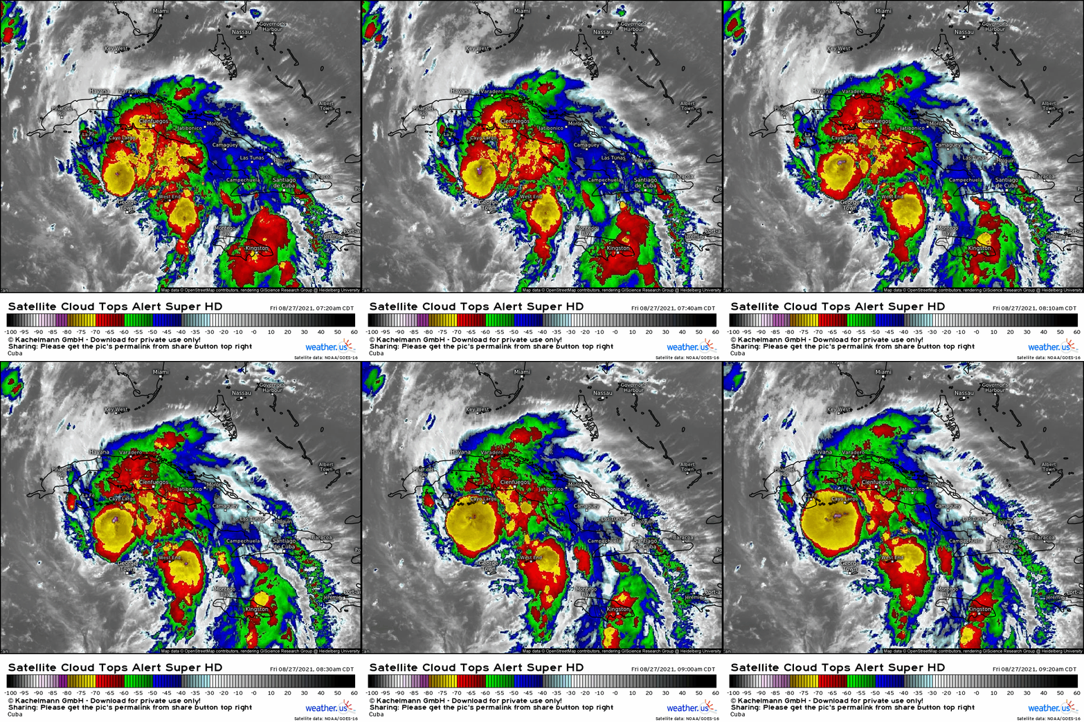
Tropical storm Ida, around 12 hours away from a landfall in west Cuba, is rapidly organizing this morning.
A combination of low shear, moist midlevel air, and very warm oceanic water is allowing vigorous thunderstorm activity to efficiently convert plentiful oceanic heat energy into substantial kinetic power. As a result, the storm’s center has developed a fairly classic ‘cold dense overcast’, or CDO, with cloud tops to -80ºC amidst explosive convection. While officially a 60mph tropical storm as of writing, Ida certainly looks like a hurricane.
Between now and Sunday afternoon, when the storm is forecast to make landfall in southern Louisiana, only one thing seems to stand in its way: the thin strip of Cuban land west of Havana. But as Ida clearly strengthens today, perhaps rapidly, substantial disruption from land interaction seems increasingly improbable. In all likelihood, a strong tropical storm or category one hurricane will enter the Gulf of Mexico from the southeast late tonight.
It will enter a swath of water extremely warm to an extreme depth, as a sea heated by the August sun and undisturbed by any substantial tropical activity mixes vertically due to the loop current. For a well-organized tropical cyclone, this is jet fuel.
Sufficiently far from a southern CONUS trough, a Bahaman low, and a Pacific hurricane, Ida will exist in a zone effectively devoid of shear as it treks over the extreme Gulf warmth. In fact, the stout Bahaman trough will encourage substantial ventilation of Ida’s outflow, helping the storm’s pressure deepen- as if assistance was needed.
With such massive energy content downstream, with such little disorganizing shear, with moist air and synoptic outflow, it seems the stage is set very, very thoroughly for a bout of long-duration, extensive rapid intensification this weekend.
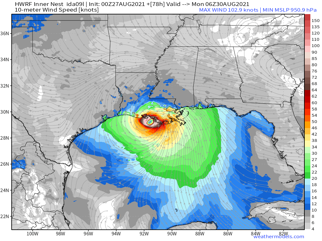
This solution is widely supported not only by an understanding of the atmosphere, but also by numerous hurricane models. Both the HWRF and the HMON, two leading models used for forecasting tropical cyclones, depict strengthening of around 60 knots in 48 hours, an unusual feat that may even be underdone- Ida is currently quite a bit stronger than initialized by the model.
Models are tightly clustered on east Louisiana for landfall, and while that could still shift due to unforeseen fluctuations in intensity or steering currents, it appears Ida will almost certainly be at major hurricane intensity as it approaches the coast.
In fact, while the NHC explicitly forecasts the storm to strengthen into a category 3 by Sunday evening’s landfall, a higher intensity is certainly not an outside bet. And considering a plausible growth in size due to an eyewall replacement cycle that could occur from land interaction over the next 24 hours, Louisiana may end up dealing with an unusually large major hurricane at landfall.
The surge threat will be most profound. Reasonable worst case surge forecasts already exceed 10ft for some, including New Orleans, and this prediction could easily increase should Ida intensify or grow stronger or larger than anticipated, a possibility more likely than usual this weekend.
The wind threat will be devastating for some, too. Reasonable worst case scenario power outages could last many weeks near the point of landfall as major hurricane winds cripple electrical grids to the extent that they must be completely rebuilt.
The rain threat could lead to catastrophic flash flooding as well, with a slow-down at landfall. Reasonable worst case scenario rain would be a widespread 10″ of rain, locally up to 20″, due to extensive prolific training tropical convection. The rain threat could extend well inland, too, with areas thoroughly saturated from excessive recent rain such as west Tennessee, west North Carolina, and parts of the mid-Atlantic potentially seeing enough rain for significant flooding.
Clearly, the reasonable worst case scenario with Ida is really bad. Those in south Louisiana, especially the vicinity of New Orleans, should prepare now, be ready to evacuate if required, and heed the advice of local officials regarding safety measures. This could really be a big one.


