Hurricane Kay’s Track and Impacts Expected
A tropical storm yesterday, and now a Category 1 Hurricane today several hundred miles offshore Southwest of Baja, CA will make a very close trek to land this week.
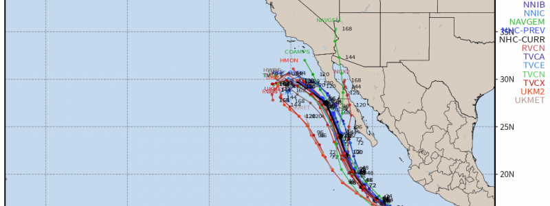
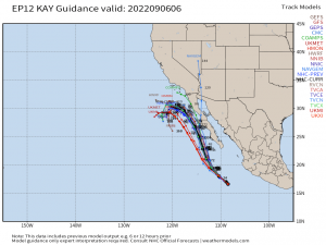
The current trajectory and consensus, as shown below via deterministic, dynamical, and probabilistic NWP modeled tracks of Kay, is for there to be a north-northwestward motion through today and into tomorrow As Kay’s center closely approaches the Southern-Central region of the peninsula of Baja, CA by early Thursday and into Friday before curving to the northwest. While the center of circulation appears likely to stay just offshore, impacts will spread several hundred miles away that include heavy rainfall, flash flooding, landslides, life-threatening swells, and tropical-storm-force wind gusts.
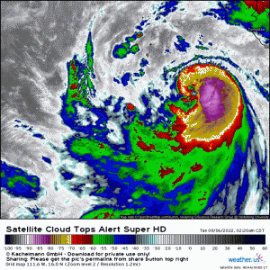
Satellite presentation of Hurricane Kay displays a maturing tropical cyclone, with evidence of below -80*C cloud top temperatures over the past several hours arcing on the eastern side and wrapping into the circulation. Kay is experiencing northeasterly wind shear and will do so through today before relaxing. By then, it’s expected Kay to strengthen again and organization will manifest through tomorrow and into Thursday.
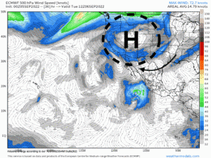
The evolution of Hurricane Kay in regards to the mid-level steering flow will be mainly driven by an anticyclone out across the western region of the U.S. Initially, Kay is currently experiencing mid-level northeasterly wind shear as aforementioned, which’ll keep Kay from undergoing rapid intensification. However, Kay will still find itself within a narrow window of weak-moderate wind shear, in conjunction with plenty of fuel via warm sea surface temperatures and high low-mid level moisture, to strengthen steadily to an extent.
By Wednesday, the mid-level high hardly budges while Kay slowly approaches the Peninsula. It isn’t until Thursday that we see Kay’s center the closest it’ll be to land. The mid-level ridge slowly then progresses to the southeast, while being “squeezed” in between Kay’s upper-level outflow and a trough to the north across the Northern Plains. This only influences Kay to turn to the northwest, before then beginning to feel effects from a large cut-off low to the west out across the Pacific, that’ll impart wind shear and help to turn the circulation as well northwestward. By early next week, once Kay has become post-tropical, we’ll see the moisture remnants get absorbed within the mean flow and a trough ejects into the West coast, picking up the moisture with it. The latter in the very least helps to provide some relief to Southern California with respect to drought conditions.
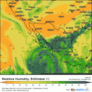
Low-mid level sufficient relative humidity is what’ll aid in Kay to maintain Hurricane strength for a few days up until around Friday where it’s expected to weaken swiftly. Notice toward the end of the animation that significant dry air wraps into the circulation, cutting of important heat fluxes needed to maintain and intensify tropical cyclones.
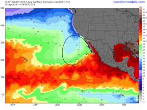
Below, notice the increasingly cooler SST’s once latitude is gained across the Eastern Pacific. Kay will be trekking into the progressively cooling waters and weakening by this weekend, in conjunction with the aforementioned dry air.
IMPACTS:
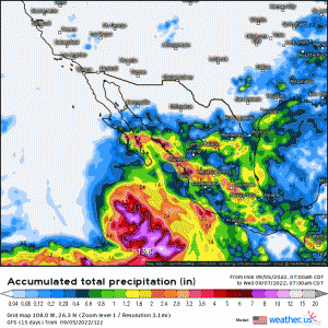
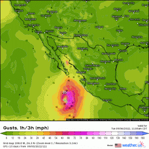
Tropical storm watches are likely to be expanded along the peninsula of Baja, CA., along with likely hurricane watches. Expected total rainfall through Saturday will be anywhere from an inch or so, up to as much as 10/11″ depending upon training of convection, persistence of outer trainbands, and ultimate track; therefore, significant flash flooding is imminent. Tropical storm wind gusts, in which gusts possibly greater than 60mph, are likely to occur along the Central-Southern peninsula and especially for portions closer to the Pacific Ocean. Large swells and significant waves in excess of 18′ are expected just offshore tomorrow and into early Friday.
The ‘good’ news is, there’ll be enough of mid-level steering and mitigating factors to deny a rapidly intensifying tropical cyclone and landfall. However, it’s critical that just because there won’t be a direct hit (still some uncertainty in overall track with possible deviations/wobbles still likely), tropical storm conditions and impacts still are expected a few hundred miles away from the center.
Will be monitoring impacts and track as the week progresses, so stay tuned!


Thank you!