Category Five Hurricane Iota Approaches a Devastating Landfall in Nicaragua
As we write this blog, Hurricane Iota has just been upgraded to a category 5 storm; the 2020 season’s first category 5. In mid November. We can’t even believe we’re typing those words, to be honest.
Iota is now the latest forming Atlantic category 5 storm on record. It also adds the 2020 season as the 5th consecutive year with at least one category 5 storm to form in the basin, smashing the previous record of three. The record-breaking 2020 season is wrapping it up (we hope) in a very big way. Iota has been a surprisingly impressive storm since its formation on November 13th. Let’s take a look at some of the stats.
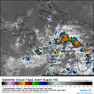
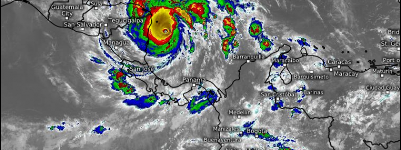
Iota was named Tropical Depression 31 on November 13th. From the beginning, it was slated to be a strong hurricane with the forecast quickly changing to include it becoming a category 4 by landfall. Looking at the satellite image above, it’s hard to believe that disorganized mess was to become the monster it is now. But Iota had the good fortune (or maybe misfortune, all things considered) of being in an environment of very little shear and sea surface temperatures that are still very capable of supporting a strong hurricane. Except for some slight north/northwesterly shear early on, nothing stood in it’s way.
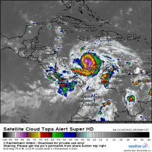
Twenty four hours later, it was beginning to get “that look,” as tropical meteorologists say. By Saturday evening it would jump from a mess with 40 mph winds to an organized storm on the edge of hurricane status with winds of 70 mph.
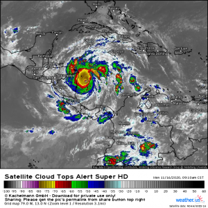
Iota continued to rapidly intensify throughout the day Sunday. From 10 am Saturday (40 mph) to 10 am Monday (160 mph), Iota’s winds increased by 120 mph. It’s pressure dropped by 61 mb in 24 hours alone which made it the 6th hurricane to undergo rapid deepening in this season alone.
Though its deepening is impressive, it’s not a record. Hurricane Wilma (2005) still holds that record with a pressure drop of 97 mb in 24 hours. When we consider the humanitarian crisis about to unfold in Central America, we think we can all be grateful that it did NOT break that particular record.
Intensification appears likely to continue, as Iota’s well-organized CDO still exists in an environment of low shear and warm water. The large-scale structure, with dual outflow aided by a midlevel anticyclone serving to evacuate mass from the column, will also remain very supportive of intensification. The national hurricane center projects a slight increase in intensity to 165mph before landfall as a result, and with more than 12 hours until then, it’s possible Iota strengthens even more.
There’s also a chance Iota has plateaued in intensity. With a storm this strong, there’s always a risk of an eyewall replacement cycle, which could halt strengthening or even bring maximum wind speeds down a notch. But it’s important to remember that EWRCs, in isolation, maintain the energy of the storm by expanding the wind fields considerably. Should Iota undergo an eyewall replacement cycle, it may end up more dangerous than if it does not.
Do not let the statistics of Iota obscure the catastrophe it will likely bring to Nicaragua and Honduras. This hurricane will shortly make landfall in the same area Eta did two weeks ago. The devastation of two back-to-back major hurricane landfalls is hard to understate in terms of wind and surge near the landfall site. But those impacts will likely not be the most dire from Iota. Instead, it will be the very heavy rain, compounding the extreme accumulations of Eta less than two weeks ago, that may cause a humanitarian disaster.
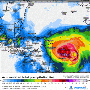
Eta dropped 20 to 30 inches of rain in Nicaragua and Honduras and it looks like Iota will do nearly the same.
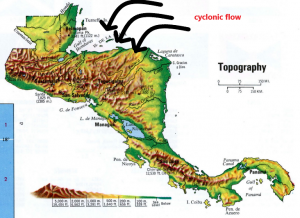
As we’ve been discussing in previous blogs, the topography of Central America is particularly conducive to producing amplified rain totals, especially with a storm that approaches from the east. The counter-clockwise cyclonic flow pushes the moisture on shore and then immediately lifts it orographically into the mountains. When moisture is lifted orographically, it condenses and then falls as additional precipitation which further enhances the rainfall totals. If you examine the projected totals in the gif above, you’ll see the higher totals are indeed over the northern mountainous terrain of Honduras and Nicaragua. Unfortunately, this was also the case with Eta. The areas that were inundated by Eta will once again be flooded by Iota. Landslides, mudslides, and extreme flooding are all likely. Iota is a bit larger than Eta, so it is possible that we may see even more precipitation further north this time around due to the onshore flow.
We’d like to take a moment here to hammer home a point. Hurricane category does not always correspond with the severity of its impacts. The category five winds are likely to be devastating, but most deaths during a hurricane occur due to water: both freshwater flooding and storm surge often kill many more people than winds do, and Iota looks to be no exception. If you are in the path of this storm, please take action now and remove yourself from harm’s way if possible.
Both the rarity and tragedy of Iota is hard to emphasize enough. The very intense storm is set to compound the devastation wrought by an already disastrous major hurricane, Eta, to an extreme degree. All indications are that the results will be catastrophic.
This blog was co-written by Meghan and Jacob.
