Hurricane Ida: Future Development and Expected Impacts
I’ll be completely honest: if I had a penny for every time I uttered the phrase “oh no” over the last two days while looking at forecasts and data for Hurricane Ida, I’d probably be a millionaire right now. The forecast, unfortunately mostly unchanged, does appear to remain rather dire for the central Gulf coast.
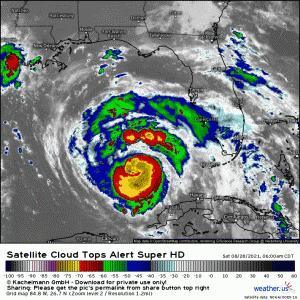
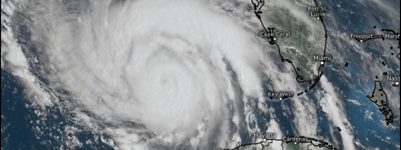
The morning began with Ida firing deep convection in the form of a few hot towers.
These towers quickly wrapped convection around Ida’s very healthy core, setting the stage for the hurricane to begin what will likely be a period of rapid intensification.
As of the 8 AM update, Ida is expected to be a very dangerous category 4 storm with winds ~140 mph at landfall, which is estimated to occur Sunday afternoon. Very little stands in the way of this storm and the forecast rapid intensification, though there are a couple scenarios that could perhaps weaken it some before landfall.
The first would be a well-timed Eyewall Replacement Cycle.
During this process, the current eyewall retracts while a band of storms outside of the eyewall strengthens. This band will then slowly move inward and effectively choke off the moisture flow to the existing eyewall. While this occurs, intensification is halted and some weakening can occur. Once the cycle is complete and the new eyewall has replaced the old, the storm is free to begin re-intensifying.
This process can sometimes take over a day to complete. You can see how this occurring sometime late tonight/early tomorrow morning could be beneficial in halting intensification/weakening the storm on its approach to landfall. However, this process is also a bit of a double-edged sword. Yes, it weakens the hurricane. But it also expands the wind field. What had been a relatively small area of hurricane force winds suddenly becomes a much larger area. Should this occur close to land, larger areas are suddenly in greater danger of significant wind damage. The area of significant storm surge also expands as a wider area of stronger winds pushes more water onshore to the east of the center.
The second would be Dry Air Entrainment.
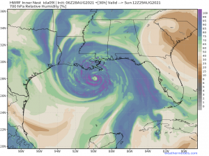
Dry air transported off of Mexico around a weak upper level low may be able to enter Ida before landfall and weaken it somewhat/halt intensification. It should be noted that while this scenario is possible, it is unlikely to have a significant effect. Landfall as a major hurricane is still expected.
So now that we’ve discussed expectations as Ida approaches the coast, let’s take a look at expected impacts. I’ll present them one by one for better understanding.
Storm Surge
Storm surge is arguably one of the more significant hazards of a landfalling hurricane. It is defined as water height above normal tidal levels. Surge becomes much more significant if the peak coincides with a high tide. On the other hand, it becomes somewhat less so if it coincides with a low tide.
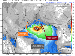
Surge is an issue for the right front quadrant of a landfalling hurricane.
This is where the onshore push is found. The most intense surge will be found where the winds are strongest, with decreasing values as you travel east of the center.
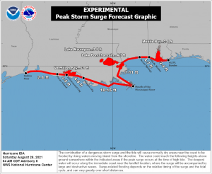
The forecast storm surge values for Ida are sobering.
Remember that these values are water levels ABOVE normal tidal levels/above ground level. That means that, directly east of the center, water heights of 10 to 15 additional FEET are expected.
I mentioned an ERC earlier. Should that occur and the wind field expands, the higher surge amounts could extend much farther. That’s something to be aware of as we move forward.
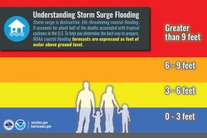
That much water is hard to comprehend. The NWS tweeted a very useful graphic this morning that helps in visualizing this threat:
I have to admit, even though I know the definition of storm surge, I sometimes fail to truly understand what that much water would “look like.” This graphic does a good job conveying the reality.
Freshwater Flooding
All tropical systems bring deep moisture with them. That much is a given and Ida will be no exception. Two aspects of this storm are poised to make the anticipated flooding worse than usual, however.
First, we have saturated ground.
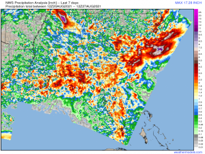
The area of coast (and even inland) where landfall is expected to occur has already seen quite a bit of rainfall over the last week. Some locations have received up to 200% of normal precipitation in that time period. With the ground already near or at saturation, any additional rainfall will go straight to run-off and become flash flooding.
Second, Ida is expected to slow down as it approaches the coast. A slower forward speed will mean prolonged effects. It will rain longer, exacerbating any flooding. Peak winds may last longer. Unfortunately, this won’t be a here-and-gone storm.
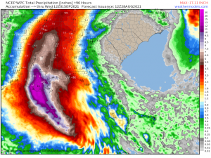
On the subject of rainfall, we’re expecting quite a bit.
Totals upwards of 12 inches, with locally higher amounts, are possible along the coast where the friction of the storm meeting land will force the air to rise and enhance rainfall totals.
Heavy rain is expected to persist well into the mid-south and mid-Atlantic, so the flooding issues won’t just stop at the coast. Everyone along the path in the coming days will need to be aware of flooding potential.
Wind Damage
Major hurricanes come with dangerous winds and Ida will be no exception.
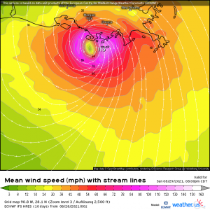
Sustained winds of ~120 mph (at present forecast) are a safe bet with higher gusts mixed in. This is enough to do damage to buildings and take down trees/powerlines. With saturated ground already in place, it won’t actually take much wind to topple trees or power poles. With winds in excess of 100 mph, I’d expect widespread power outages, even extending further inland.
Rough Seas
The state of the ocean away from the shore is not really one we worry about much with a landfalling system as it doesn’t usually directly affect us here on land. It does, however have indirect effects, depending on the track of the storm.
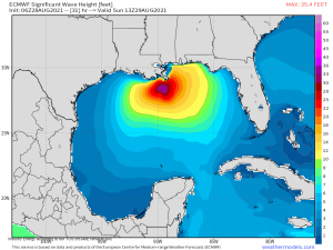
The Gulf of Mexico has many off-shore oil platforms. A lot of these are clustered around Louisiana, directly in Ida’s path. Rough seas with wave heights approaching 40 ft near the center combined with the wind threat from the storm will force evacuations for these drilling sites. A halt in production will translate to a rise in prices over the next few days/weeks. Basically: go top off your gas tanks now before prices go up.
Tornado Threat
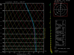
The right front quadrant of a hurricane is by far the worst. Not only do you have to deal with the heaviest rains and storm surge from onshore flow, but that very same SE’erly flow creates shear that is adequate for the tornadic activity.
This is a forecast sounding for slightly north of New Orleans for tomorrow night. You can clearly see the wind “turning with height” – something tornadoes need to form.
As with most landfalling systems, these tornadoes tend to be shallow and are hard to catch between scans. Therefore, warning lead time may be limited. Be aware of this and have a plan to shelter ready to execute quickly if you need it.
This threat will translate northward as the storm moves inland – possibly even into the mid-south in the coming days – so that is also something to be aware of.
With the threats covered, I want to say a few things on safety.
Evacuations:
If you are in a location that floods easily or will flood with the expected surge, GO.
If you are new to the area and aren’t sure what your location can handle, GO.
If you are on the fence about evacuating, unsure if you can make it through this (prolonged) event, GO.
This is NOT the storm to attempt riding out for the first time. Major hurricanes are dangerous and there’s a reason mandatory evacuations are issued. If one has been issued for your area, PLEASE GO and go quickly. You need to be out by tonight at the latest. Conditions will go downhill in a hurry tomorrow morning.
If you have friends or family in the cone, please encourage them to leave if they haven’t already. Pass on the info of the many hazards of a landfalling hurricane and get them safe.
Jacob and I will keep you apprised of any changes in the forecast via Twitter throughout the day. Expect a joint blog from both of us tomorrow pre-landfall outlining any changes as well. Stay safe!
