Hurricane Fiona: What’s Next?
As you may already know, Hurricane Fiona made landfall on the southwestern tip of Puerto Rico yesterday as a Category 1 hurricane with max sustained winds of 85 mph. Gusts of over 100 mph were reported in the eyewall.
However, despite these strong winds, Fiona’s legacy will not be related to wind damage, but rather to the unbelievable amount of rain it unloaded on the island.
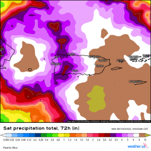
This is satellite-estimated rainfall for Puerto Rico, valid through 5 am eastern this morning. Now, keep in mind that satellite estimates can be smoothed a bit. They also may not pick up on local maximums. That said, these are still impressive totals. A widespread 6 to 12 inches was recorded with locally higher amounts, potentially up to 30 inches – especially where terrain helped enhance and funnel rainfall.
And, it’s not over yet.
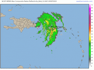
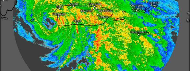
Though Fiona’s core has moved over the Dominican Republic, feeder bands bearing heavy rainfall continue to train over the island.
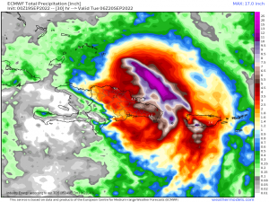
This training band is modeled fairly well on the ECMWF. Its not unreasonable to predict that those under the feeder band may pick up 6″+ of additional rainfall. Needless to say, the flooding situation will remain dire for a large portion of the island through the rest of today (Monday).
But even hurricanes move on, so what’s next for Fiona?
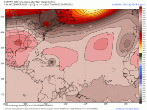
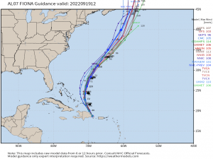
Fiona is expected to begin to “feel” the weakness between the ridge over the US and the ridge over the Central Atlantic. This will cause it to turn north, out to sea. Later in the week, a strong trough is forecast to emerge into the northwestern Atlantic, grab Fiona, and take it further north, potentially impacting Atlantic Canada over the weekend.
This turn out to sea may not be without impacts, however. A tiny island exists within range of Fiona’s expected path. Yep, I’m talking about Bermuda. For such a small, remote island, it sure does seem to be impacted a lot by TCs, whether directly or (more often) indirectly.
Fiona is forecast to strengthen to a major hurricane as it accelerates northeastward, which could potentially mean trouble for the island – but it all depends on that track.
Depending on how far NE Fiona tracks, Bermuda could end up in the milder outer bands or perhaps even near the core of the TC. This is something that will need to be closely monitored as the week wears on, especially by the residents of this island. I imagine this forecast will also throw a wrench in any cruise itineraries with Bermuda as a port-of-call as well.
As the forecast stands now, it seems the contiguous US will escape any direct impacts from Fiona.
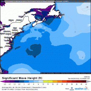
Indirect impacts, however, are a possibility – namely in the form of rough seas, rip currents, and perhaps some coastal flooding with on-shore flow. These impacts should be similar to those seen from Hurricane Earl a couple of weeks ago.
We’ll be monitoring Fiona’s track and intensity and will keep you updated here and on our Twitter feed!
