Hot, Cold, Repeat
A fluctuating jet stream is common in the transition seasons as the atmosphere struggles to balance between the left-over heat of summer and the chill winter brings. Ridges and troughs swing through in rapid succession as the jet stream dips and retreats.
And with this transition comes a rollercoaster of temperatures for many of us in the mid-latitudes. It’s a ride we’ve been on for a few weeks and one we won’t be getting off of in the medium term.
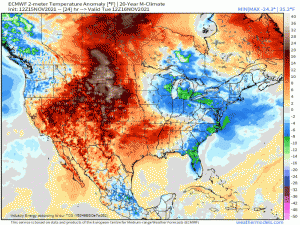
It looks a bit like this:
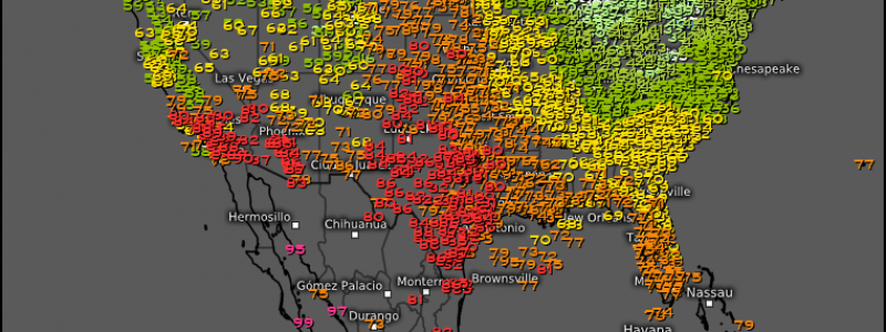
We’ve sure seen some wild swings lately. Just last week, the valleys of southern Appalachia began their day below freezing only to top out with a high temperature near 80 degrees 6 hours later. That’s a ~50 degree swing… in 6 hours!
These fluctuations are nothing new, of course. We just seem to forget sometimes that this is normal while we’re in transition from Summer to Fall to Winter or Winter to Spring to Summer. These drastic changes are what drive the primary and secondary severe seasons for both the Plains and the Southeast. But, I digress.
My main point is: more wild swings are on tap this week as the systems continue rolling across the country.
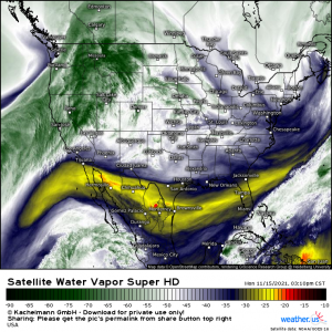
Current water vapor imagery shows pretty well what exactly is going on today – and how it sets us up for the rest of the week.
We have a system exiting into Canada and cold air sinking in behind it. Behind that, a new ridge is building and warmth is returning. This warmth may even result in some record-breaking temperatures for western Texas tomorrow. Check out the NWS NDFD model if you’re interested in those values.
Behind that, an atmospheric river is inundating the Pacific Northwest.
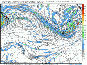
The trough driving that AR comes ashore today and will undergo cyclogenesis in the lee of the Rockies mid-week, bringing the next big front through the rest of the US.
We’ll keep the trough-ridge-trough-ridge pattern and temperature rollercoaster through at least next week. But something lurks on the horizon that could spell interesting weather for the Eastern US.
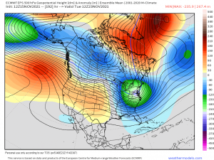
Both the GEFS and EPS ensembles along with the deterministic ECMWF and GFS are sniffing out a developing Greenland Block mid to late next week.
If you don’t know what that is, here’s a brief explainer – it’s the area of high pressure (red on the map above) sitting over Greenland. Instead of moving on downstream it will retrograde (or back-track) over southern Greenland and stall, preventing anything upstream from moving on. Arctic air that would normally keep flowing in a zonal (west to east) manner would then be forced underneath the block – and into the Eastern US.
This pattern could lead to the development of a winter storm or two, depending on the strength and duration of the block. It’s far too early to nail down specifics such as who will see what and how much, if anything, though. For now, it’s merely something interesting to monitor for the upcoming week.
We’ll revisit that subject later in the week if it looks more certain. For now, enjoy your rollercoaster… and good luck picking out a daily wardrobe in this pattern.
If you’re curious about the trends in your specific city, check out the City Charts section on weathermodels.com or the Weather Overview on weather.us
