Historic Lake Effect Snow Now, Temperatures Moderating In the Days Ahead
Is anyone else cold?
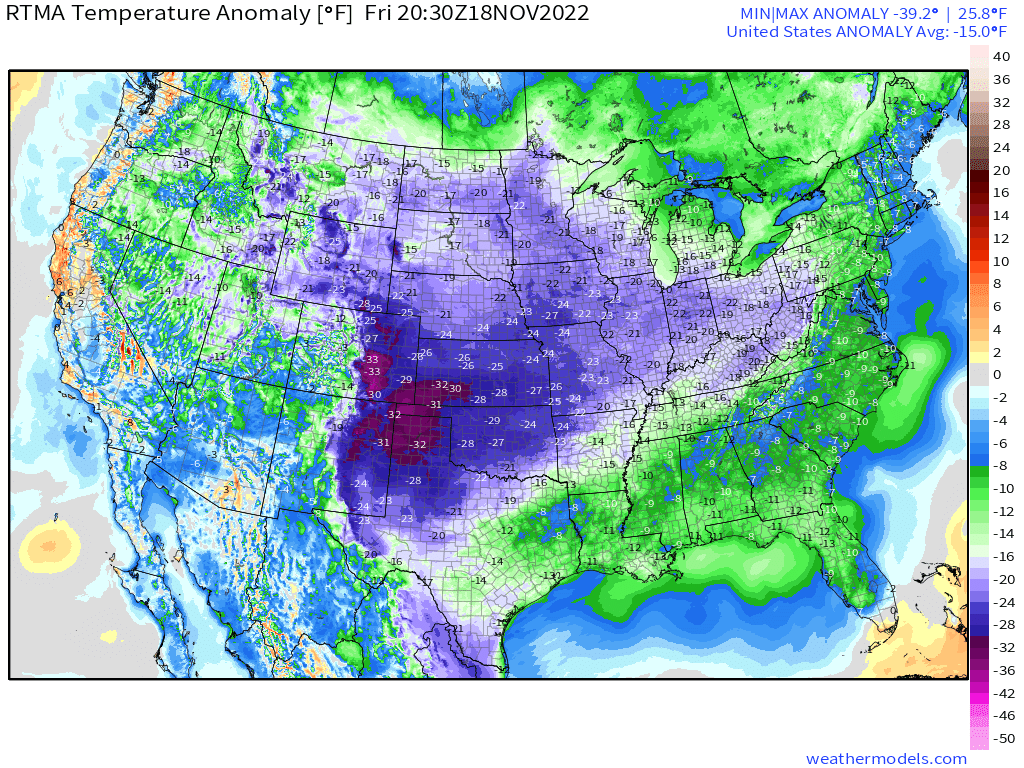
I hate to admit it after roasting for most of the summer, but when I woke up to a morning low of 20 degrees this morning, it was a bit too cold for me. And honestly, that doesn’t even compare to the single digits seen in the Northern and Central Plains!
Before you scoff at me, I grew up in Northeastern PA in the 1990s – you know, back when it was actually frigid during the winter. I am no stranger to cold. I just have less of a tolerance as I get older.
Additionally, my feelings are: if it’s going to be that cold, it should be snowing as well. No luck here in East Tennessee, though.
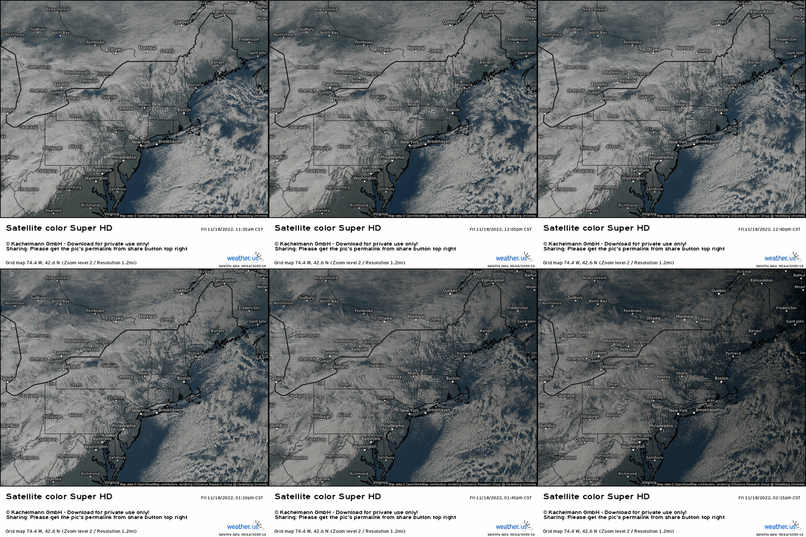
The same cannot be said for those downwind of Lakes Erie and Ontario, however. The lake effect snow event I wrote about in Wednesday’s blog is well underway and absolutely dumping snow on places like Hamburg, NY and Watertown, NY. As of 18z (1 pm Eastern), the NOAA NOHRSC Analysis estimated over 26 inches of snow near Buffalo, NY – and it’s been pouring snow since.
Aside from the snowfall rate, another part of this event has really held my attention.
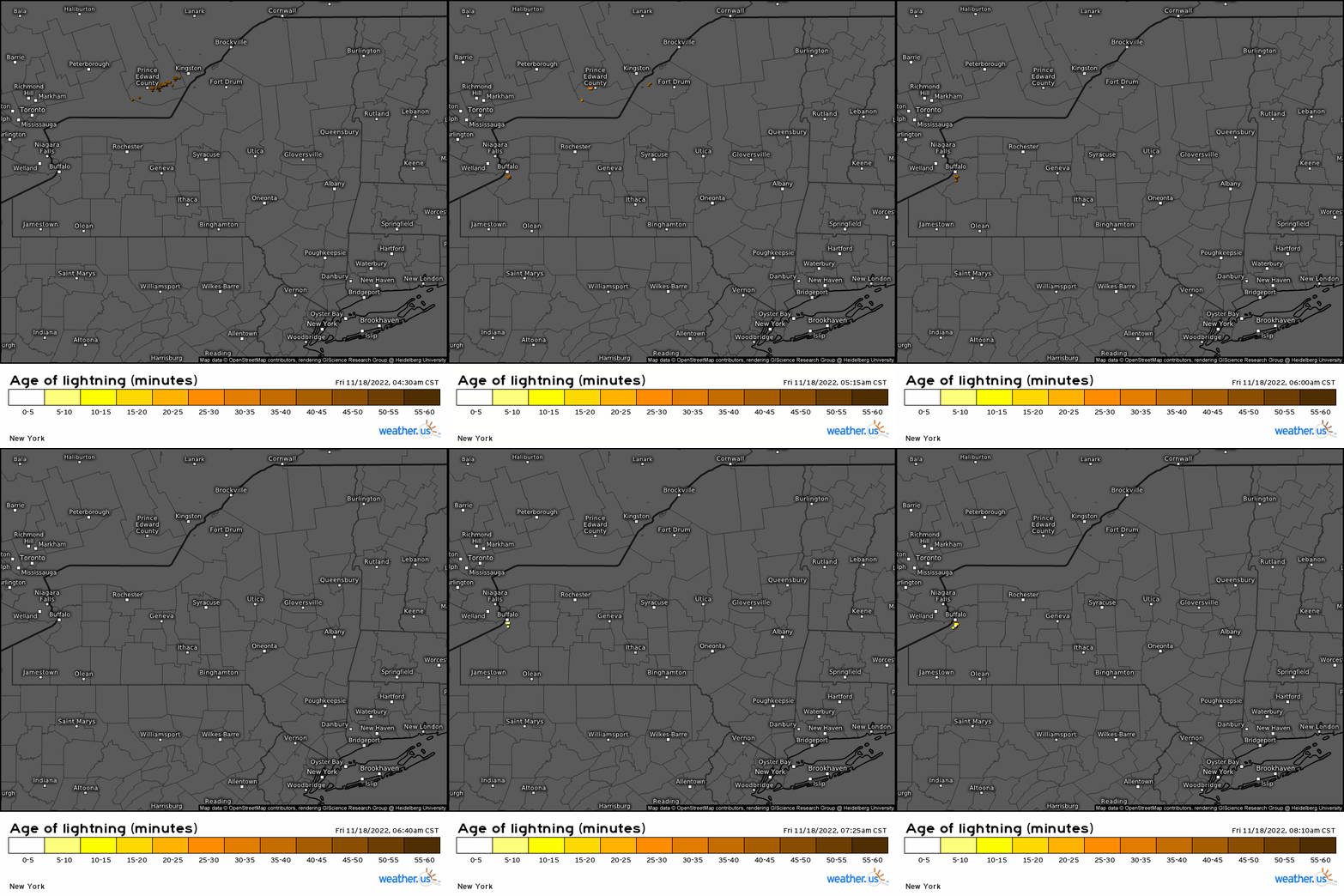
And that’s the shear amount of lightning being produced. Lake temps of 50 to 52 degrees combined with very cold air aloft has lead to enough instability to consistently produce thundersnow. Not going to lie, I’m kind of jealous.
While this event is far from over and will continue, though perhaps with some wavering of the banding through Sunday, it will end. The pattern will change.
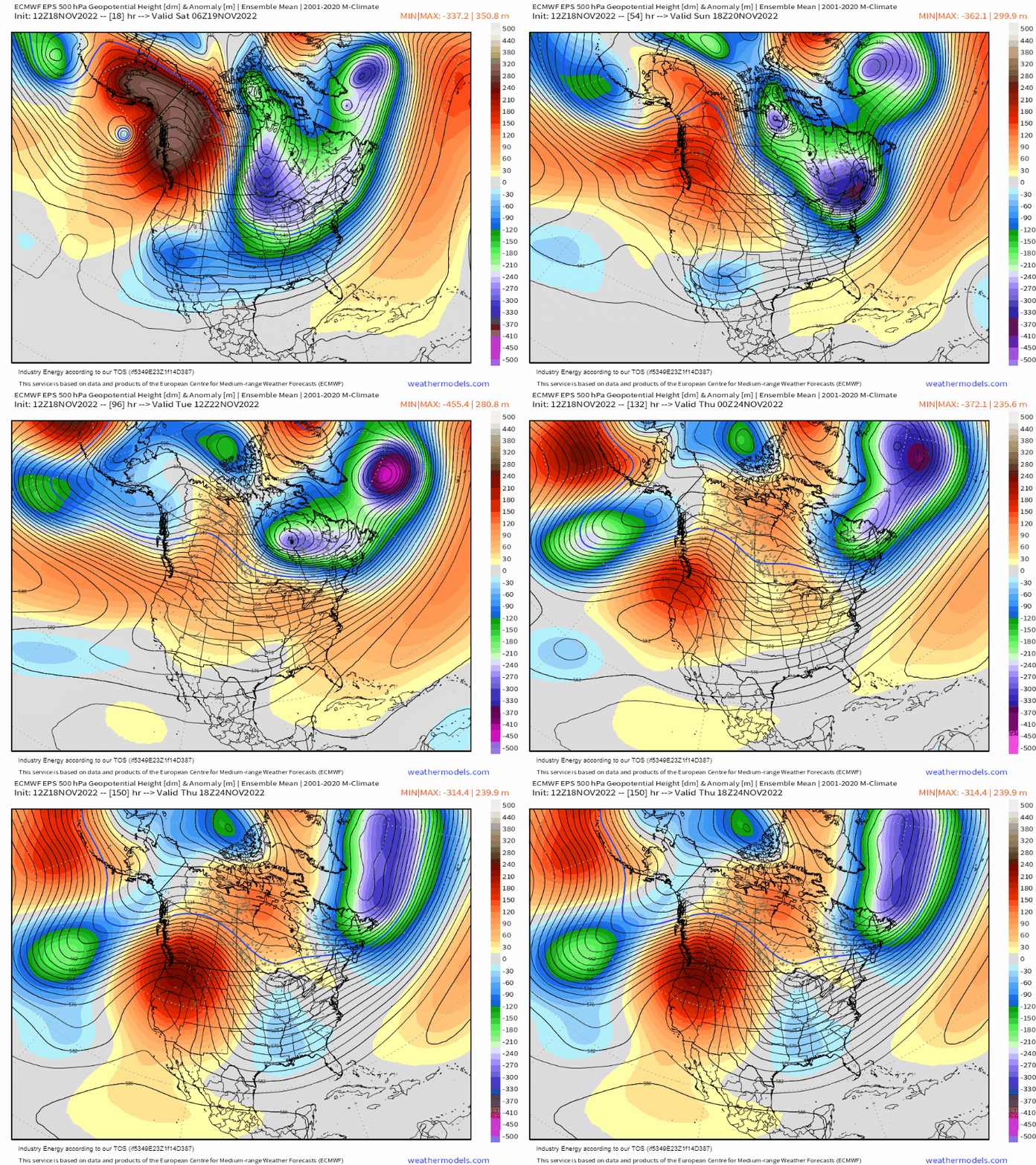
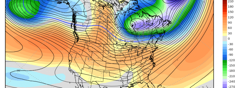
The highly amplified ridge over Alaska will collapse this weekend. In response, the overall flow will become slightly more zonal (or without large extremes) before the next disturbance is introduced later next week.
What does this mean for us?
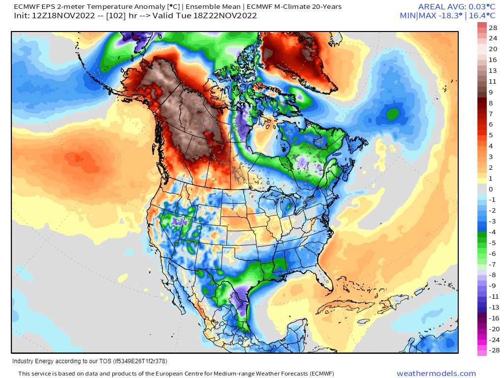
It doesn’t mean temperatures will return to average for everyone, but the large anomalies will ease up for a bit.
The exception to this is Alaska and Northwestern Canada. While the amplified ridge will collapse, some semblance of ridging will remain in place into next week – before the pattern becomes amplified yet again.
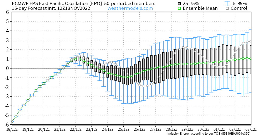
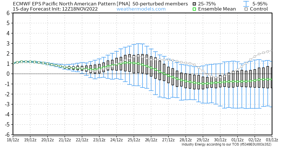
We can see this pattern in both the PNA and the EPO.
The PNA remains mildly positive through the upcoming week, suggesting western ridging. Additionally, the EPO, after becoming positive very briefly, returns to a slightly negative phase indicating the presence of ridging over Alaska. A slightly negative EPO would also introduce more polar air to the Eastern US, but not nearly as potent of a shot as we are experiencing now.
That air combined with a developing system may drive some winter weather mischief for some in the Eastern US late next week – but that’s still pretty far out. It’ll just be a signal to watch in the coming days.
So to sum up: more moderate, closer to average temperatures are ahead as we move into next week followed by a chance for winter weather late week from another system. As always, we’ll keep you updated!


