Highly Impactful Winter Storm Expected This Week
Forecast chaos continues this morning as at least some level of disagreement remains among models.
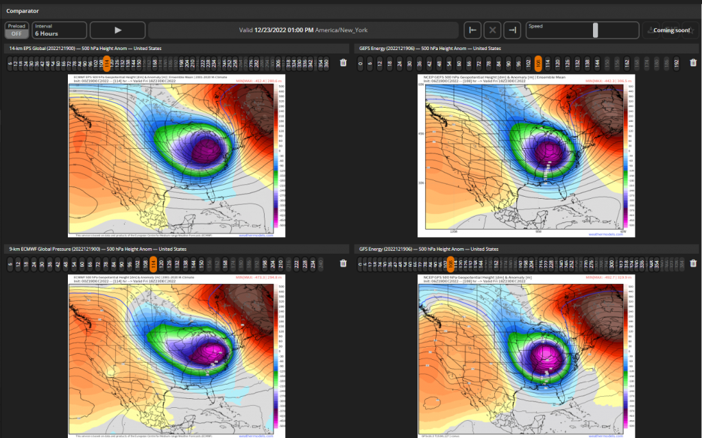
While we have honed in on a “biggest impact” location of the Great Lakes/Midwest, the track continues to wiggle around. The main question now is not where the biggest impacts will be felt, but how far south and east the trough will dig before lifting out to the northeast.
As you can guess, this has big implications on the precip type for parts of the south and east. It also has implications on the timing.
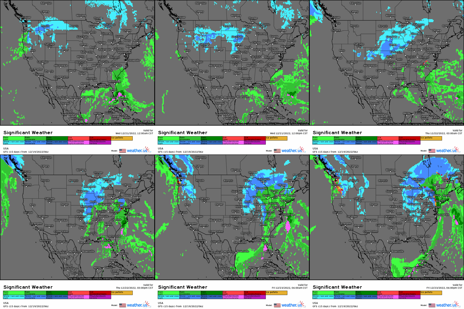
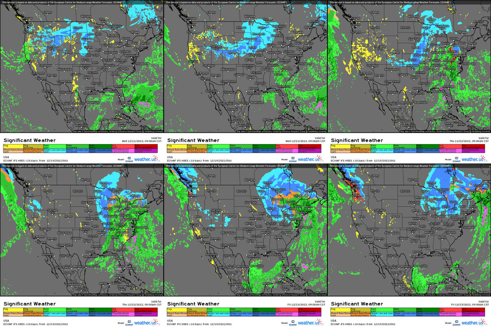
Take a look at the difference between these two loops. The first is the GFS. The second is the ECMWF.
GFS
- Trough digs further south
- Slower overall progression
- More potential for snow as far south as the N Georgia mountains
ECMWF
- Trough digs further east but not as far south
- Lifts out sooner
- Faster overall progression
- Less potential for snow further south
However, as mentioned in the beginning of this blog, both more or less agree on the “big event” occurring over the Great Lakes and Midwest. Track wiggles will have minor implications here in the core of the event, but larger implications outside of it.
There’s one thing we really need to watch when determining how far east or south the trough will dig.
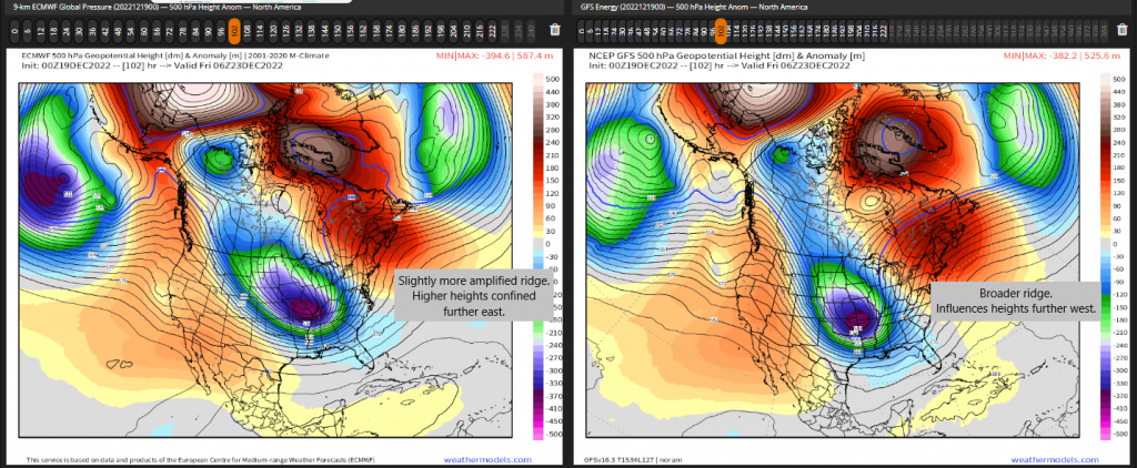
The state of the ridge centered over the far Northeast/Atlantic Canada region is important.
- A broader ridge will allow higher heights further west. This will force the trough to dig south rather than east.
- A more amplified ridge (if only slightly) would pull those higher heights further east, allowing the trough to move a bit more east before lifting out.
Watching the development and evolution of this ridge in the next few days is going to be rather important to future track.
Let’s switch gears for a moment and talk about the core of this system, where confidence is highest.
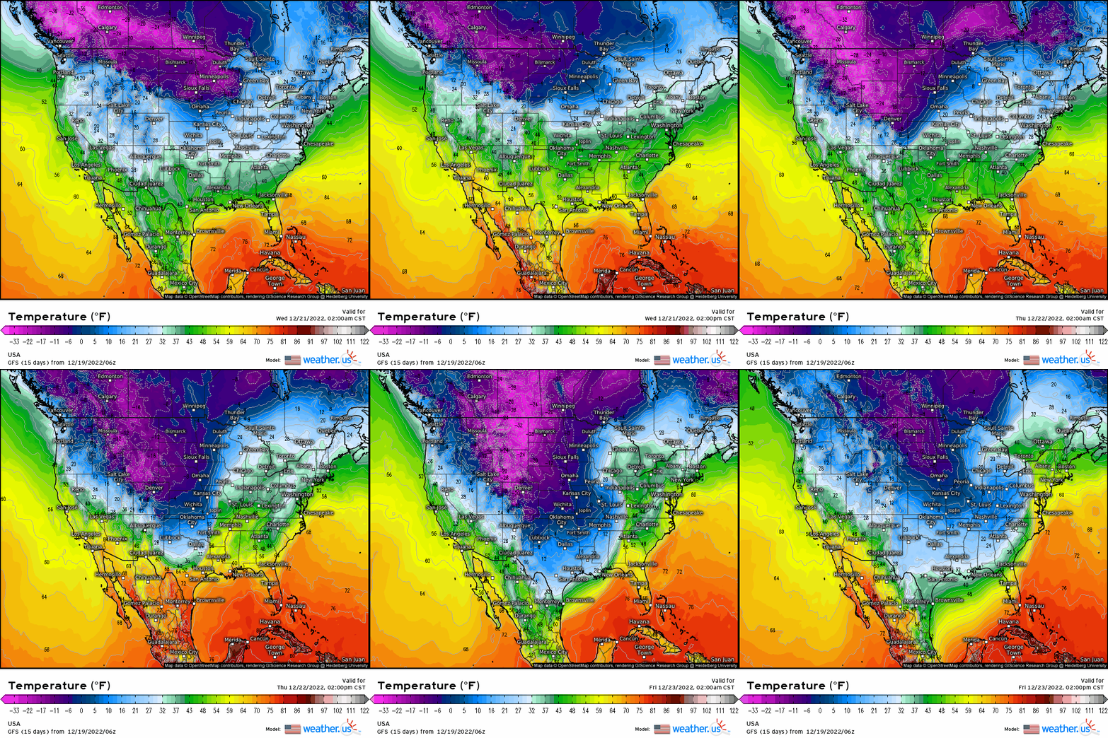
The temperature gradient between the incoming Arctic air and the fairly mild air in place ahead of it is going to be very important to this system. In meteorology, we refer to this as baroclinicity. The temperature difference over a constant pressure surface lends energy to perturbations and allows them to become these large mid-latitude cyclones.
And this is going to be one heck of a temperature gradient. As currently modeled, it’s possible that a location ahead of the front will be nearing 50 while a location less than 200 miles behind the front will be dipping below zero.
So it’s no stretch then to assume this storm will likely “bomb out,” or become very strong very quickly.
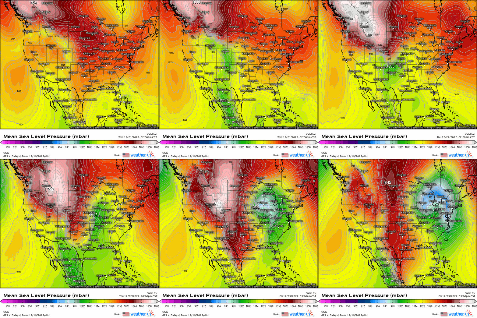
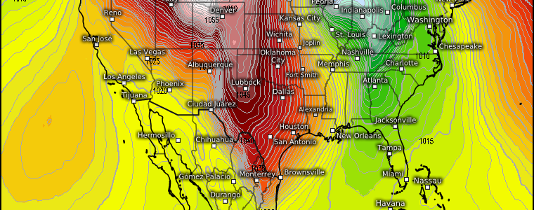
Rapidly lowering pressure will be compounded by a very strong Arctic high just to the west. This results in a very tight pressure gradient. The tighter the gradient, the stronger the winds.
Strong sustained winds combined with falling and blowing snow would suggest that this will likely be an actual blizzard for some in the core of the system. Travel will be difficult if not impossible at the height of this event.
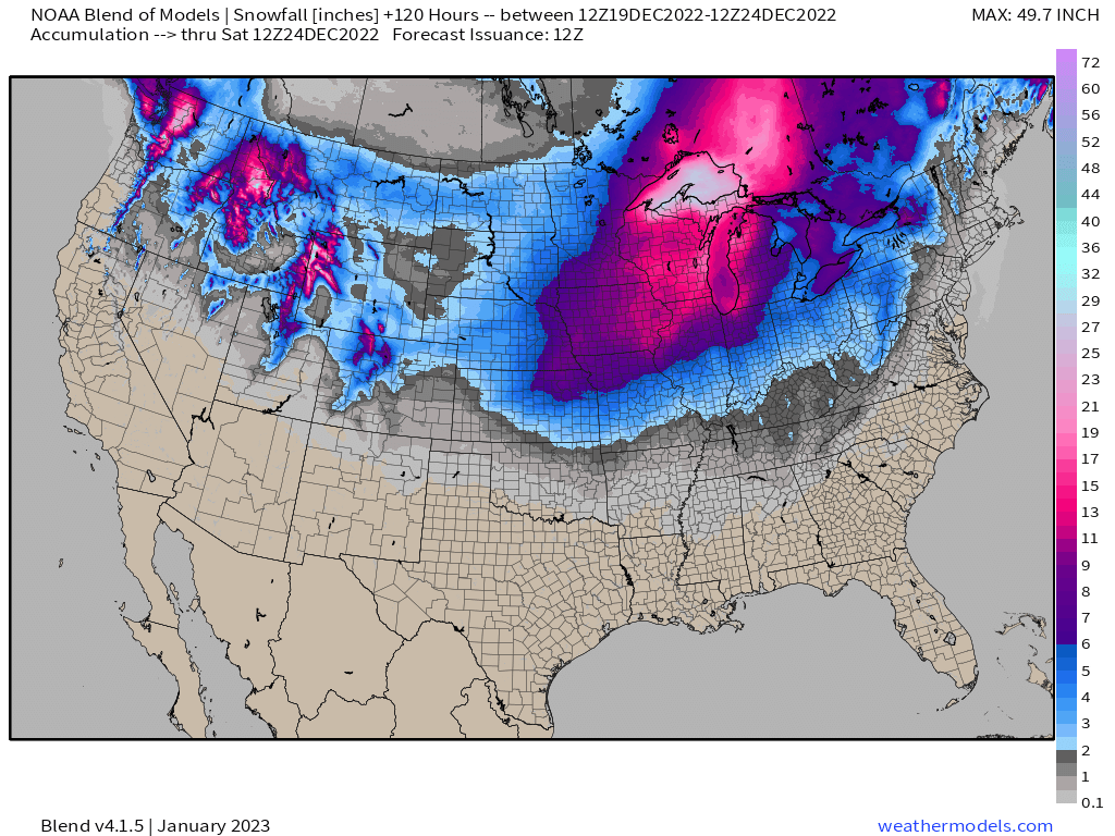
This snowfall map produced from the NOAA Blend of Models (all models averaged together) does a good job showing where the core will be and the potential for big snows from it.
However, I’d urge caution on taking this at face value right now, especially in the further south and east locations, until we get a track better resolved.
When will that occur? We should be able to sample the “energy” that will eventually become this storm in real time in the next day or so. After that, models should come into agreement. Give it another 24 hours before you start putting stock in snow maps.
Regardless of exact track, this will be a large, highly impactful storm for most of the US east of the Rockies. One thing to keep in mind even if you only receive rain: once the front rolls through and temps drop rapidly, anything liquid will freeze. Travel will undoubtedly be disrupted, especially Thursday and Friday. If you have travel plans and can change them, I would most certainly look into it.
What You Need To Know:
- While we’ve identified and have good confidence in the region receiving the biggest impacts, the exact track is still uncertain. Small changes can have large impacts on areas outside of the core.
- This will be a strong system with widespread impacts. It is coming during a very busy travel period. Adjust plans accordingly if you can.
- Exact track should shake out in the next day or so as we are able to sample the “energy” in real time. Hold off on putting too much stock in snowfall maps for at least another 24 hours.
- Temperatures will drop very quickly behind the front. Liquid precip on roads/trees will freeze. Strong winds will be present due to a very tight pressure gradient. Power outages are absolutely possible. Have a plan in place to stay warm if your power goes out.
We’ll keep you up to date on the most current forecast as we creep closer to the onset of the event!


