Highlighting A Couple of the 3/25 Tornadoes; Severe Weather Concerns for the Eastern US
Wow, what a day yesterday was. We saw some serious severe weather scattered across the south, even into the far eastern reaches of the defined risk areas. That’s why it pays to be aware no matter what category your area is given. We can predict the weather all we want but, in the end, the atmosphere is ever-changing and going to do what it wants to do with sometimes very little advanced notice to us.
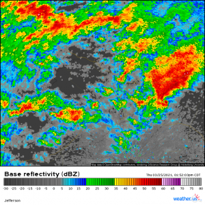
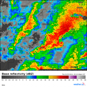
I want to use weather.us’s radar archives to highlight a few of the storms from yesterday. A few of the tornadoes were just textbook supercells.
This was the first Alabama tornado that tracked through places like Helena, Pelham, Pell City, and Ohatchee. The tornado was long-track and violent, tracking from SW Alabama through north Georgia before dissipating, leveling more than a couple houses in more than a few neighborhoods at it’s peak. Unfortunately, this was also the tornado responsible for the 5 deaths that have been confirmed so far. Surveys will be done in the following days and intensity and track length will be announced later.
The second long-track, violent tornado occurred just about an hour after the first lifted and unfortunately took a very similar path, though not exact. This one hit places like Centreville, Brent, and Calera. It tracked from SW Alabama into NE Alabama. Supposedly, it was on the ground the entire time. If surveys find that to be true, it would have been on the ground for nearly 100 miles.
There were a few others later in the evening, including a powerful tornado in east-central AL and even in the Atlanta metro. If you’d like to see the imagery for those, hop on over to https://weather.us/radar-us and take a look through the archives. Plenty of cool images to find!
Now, while it’s fine to admire the structure of these storms, we also need to remember the human impact. Many people lost everything yesterday and will be picking up the pieces for months, if not years. Some even lost their lives. If you can help in any way in the coming days or weeks (donating supplies, helping with clean up if you’re local, etc), please do so. The news outlets will focus on this tragedy for a day or two and then it will be largely forgotten, leaving these people to recover alone.
Moving on to current weather:
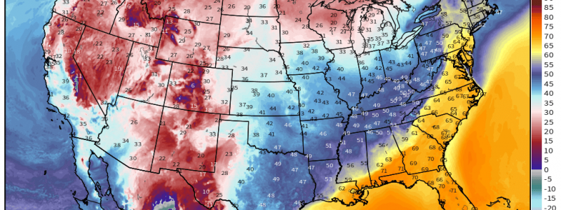
The surface low that helped to drive yesterdays severe weather has rocketed to the northeast overnight and currently sits over the Great Lakes, creating very windy conditions via a tight pressure gradient across the Midwest and into the Northeast. Ahead of the cold front trailing from the low, warmth is surging north.
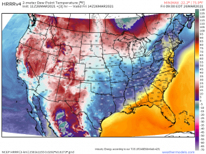
Dew points in the 50s and 60s extend well into the Northeast, even approaching the Canadian border. This moist air combined with lift from the approaching front will incite the risk of severe weather in parts of New England and the coastal Southeast today. It is a marginal risk, so no huge outbreak is expected, but the storms that form could be capable of hail, damaging winds, and even a few weak tornadoes, especially closer to the low in New England where a few low-topped supercells could form.
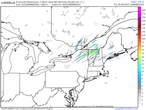
It’s never a good idea to take the Updraft Helicity Swaths as gospel as far as location of storms goes, but it is useful in identifying the POTENTIAL for rotating storms. So, using the map above, there’s a decent signal that rotating storms are a possibility across northern New England this afternoon. Will this lead to tornadoes? Maybe. They are possible, at the very least, which means anyone living here needs to remain vigilant through the afternoon/early evening hours. You know the drill by now: have multiple ways to receive warnings and a plan to shelter that you can execute quickly if need be.
The threat for the coastal southeast leans somewhat more toward wind damage as they are pretty far removed from any significant vorticity (the low). Still, remaining alert wouldn’t hurt. Winds inside severe thunderstorms can oftentimes do just as much damage as a weak tornado and lightning is dangerous no matter where it occurs. Be able to receive warnings here as well.\
Stay safe and enjoy your weekend!
